An Unknown Alaska

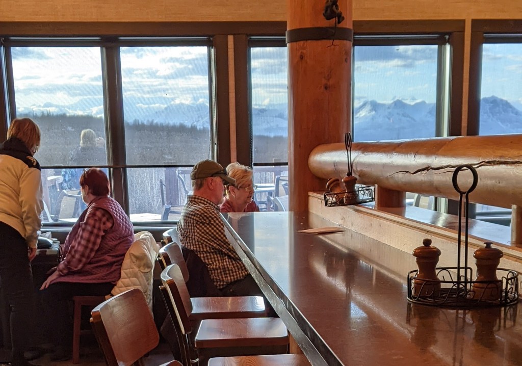
The 20th annual conference of the North American Travel Journalists Association, held in Fairbanks, Alaska, in May 2023, ended on a high note, indeed. It represented the culmination of a 16-day journey that included travel by air, cruise ship, bus, and train. The route took me from my home in Arkansas to Vancouver, British Columbia, then north along the inland passage to Alaska’s port cities, and on to Anchorage, Denali National Park and inland Alaska.

At the conclusion of the conference, I was off on another type of adventure — a grueling ride along the Dalton Highway, a mostly unpaved roadway that loosely follows the route of the Trans-Alaska pipeline from just north of Fairbanks to Deadhorse, Alaska, on the Arctic Ocean. It is barren, uninhabited land.

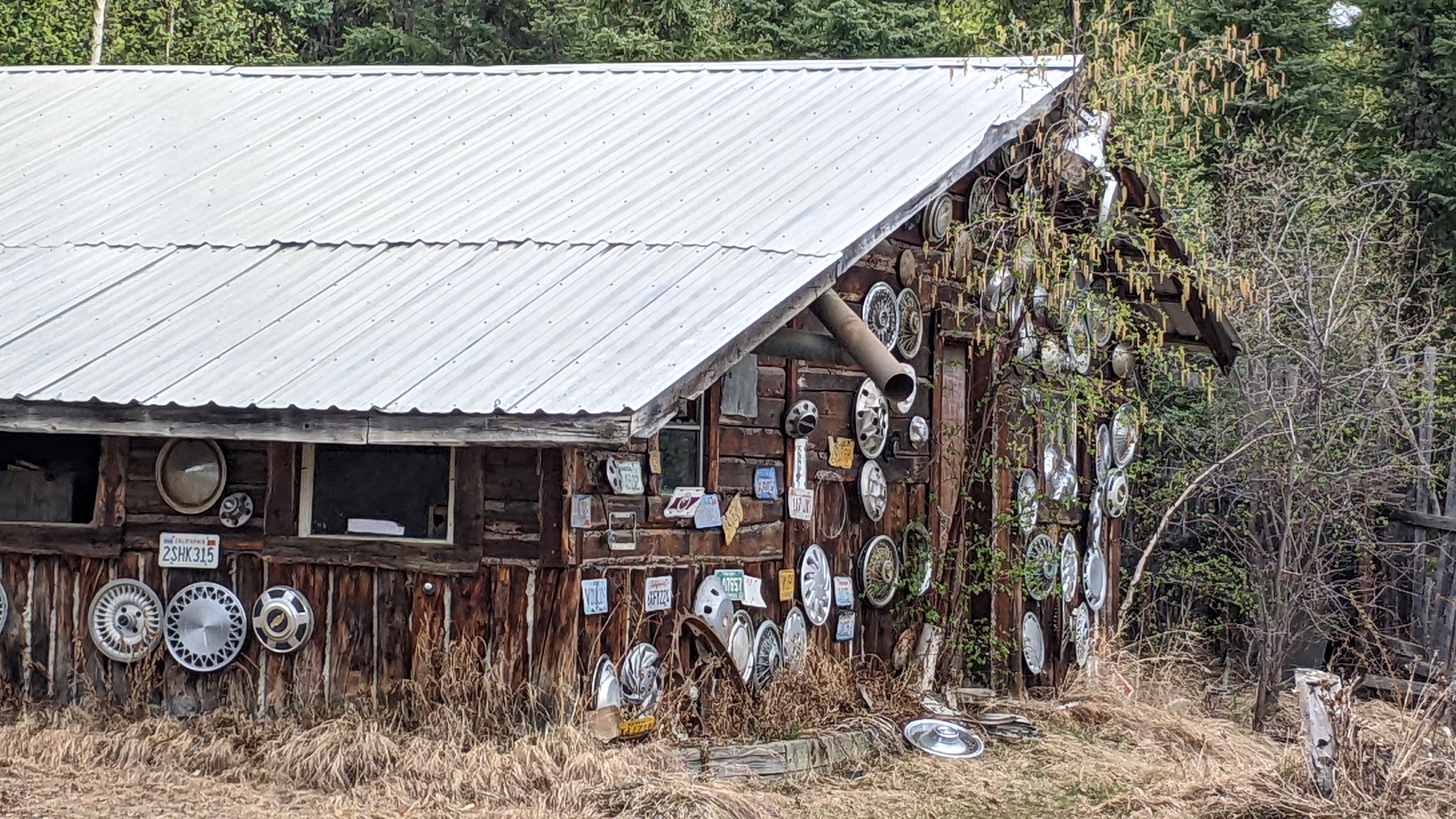
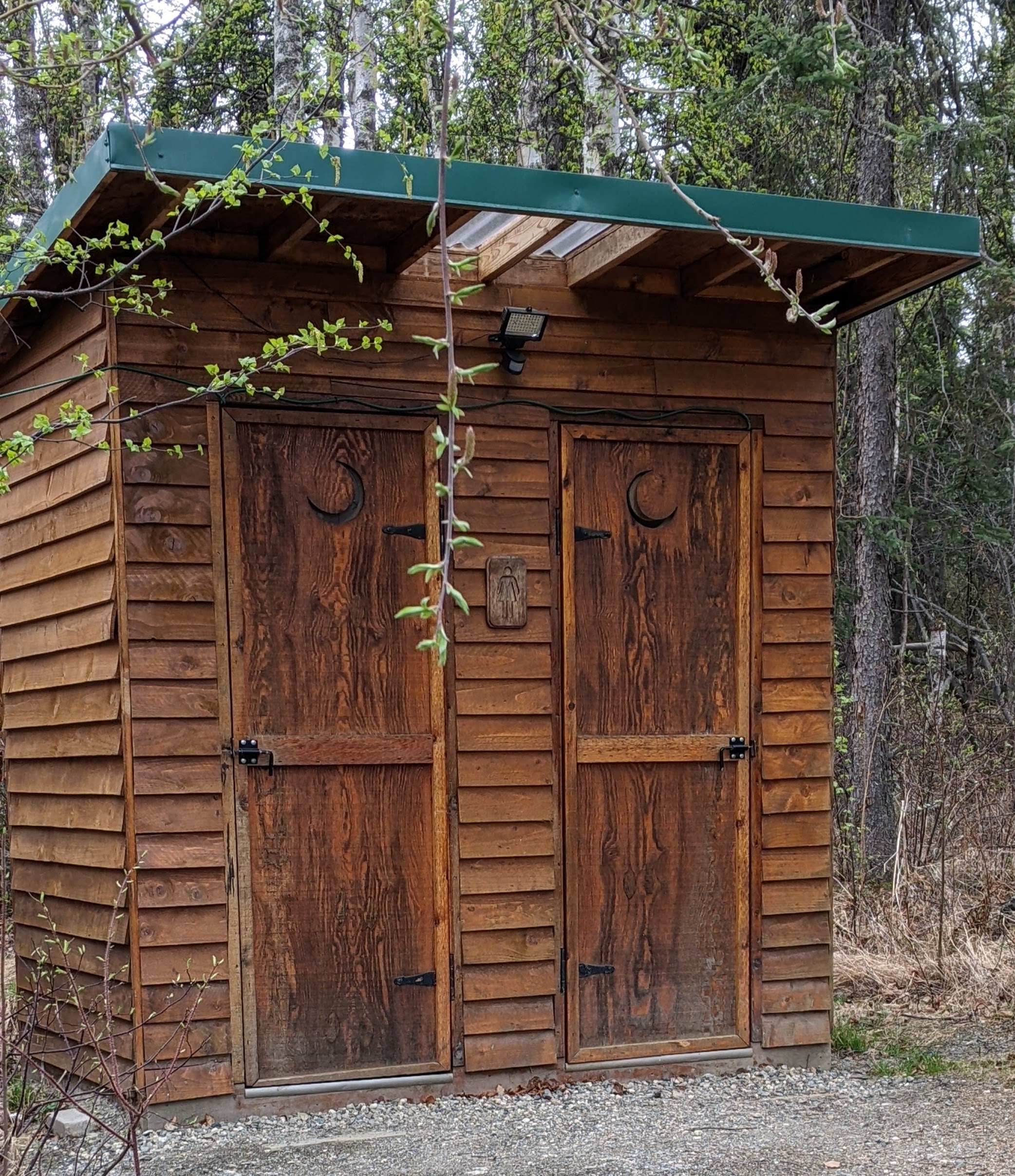
Our guide and driver told us that in the 1980s, a group of homesteaders had formed a small community in an “off-the-grid” location along the route. Today, even they have moved on, with only a handful of buildings as testimony to their former lifestyle. We stopped at what was once the general store in the area, now owned and maintained by the tour company as a convenience stop for participants on the Highway excursions. The site’s several buildings stand empty and unused, but there are clean, well-maintained outhouses, complete with lighting and framed art on the walls. It was not only a welcome rest stop, but the site offered numerous photo ops as well!

Leaving Fairbanks, we traveled along the Stease Highway, then joined the Elliott Highway (roadways in Alaska have names rather than numbers) until we reached the Dalton Highway, made famous by the television show, “Ice Road Truckers,” for the long-haul drivers who bring food and supplies to oil field workers and support crews along Prudhoe Bay.

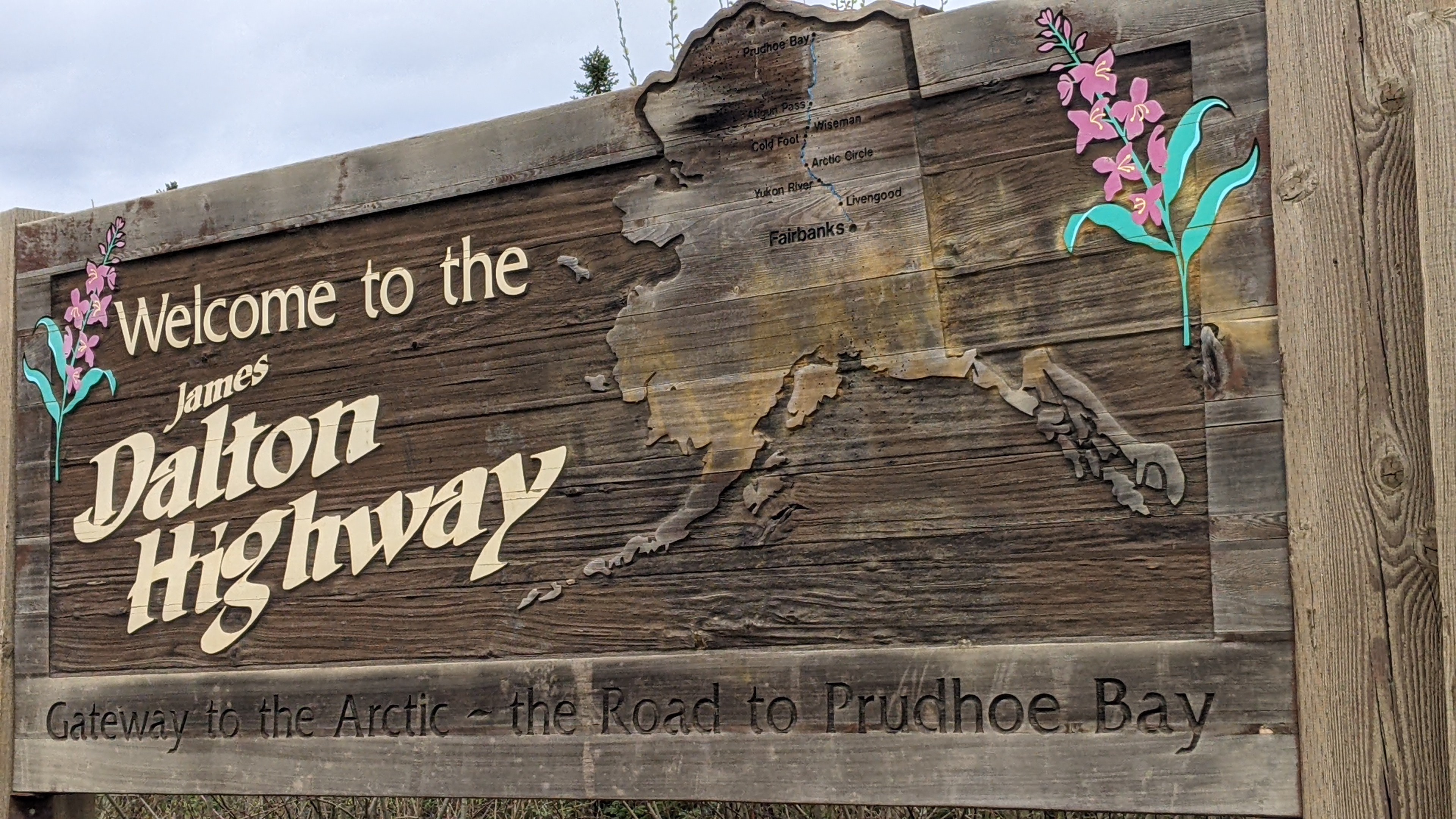
There is a welcome sign where the Dalton Highway begins. At a stop there to take photos, we met a couple of motorcyclists traveling north from California to Deadhorse!

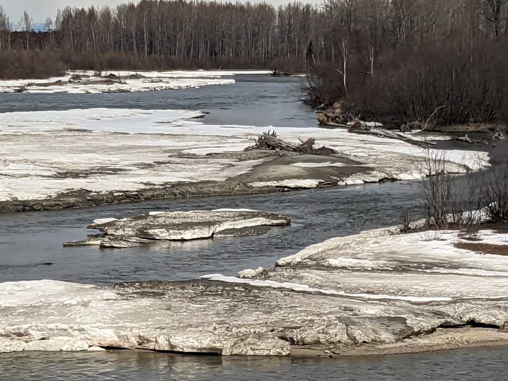
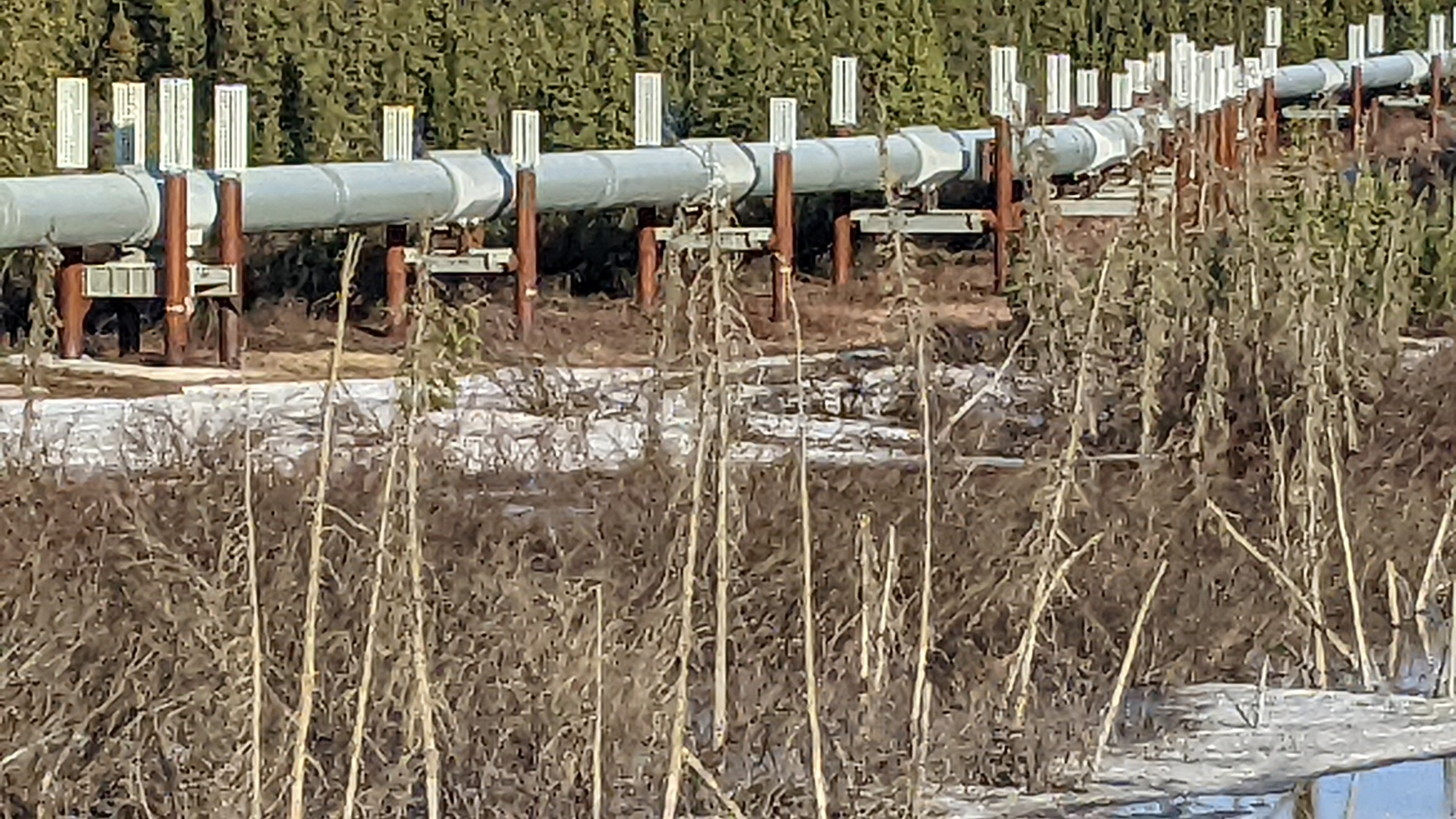
The Dalton Highway stretches 414 miles north from Livengood, a former gold mining town approximately 80 miles north of Fairbanks to Deadhorse, Alaska., at the Arctic Ocean. Originally known as the North Slope Haul Road, it was begun in 1974 and completed in just five months to facilitate pipeline installation. The pipeline itself stretches approximately 800 miles from Prudhoe Bay to its terminus at the ice-free port of Valdez in Prince William Sound. Still a marvel of engineering, the Trans-Alaska pipeline was operational in just 20 months, and began pumping oil in 1977.

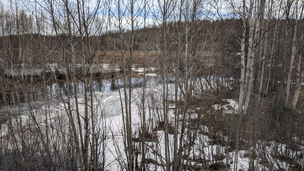
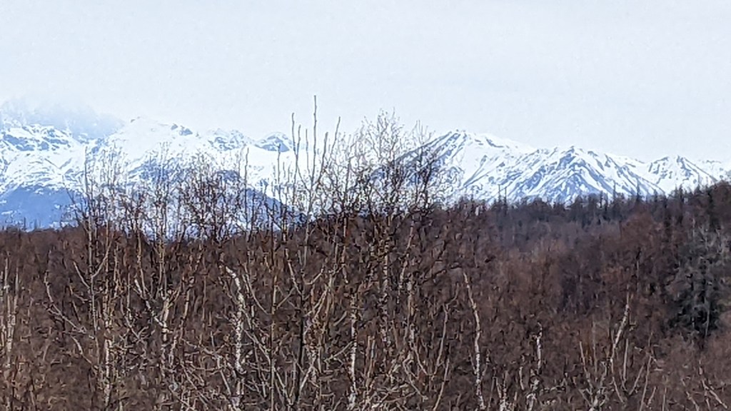
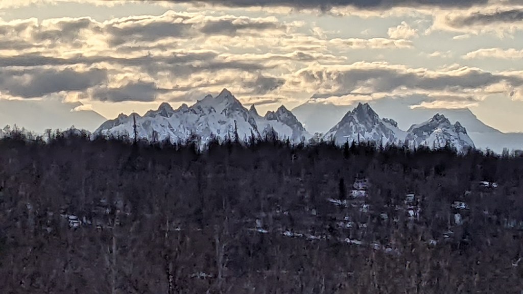
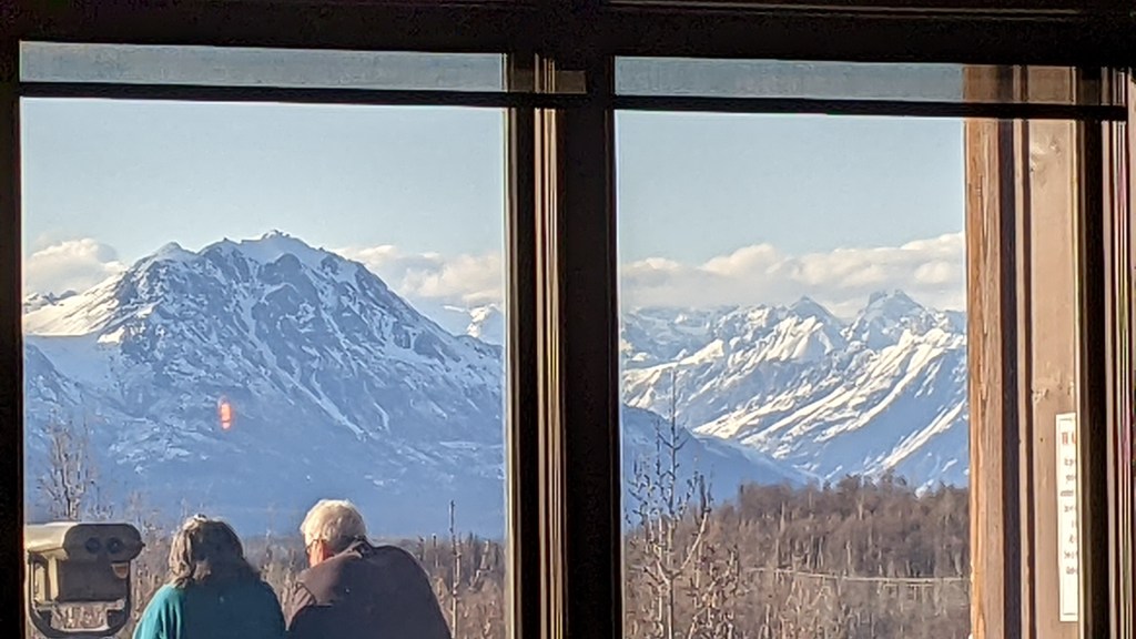
The highest mountain in this northern region is just over 3,200 feet (in contrast to Denali’s height of more than 20,000 feet only a few hours to the southwest). The high point on the Dalton Highway is 2,200 feet, but much of this land is above the tree line, and it appears stark, nude, and forbidding in its solitude.

Hilltop Gas Station, 15 miles outside of Fairbanks, is the northernmost source of fuel until drivers reach Coldfoot, on the Yukon River, or the northern terminus of Deadhorse. The power line also ends not too far north of Fairbanks. In a very real sense, this is “the end of civilization.” Pedro Dome, situated northeast of Fairbanks, provides the only Doppler weather radar tracking for the entire state. If it goes down, weather forecasts for Alaska are only guesses.

Our second stop was at Yukon River Camp, where pipeline workers, roadway maintenance crews, and truckers gather. It serves as rest stop, information and communications center, local store, no-frills eatery and is a welcome sight for the few tourists along the lonely road. There is a small village of support personnel, with overnight accommodations available.

Visitors can check the weather, make phone calls, grab a hot cup of coffee, even purchase sweatshirts, postcards, and souvenir magnets. It was here that we once again met the cyclists and wished them well on their continued journey north.

Cities in this northern inland portion of the state are non-existent; even primitive settlements are few and far between. Water, power and fuel do not exist, and travel is treacherous.

Although our excursion traversed not quite half the length of the Dalton highway, we traveled far enough north to literally leave civilization behind. It was a unique experience.

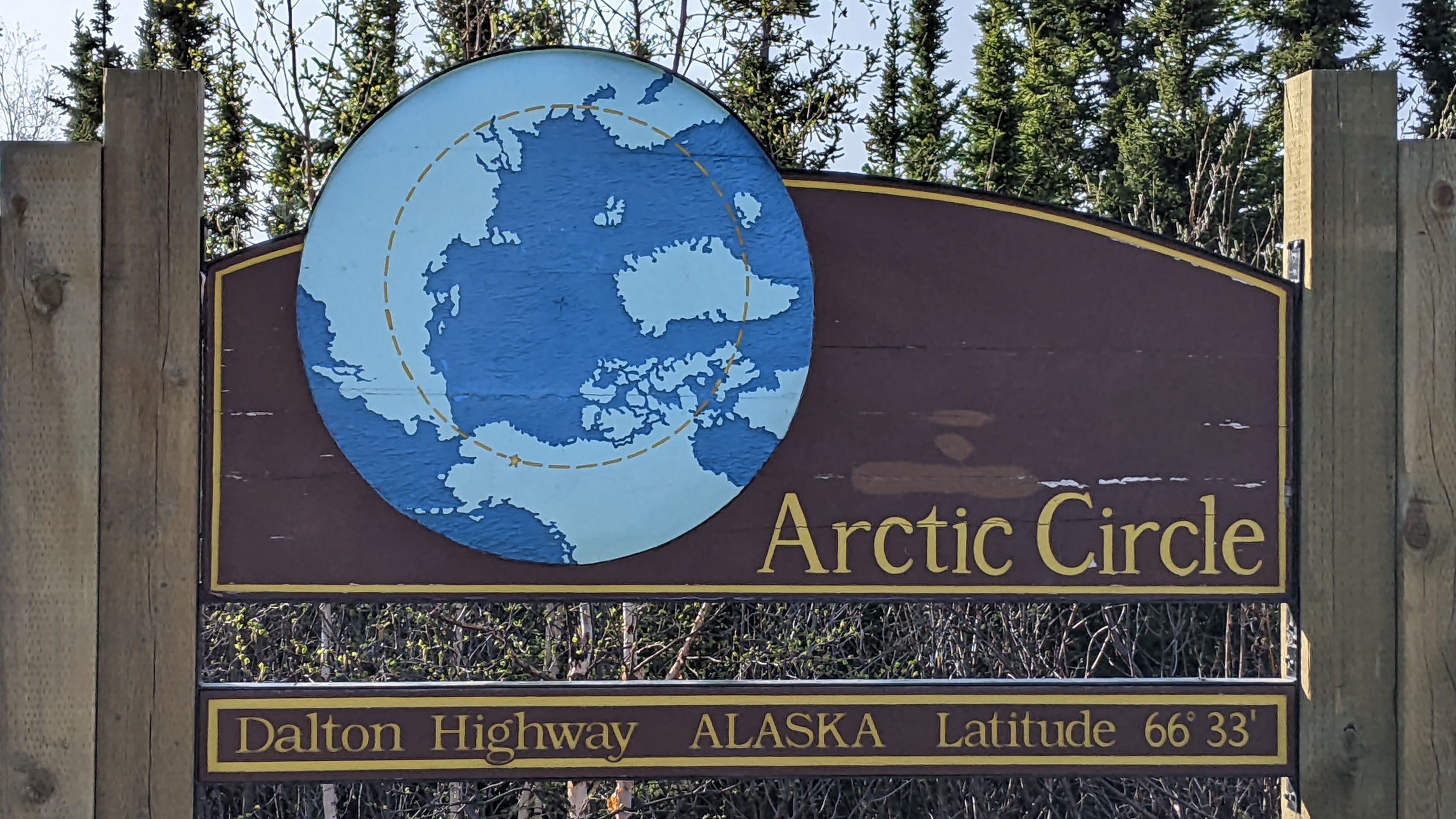
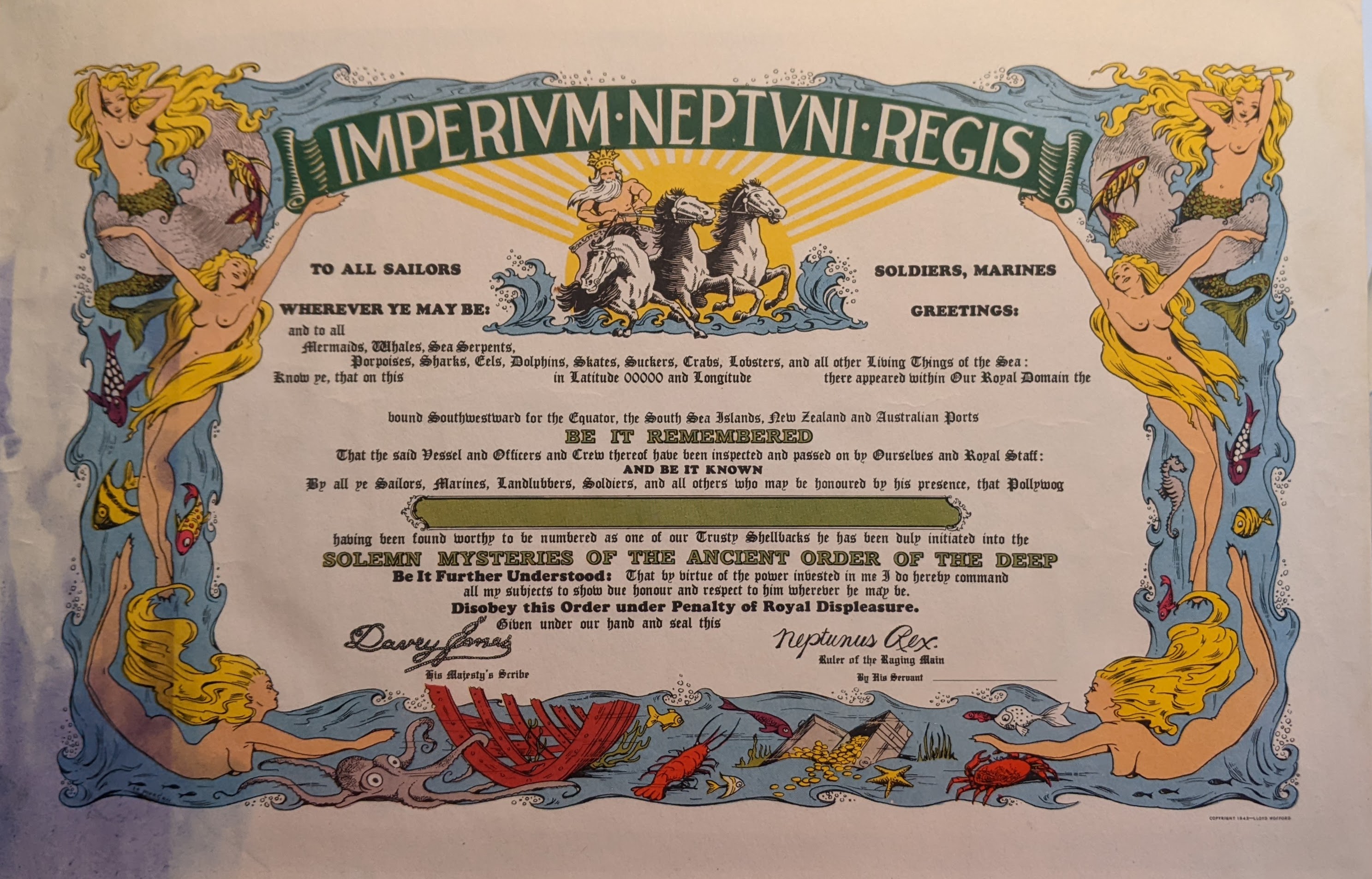
Later, our group stepped across the latitude line (66 degrees, 33 minutes) that marks the Arctic Circle, and we celebrated with “Alaska mud cake” and whipped topping at a picnic table in the forest — under the watchful eyes of curious squirrels and hopeful “thieving birds” perched just above us in the trees. It was there that we picked up a handful of southbound travelers, adventurous souls who had previously ventured further north and would be returning with us to Fairbanks.

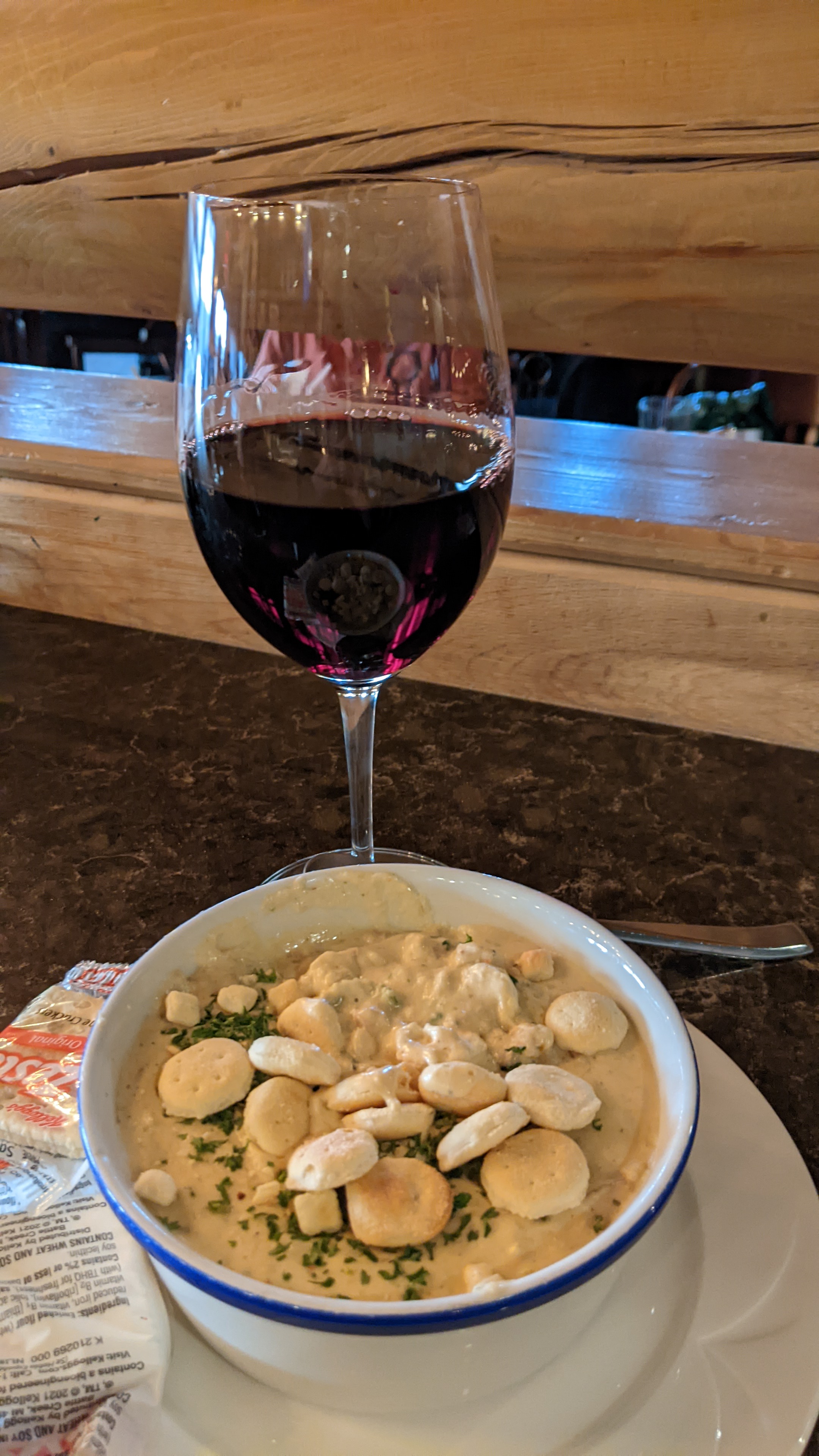
On our return south, we stopped again at the Yukon River Camp. But now the kitchen was closed, and the staff had gone to bed. We brought our own sandwiches or microwavable dinners. Water and hot coffee were available to us, but there was little else other than tables, chairs and clean rest rooms. The camaraderie made up for the late-night lack of service.

My colleagues and I — participants in this unique post conference Dalton Highway press trip — discovered the uninhabited, “ungoverned wilderness” of far north inland Alaska. I was overwhelmed by the isolation, and enthralled by the beauty of the land. Only a limited number of participants were chosen for this unique tour offered by the Northern Alaska Tour Company. Another somewhat less-strenuous option offered to Alaska tourists provides an alternative overnight stay near Coldfoot, Alaska, in the Brooks Range, a bumpy hour or so north of the Arctic Circle. On that excursion, travelers can opt to take a morning hike along the Yukon River, followed by a bush-plane flight back to Fairbanks. Fellow journalists who took part in that trip reported that the return flight was spectacular, not to mention a few hours of welcome sleep in a rustic cabin with a comfortable bed!

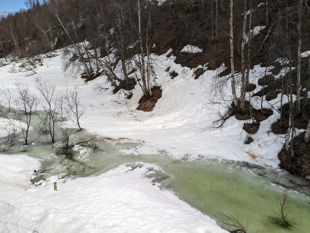
We traveled through the northern boreal forest that spans the globe from Alaska to Scandinavia. Russia and Asia boast greater biodiversity and life forms; in Alaska, there are only four species of trees that grow in the permafrost: white and black spruce, aspen, and birch trees. Because we were there in spring, we witnessed the aspen and spruce leafing out, even though snow remained on the ground in some areas. We were told that a few weeks earlier, the land was fully blanketed with deep snow. But spring comes quickly to this part of Alaska.

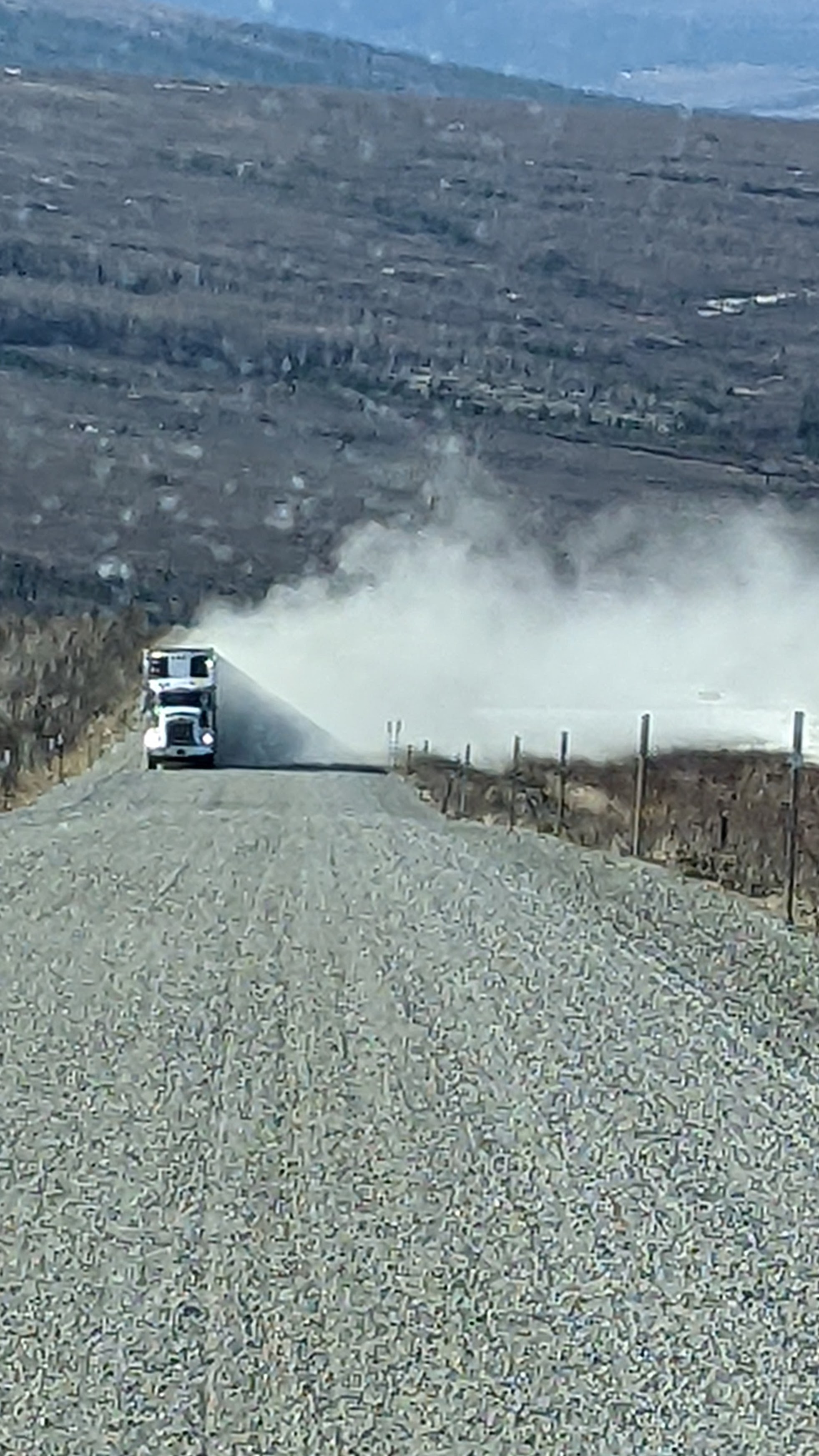
For my part, though, I was grateful for the opportunity to learn from our knowledgeable guide about the history of the Trans-Alaska pipeline and its current upkeep and operation. I was impressed by the ongoing maintenance work along the mostly unpaved roadway, even though construction delays late at night were a bit unnerving! I felt a slight sense of fear, tempered by awe, each time a swirling cloud of dust signaled the approach of a speeding 18-wheeler.

Those long-haul drivers are experienced, professional and, usually, extremely courteous. But it is obvious they operate on an unforgiving timetable, and they simply “keep on trucking.”

I was duly impressed by the sight of the 45-year-old, mostly-elevated oil pipeline as it snakes across the land. For more information about the construction and continuing operation of this engineering marvel, visit TAPS Construction -Alyeska Pipeline.

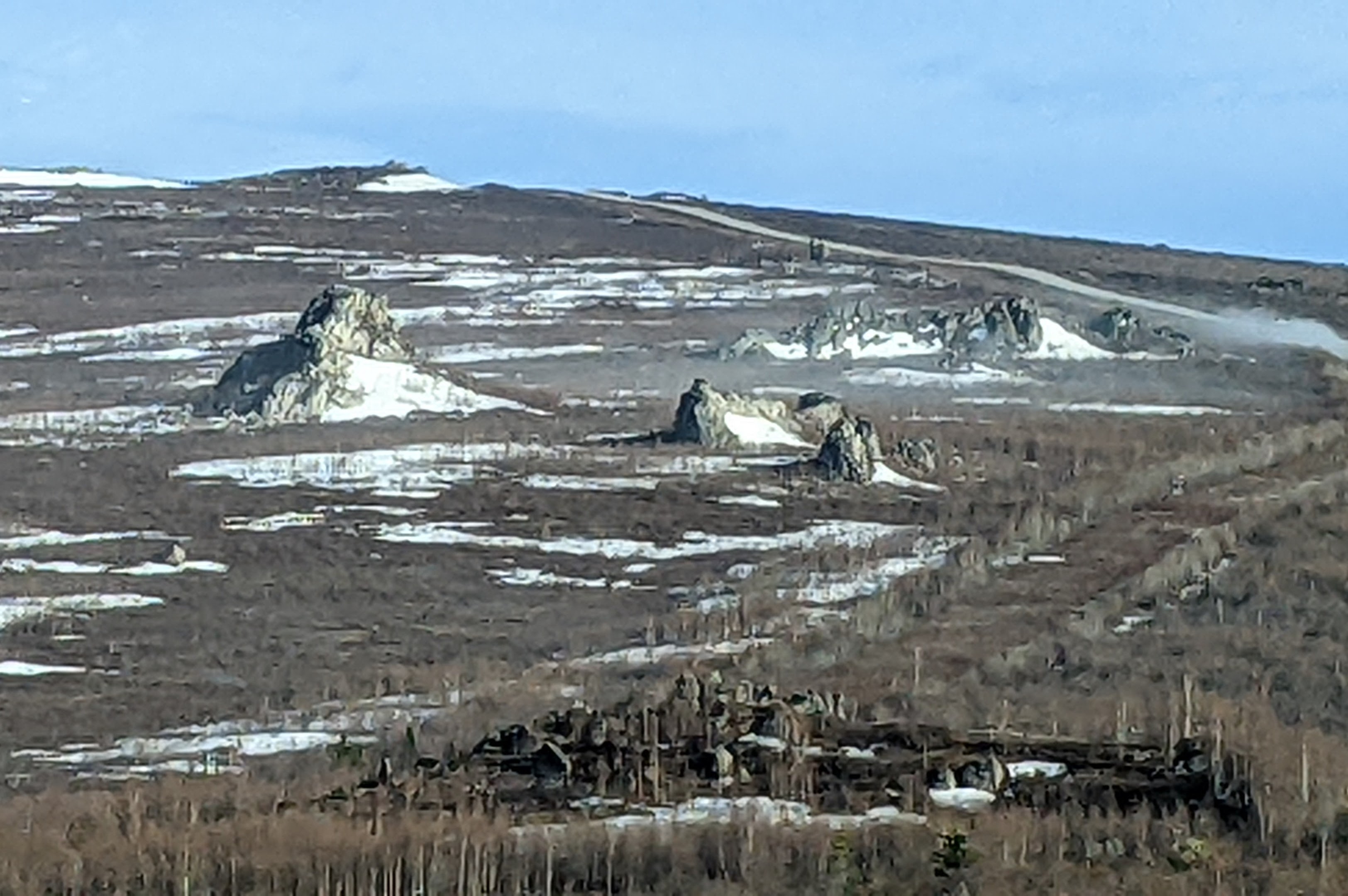
We stopped for a short time at an outcropping of granite tors, huge natural outgrowths that stand like sentinels on the barren land. Much further to the south, there is a 15-mile trail and public campground at another tors site, maintained and administered by the Alaska Division of Parks and Outdoor Recreation.

This trip is by no means an excursion for the faint of heart. But neither was it, as a participant on a tour prior to mine proclaimed, “the worst day of my life.” It was long, yes; cold, drizzly, uncomfortable, and tiring. We returned to our Fairbanks hotel at about 3 a.m. for a few hours of sleep before flying out that afternoon to the Lower 48. Would I do it again? No, but I’m certainly happy to have had the full experience.

It was a ride I will not soon forget! And the changing hues of blues, pinks, and striated yellow and orange that filled the night sky in those late night and early morning hours will forever color my memories of far north Alaska, a land full of wonders and surprises.

The certificate I was presented proclaims that I crossed the Arctic Circle and “survived an adventurous journey through the Alaska wildnerness.” That says it all!

Traveling solo can be fun when you’re old enough to be somebody’s grandmother!

I recently had an opportunity to be on the road alone — partly for pleasure, to be sure, but with a business connection. I had a professional conference to attend in Fairbanks, Alaska. Instead of booking a round-trip flight from my home in Arkansas to the conference city I opted to cruise north to Alaska from Vancouver, British Columbia. I then spent a few days sightseeing near Denali National Park, finally arriving in Fairbanks the evening before my conference began.

After many years of marriage, my husband and I are well aware that our interests, priorities, enthusiasms, and commitments sometimes differ. That’s all good, and on several occasions over the years, we have kissed each other goodbye and wished one another safe travels. It’s just the way we do things. This was one of those times.

I simply could not resist the appeal of a seven-day cruise followed by a three-day land tour to Denali National Park. My husband, for his part, was not ready to embark on another cruise so soon after our epic Antarctic adventure earlier this year. So, for 16 days, my husband and I led separate lives. In addition to a memorable vacation experience, I told myself that this particular journey could be counted as a business trip, providing valuable background for future posts about traveling solo as a senior woman. And, yes, those planned posts are in their early stages as I write this.

The cruise was truly enjoyable, made even better by spending two days in Vancouver to visit with old friends — my own superb tour guides! I found solo cruising to be totally enjoyable, and not at all intimidating. In fact, I look forward to another solo travel experience should an opportunity arise. The land portion of the trip was almost exactly as I expected. Travel arrangements for the land portion of the trip were part of the cruise package, well-planned and executed by Princess Cruise Line. Even though May is the beginning of the season in Alaska, and local staff members were still learning their specific duties, transfers, tours and accommodations were perfectly choreographed.

We disembarked in a grey drizzle in the port city of Whittier and boarded a bus for the trip north to the mountains and the national park, stopping briefly in Anchorage. On the way north, the scenery becomes more dramatic and our driver was happy to point out our first view of Denali in the distance. We passed through small towns, including Wasilla and Talkeetna, and viewed the still-snow-covered terrain and ice-clogged rivers. Originally named for President McKinley in 1897, the name of this largest mountain in North America was changed in 2015 to Denali. In the indigenous language of early tribes in the area, the name means “the tall one,” or “the high one.”

Once we arrived at the Princess Mount McKinley Lodge, a beautiful facility with a “knock-your-socks off” view, I spent my first few hours warmed by the sun on the lodge’s wraparound deck. I was enthralled by the drama of clouds which parted only periodically to provide breathtaking views of the mountain known as “the great one.” It truly is.

I snapped far too many photographs of the changing vista as the late afternoon sun sank lower on the horizon. Denali, at an elevation of 20,310 feet, dwarfs surrounding peaks, but they are not mere foothills, and they have their own allure. Finally, when the clouds seemed to be massing to surround the mountain for the evening, I decided to make my way inside.

I found an unoccupied seat at a bar counter in the casual lounge. My seat still offered a commanding view of the faraway mountain ranges through the great room’s wall-to-wall windows. Tired from a day of traveling, I ordered a glass of wine, content to simply relax in comfortable surroundings.

My attentive server asked if I wanted to order dinner and suggested I begin with a bowl of hot fish chowder. Happy to not have to make a decision, I agreed that would be good. We chatted a bit as I waited.

He had returned to Alaska the previous week to work at this lodge for a second summer. A university student in the lower 48, he said that his experience the previous year hadn’t seemed quite long enough. This year, his girlfriend had signed on for summer work as well.

This was the first of many conversations I would have over the next few days with the summer employees who arrive in Alaska eager for adventure. Must of the seasonal employees are U.S. or Canadian students. All are happy to have the opportunity to earn money working in one of the top vacation destinations on the globe. Many have returned year after year. Most try to save the bulk of their earnings for the coming school year. Not a one complained about the hours or the work load. And every one admitted to seizing every possible opportunity to hike or camp in the adjacent national and state parks or to explore nearby towns and villages. Almost all planned to return to the lower 48 at the end of the summer to continue their schooling.

I listened willingly to the stories of other servers and staff. I joked with the bartender, and I exchanged smiles with other guests. When my chowder arrived, they all gave me “space” to enjoy my light meal. Suddenly hungry, I ate, sipped my wine, and thought how lucky I was to be in this place at that time. But, in that moment, sitting in a crowded bar in the shadow of a great mountain, I also had to admit that I missed my husband. It was an experience I would have enjoyed sharing with him.

In Alaska, in May, it’s light late into the evening and as I finished my chowder, Denali’s snow-covered summit was once again visible. Despite the many previous pictures I had taken, I wanted just a few more in the twilight of the day.

I was eager to make my way out to the deck once again, and I signaled for my check. As we settled up, this young server and I agreed that getting to know one another was a highlight of the evening. As I stood to leave, he looked at me and asked if he could give me a hug. Somewhat taken aback, I hesitated for just a moment.

He confessed, “You remind me of my grandmother, and I miss her.”

Of course we hugged, and I believe we both treasured that brief connection in a place far away. This time, the human connection was more memorable than the food. And this brief encounter with a stranger was at least equal to my last view of Denali on that day.

Polar Opposites

71-10-21 and 64-89-??

Points on a compass have little meaning to most people. Schoolchildren learn about the north and south poles, that the earth is tilted on its axis as it travels around the sun, and that the globe is divided into latitude and longitude lines. Most come to know that the equator separates northern and southern hemispheres, and that the latitude lines defining Arctic and Antarctic circles are set at 66 degrees thirty minutes north and south of the equator which is at zero. But it’s a fact long forgotten by most adults. In truth, there’s little reason to know exactly where one is on the globe at any given point in time, unless you have a precise need to navigate to a destination. Airline pilots and ship captains need that knowledge, but casual travelers really do not.

For what it’s worth, however, the coordinates of Hot Springs Village are 34.6720 degrees N, 92.9988 W. It won’t replace a street address, but if you’re interested in little-known facts, make a note! I once was tempted to have the coordinates of the tiny train depot in my favorite little village in Maine printed on a t-shirt, just to see if anyone would ask what the numbers meant. I didn’t.

Ancient mariners noted the crossing of that zero latitude line regularly, and it is an honored tradition still practiced by sailors today. If you have been lucky enough to sail across the equator, you may know about the good-natured and sometimes raucous festivities that mark that passage. Read about the Royal Navy’s Crossing the Line ceremony aboard the aircraft carrier HMS Queen Elizabeth on the ship’s first equator crossing in 2021. I also have a certificate of passage across the equator. It is colorful and ornate, and it is not mine, but it is part of my family history.

The latitude is noted as 0000 — the equator. The longitude is left blank, as are other blanks for the name of the ship, the name of the sailor, and the date and time. On the back, however, is this handwritten note:

Longitude “Secret.” USS Admiral Benson. Destination: “On a Mission of War” Date: “Secret 1945.”

I find it fascinating that some traditions were kept even during wartime. Celebrations take place aboard modern cruise ships, to the delight of most passengers. And crossing the International Date Line can be a bit disorienting. At basically 180 degrees longitude, or half the globe away from Greenwich, England, at Longitude 0, the date line was only designated as such in 1884, to make timekeeping more consistent. The line, which designates the change of calendar dates, sometimes follows a zigzag path around political boundaries, as between eastern Russia and the Aleutian Islands of Alaska. Gaining or losing an entire day in an instant while crossing the International Date Line must be disorienting as well as exciting. Crossing from east to west means that travelers “lose” an entire day! You can gain that day back if you return later to your starting point. That must be disorienting as well as exciting. I don’t know if a certificate exists for that or not!

Some airline pilots will also announce the crossing of the equator, or the time-altering effects of crossing the International date line.

Breaking the Barriers

Tourists can easily venture north of the Arctic Circle on Scandinavian itineraries, whether on land, sea or in the air. Travel to Antarctica typically requires a sea voyage, and is only possible during the height of the southern hemisphere summer. A commemorative certificate is commonly awarded to passengers, denoting the actual southern latitude a vessel reached, but traditions vary. Most visitors to Antarctica do not actually cross into the Antarctic Circle. Most don’t get even to 65 degrees south latitude — the passages are too treacherous for all but sturdy scientific vessels with ice-breaking ability. There are no scheduled flights to the seventh continent from either South America or Australia. Scientists and researchers most often arrive by air at their remote research stations in late spring and depart the same way prior to the onset of the long Antarctic winter.

The earth’s magnetic poles continue to shift slightly, and the imaginary lines that describe the polar regions also vary somewhat. The boundaries of the polar circles are typically noted as 66-33-39 degrees North or South latitude. They are sometimes said to be situated at 66.5 degrees. There are only about 69 miles between degrees of latitude, so the difference is truly miniscule.

When my husband and I cruised along the coast of Norway in 2022, we entered into the Arctic Circle, according to our certificate, at 12:12 a.m. on June 17, at Latitude 66-30.1 N Latitude and Longitude 009-26.3 E. We continued north to Nordkapp, or the North Cape, at 71-10-21, the northernmost point of the European continent, and also to Skarsvag, a Norwegian fishing village with a population of 60, at latitude 71-06-47 N.

Approximately seven months later, we sailed from Ushuaia at the southern tip of Argentina across Drake Passage and along the Antarctic Peninsula, achieving a “most southerly latitude of 64 degrees 58 minutes.” The date and time are not noted on that certificate.

Next month, I will travel along the Dalton Highway, which runs north from just outside of Fairbanks to end at Deadhorse, Alaska, close to the Arctic Ocean. There’s a simple wood sign at about milepost 115 on the roadway, at which vehicles traditionally stop for photos. The sign, depicting the earth as viewed from the North Pole, simply reads “Latitude 66 33”. The 414-mile highway, some of it still only hard-packed gravel, was built to facilitate construction of the Trans-Alaska Pipeline. The pipeline itself stretches for 800 miles, from Prudhoe Bay in the north to Port Valdez, where the oil is loaded onto tankers for shipment to market.

Why do I do these things?

Well, for one reason, like Captain Kirk, I like to go where few other people have been. Secondly, I am especially fond of quirky destinations, and I will go out of my way for the photo ops and the unique experiences they provide. I like to stand at points where the land ends and the sea begins, and imagine what lies beyond. Many of these “furtherest” points fill me with a sense of wonder that past explorers, sailors, and adventurers stepped out into the unknown not knowing where exactly their journeys would take them, when they would end, or if they would ever return.

Just for the fun of it while we were boating in Maine, my husband and I visited Lubec, Maine, the easternmost point of the continental United States. Nearby are the distinctive red and white striped West Quoddy Head Light in Maine, and the historic East Quoddy Head Lightstation which stands at the most northern point of Campobello Island, New Brunswick, Canada. The names confused us until we consulted our navigational chart and realized that they designate opposite sides of Quoddy Narrows, and make perfect sense to local mariners, as they have for nearly two centuries.

We have returned to Key West many times to stand at the southernmost point buoy. Just for reference, latitude and longitude readings there are 24.5465 N, 81.7975 W. The northwesternmost and most western points of the contiguous 48 states are near Cape Flattery on the Olympic Peninsula in Washington state. Despite living in Washington for many years and boating in the waters around Puget Sound and the peninsula, I have not been there. Maybe someday.

Trips to Gibraltar give us reason to look longingly across the Staight that separates Africa from Europe — a mere eight miles. A trip to Portugal several years ago found us enthralled with the lighthouse at Cabo Sao Vicente, the southwesternmost point of Europe. It is said that it can be seen from 60 miles out to sea. And, yes, I have an ongoing fascination with lighthouses!

It is at these times, as I stand in these faraway places, I realize anew just how vast and beguiling this earth we call home truly is, and just how many places remain for me to discover.

Note: If you’re interested in random facts, have time on your hands that invites mindless armchair exploration, or are in need of trivial conversation starters, visit Wikipedia’s List of extreme points of the United States.