We had invited an assortment of neighbors and friends to join us for a potluck get-together at our home last Sunday — Easter Sunday — and they all arrived promptly at the appointed time.
The sky was grey, but it did not seem threatening at that moment.
Darkening gray clouds had not dampened spirits in the slightest as our group of 12 assembled. However, dinner was destined to be delayed as the existing tornado watch was upgraded to multiple tornado warnings for our area, including the Hot Springs, Arkansas, area and the Village we call home.
At that time, Hot Springs Village was not included in the “take cover” area. But that changed before long.
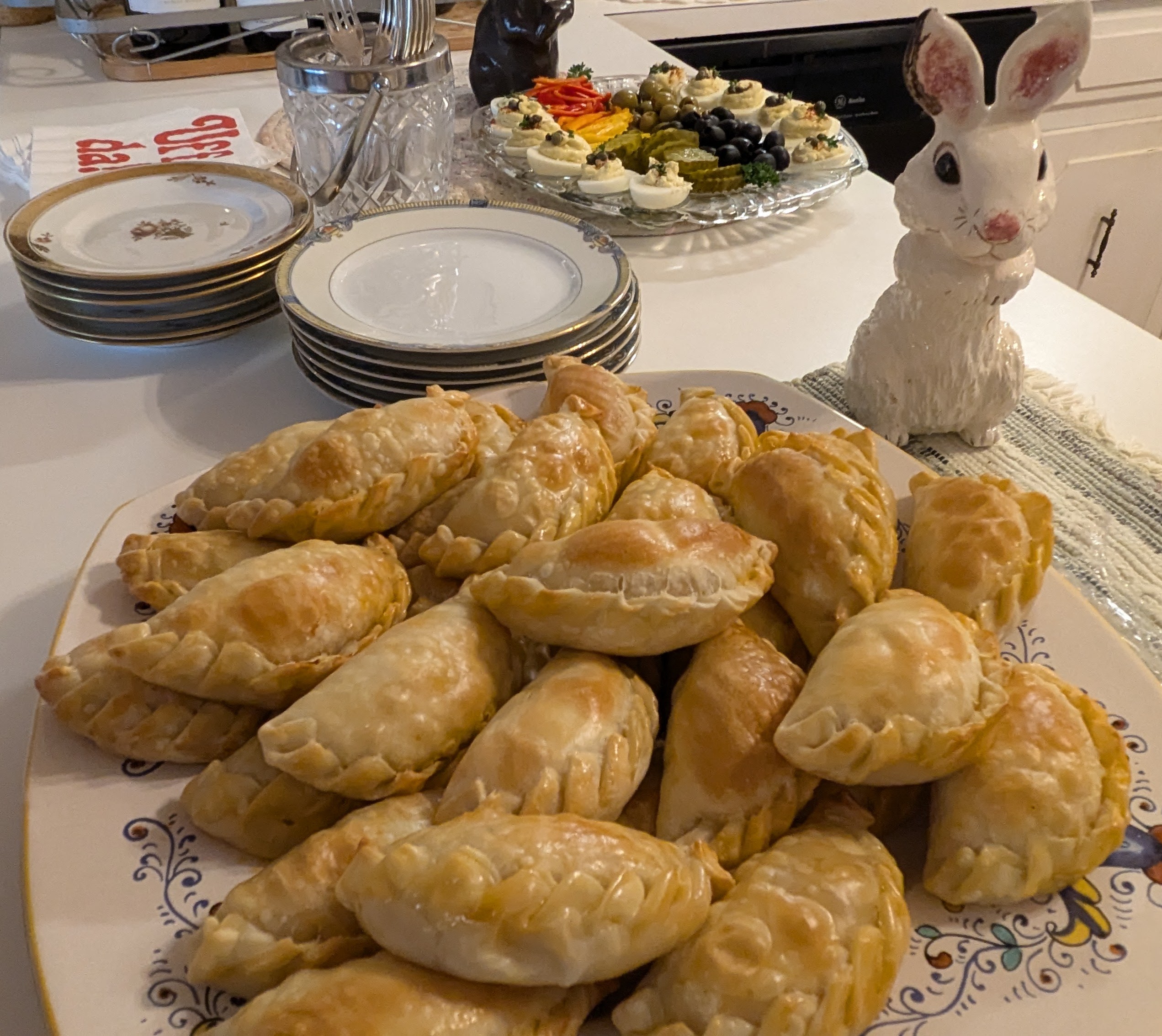
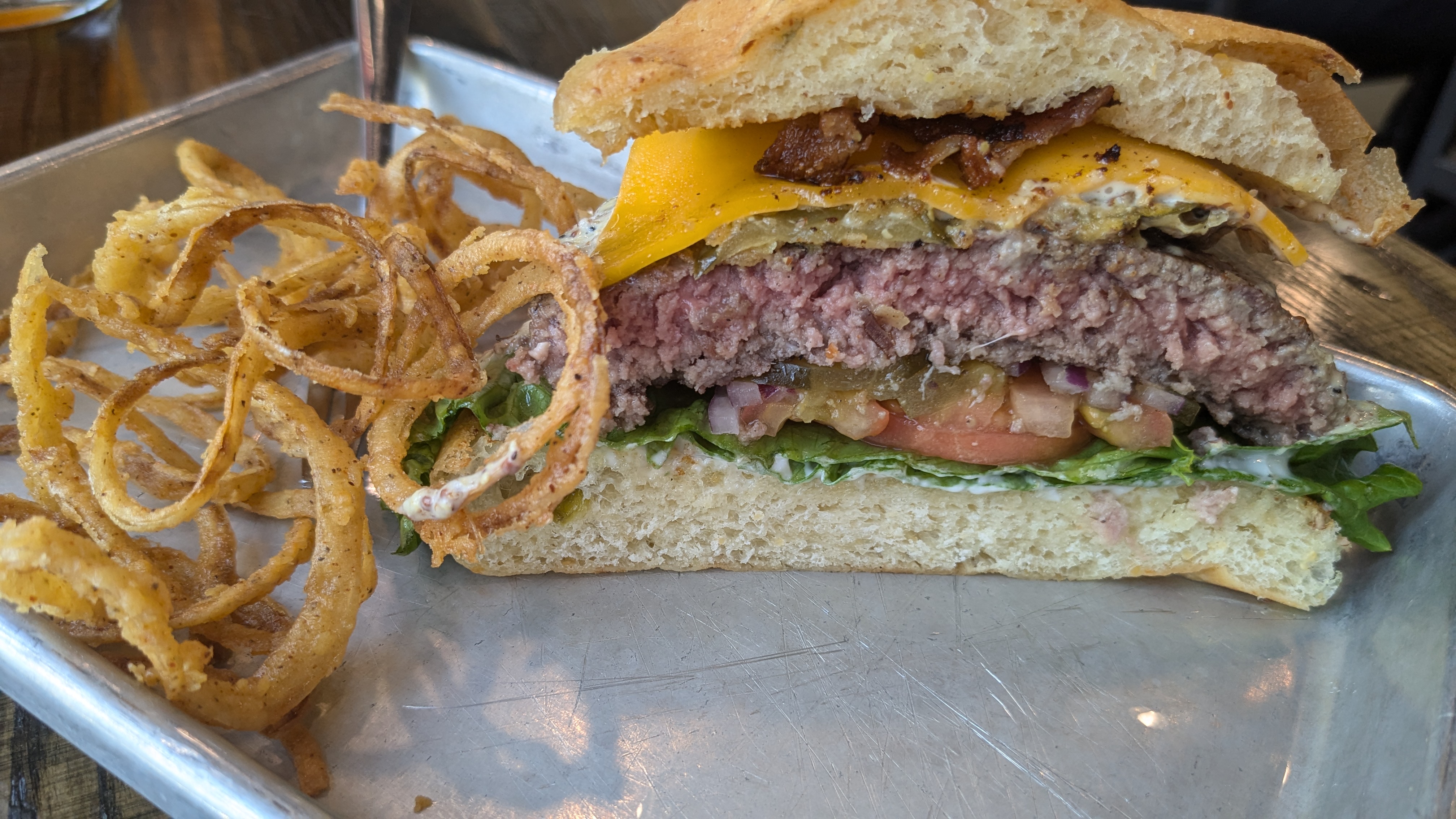
With celebratory glasses of champagne or wine in hand, and a buffet well-stocked with hors d’oeuvres, we resolved to delay serving dinner until the severe threat had passed. Conversation was lively, and the appetizers alone could have served as our meal. We kept a watch on outdoor conditions and listened to the continuing weather updates, while sampling Argentine empanadas, deviled eggs, salmon-topped cucumber slices, toast points topped with savory olive tapenade, and an assortment of pickles, olives, and peppers.
Great appetizers kept us company during the storm watch.Our friends and neighbors are creative chefs.
We all knew there was more food to come, but somehow the worsening weather spiked our appetites.
The screen was ablaze with red and yellow blobs of color in our viewing area. Place names seemed eerily close and familiar, but the sky was still light, the air was calm, and no rain was falling. However, the weather forecaster repeatedly recommended that area residents take shelter.
The warnings kept us all informed of the storm’s progression through our area.
The 12 adults gathered in my living room and screened porch looked questioningly at me and my husband as the wind picked up and raindrops began to fall. Together, we explained to our guests that getting to our “safe place,” a room we use strictly for storage, involved going outside and walking down an incline that becomes treacherous in the rain. It is definitely not a place of comfort. It has no television, and it has a large window.
We had no intention to gathering in our designated “safe room” with plates filled with game hens, wild rice, peas and carrots, and fresh-from-the-oven homemade rolls. Instead, we gathered loosely around the television, and continued to catch up on one another’s lives and activities since we had last been together.
The consensus was to remain where we were, closely watching the TV coverage, monitoring our phones for the latest information, and enjoying our holiday get-together. We agreed that, should a confirmed tornado veer in our direction, we would all gather in the single interior room in our home, the guest bathroom.
It’s adjacent to a concrete block fireplace wall and chimney, has no windows, is fortified by plumbing pipes and drain lines, and boasts at least two walls in every direction between the interior and the outdoors.
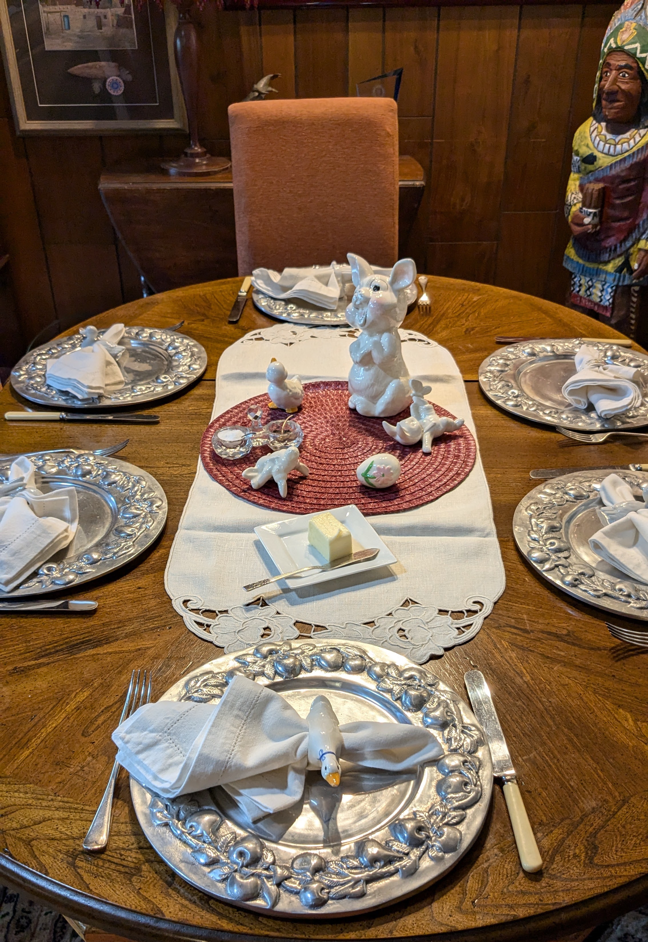
The settings, complete with bunnies and chicks, invited conversation.Our Easter tables were upscale, but also playful.
Once or twice, 12 cell phones served up a cacophony of high-pitched weather alerts along and the concerned faces of our local news station weather forecasters filled the television screen. Weather alerts continued to preempt the scheduled golf coverage on television.
As the minutes ticked by, we all remained comfortable, albeit watchful; some surveying the clouds and breathing in the fresh odor of falling rain. The assortment of appetizers continued to disappear, wine glasses were refilled, and interesting conversation flowed non-stop.
When the tornado threat was deemed to be beyond our geographic area, we drank another toast to friendship and fine food, moving to take our places at tables adorned with ceramic bunnies and white linen napkins, a casually elegant setting combined with a playful sense of humor.
We enjoyed our dinner, with a sense of camaraderie and thankfulness.
We could, at last, give thanks for the holiday celebration — and for the friendships — that are anything but ordinary. This year has already brought our state, and the entire nation, repeated weather events that have been far from ordinary. We will hope that as spring moves into summer, weather patterns calm and we can enjoy the beauty of the seasons to come.
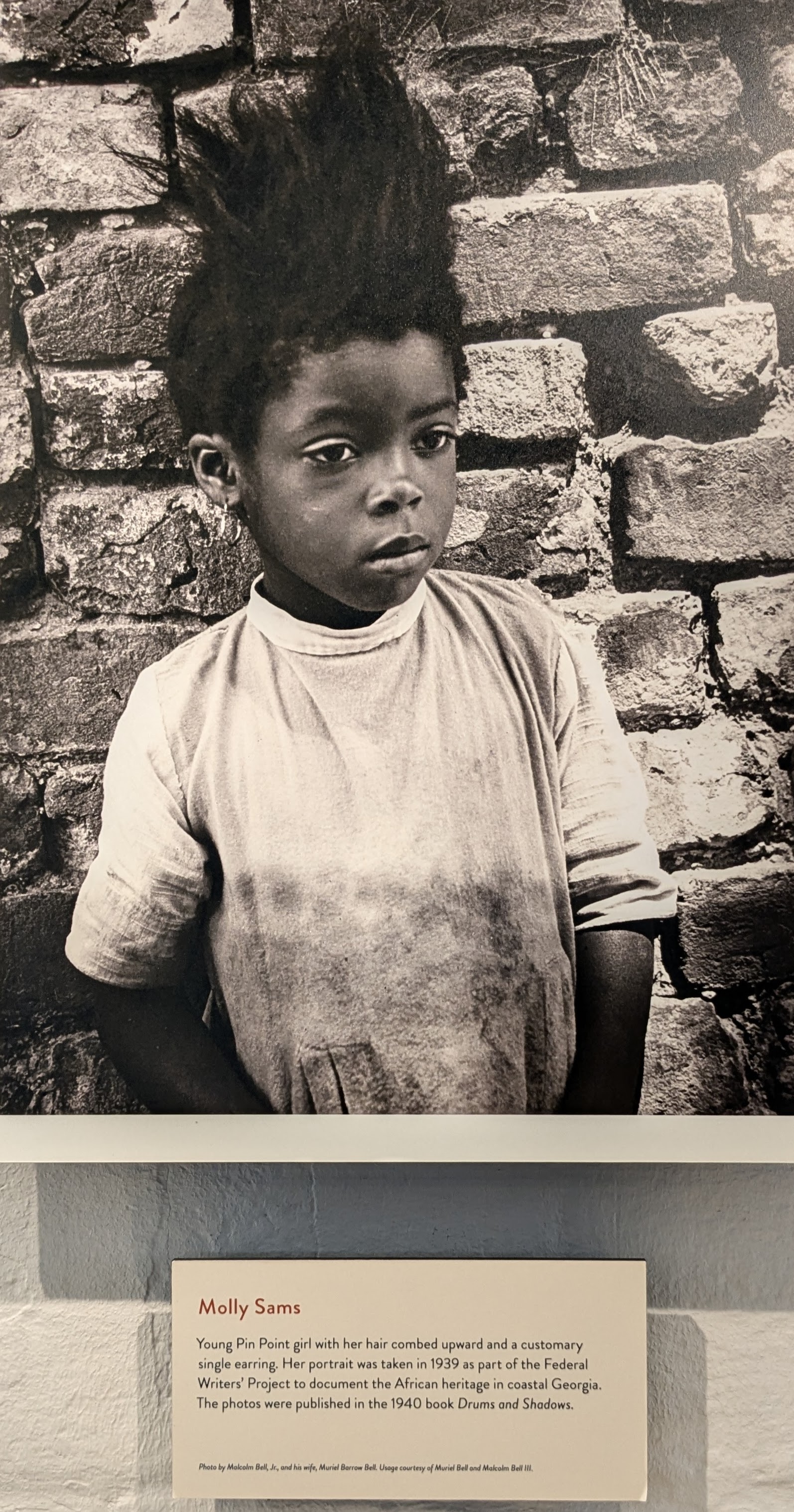
It’s a paint color, a pale, watery shade that seems somehow imbued with sky, water, serenity, and the hopes and dreams of an entire culture. It’s traditional for the Gullah Geechee inhabitants of Georgia, the Carolinas and the sea islands that extend along the Eastern seaboard all the way to northern Florida. These people were transplants from western Africa, primarily Angola. For them, the color blue was sacred.
One of the many variations of Haint Blue colors a door at Pin Point, an impressive Gullah Geechee Heritage Center only about 11 miles from Savannah. Also, the deep indigo bottles on the tree are a reminder of the heritage of the hue.
In their native land, and also in the new world as enslaved people, they worked indigo plantations. The distinctive blue dye derived from indigo plants was used for textiles and was also adopted for home furnishings and décor. The Gullah people frequently painted the trim on their dwellings or the ceilings of their porches the distinctive shade known as Haint Blue. Today, you’ll spot the color as building trim on small coastal cottages, and as the accent color on larger city dwellings along the Eastern Seaboard from the Carolinas to Florida as well. The blue that originally was derived from the Indigo plant has become an international favorite, and is a highly popular choice for home decor, particularly along the coast.
It’s a color that has also graced the porch ceilings of my homes — from Maine to Texas, and now in Arkansas — since I first learned about its history and its significance. It is said to ward off evil spirits. It is also believed to deter pests, particularly flies and mosquitoes. For those reasons alone, I would have chosen it, but the color is also calming and just unusual enough to appeal to me.
Besides that, it offers one more chance to tell a good story! I learned more about Haint Blue and its American roots during a trip last fall to Savannah and Tybee Island, Georgia.
The History of Haint Blue
In the early days of the American Colonies, the enslaved peoples from western Africa also brought with them the indigo seeds that thrived in their home countries. They grew well in the marshy sea islands along the Atlantic coast and the blue dye derived from the indigo plant became a cash crop for plantation owners, prized by the British in both the Old and New Worlds.
That distinctive blue retains its significance, although it appears today in a multitude of shades, from deep cobalt to a pale robin’s egg tint, from vibrant turquoise to a milky mixture of sky and sea with hints of grey or green. This historical affinity for blue is evident throughout the Low Country.
The African slaves toiled over indigo, along with cotton, rice and, later, tobacco. Following the Civil War, Gullah populations settled in communities along the coast, subsequently beginning the tedious job of “farming” the marshes for shrimp, oysters and crab. They also planted fruit trees and small vegetable gardens. Interestingly, it is the Gullah culture that can be credited for some of the more popular “Southern food” that we enjoy today.
Deemed unsuitable for wealthy Savannah buyers, former slaves pooled their money to buy the unconventional lots.
Waterfront property not far from Savannah that had been owned by Judge McAlpin as part of the Beaulieu Plantation was subdivided and sold to wealthy Savannah residents. Less-desirable marshy lots were made available to freed slaves who pooled their money to acquire long, narrow plots with limited access other than by boat through the marshes. The community of Pin Point was founded in 1896, and today it survives as the only Gullah Geechee community along the Atlantic coast that is untouched by commercialization.
Many of the newly-freed slaves remained on Skidaway, Ossabaw, and Green Islands as tenant farmers, crabbers and fishermen. However, a series of hurricanes swept through the barrier islands in the 1890s, killing many hundreds, if not thousands, of the inhabitants.
Pin Point is included in the swath of land from the Carolinas to northern Florida designated by the U.S. Congress in 2006 as the Gullah Geechee Heritage Corridor. Late last October, during the time of my visit to the area, a bridge to one of the coastal islands a bit further north collapsed during a Gullah Geechee celebration, killing seven people and injuring many more.
Against the Odds
From the beginning, the story of Gullah Geechee communities has been one of survival against the odds. It was a hard life, but the newly freed families “made do,” according to Gail Laverne Smith, who was born in Pin Point, Georgia.
Smith’s recently published book, “Gullah Geechee Gal,” is a collection of stories and poems that speak of her life in the community.
I met her at the Pin Point Heritage Museum, where she served as the Historic Interpreter. She spoke freely about her younger years as one of five children growing up in a community of fishermen, noting that they were “also skilled laborers who gathered to build homes, many of which were elevated on stilts to survive the heavy rains.” Known as shotgun houses, she explained that “when the front door opened, one could see clear through to the back of the house.” Other dwellings, including some of the first cabins in the community, were constructd of Tabby, a mixture of burned oyster shells, sand, water, and lime. A few still exist.
Today, about 100 residents still live in Pin Point, and the historic church and cemetery still serves local families. When the community was established, the first settlers built Sweetfield of Eden Church, an “offspring” of Hinder Me Not on Ossabaw Island.
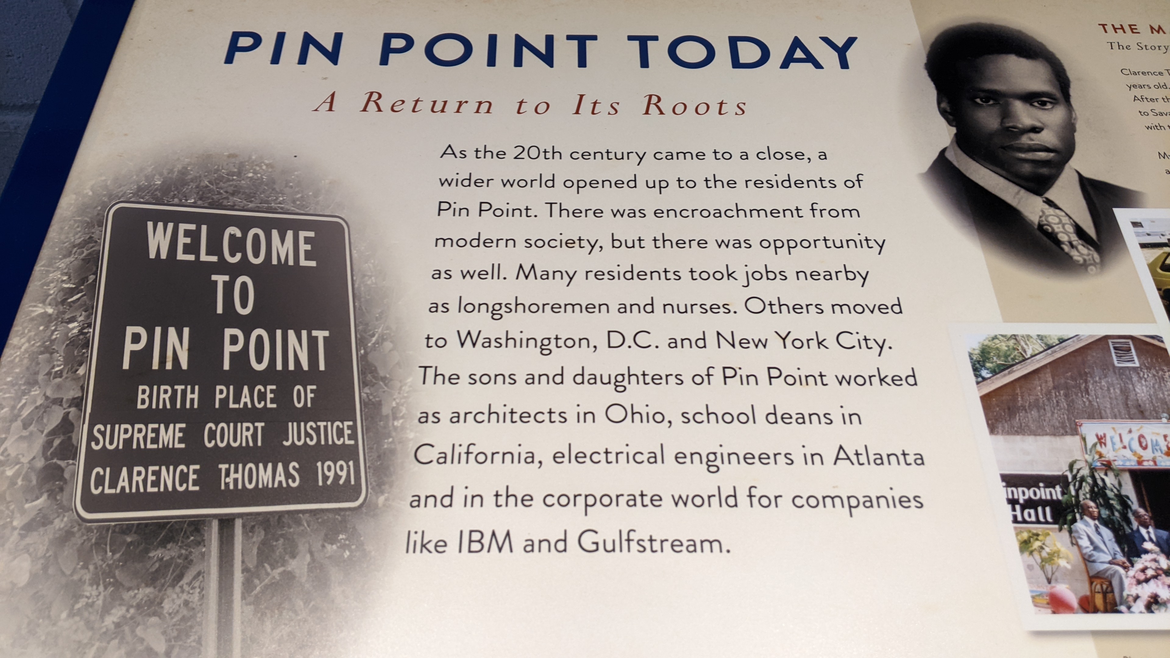
In the 1960s, according to Smith, about 400 families lived in Pin Point. Supreme Court Justice Clarence Thomas was born in 1948 to a Pin Point family. He was not only instrumental in the establishment of the cultural center, but is one of the featured former residents in the informative film shown to Pin Point visitors.
The Pin Point Heritage Museum
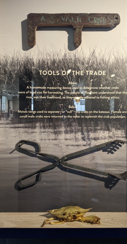
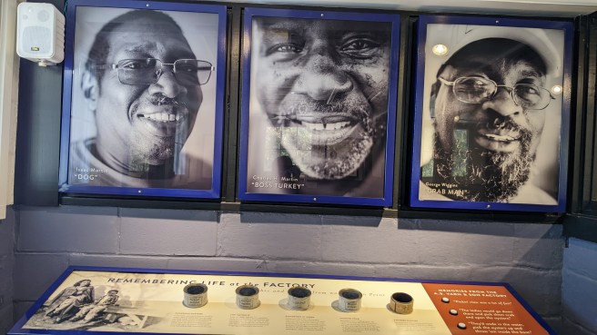
The educational center at Pin Point Heritage Museum is located in the former A.S. Varn and son Oyster and Crab Factory. Visitors are first treated to an introductory film, and then are free to explore the grounds at their own pace, learning about the factory’s operation during the years from its founding as a processing plant in 1926 until it ceased operation in 1985.
The Pin Point Heritage Center is located on a tranquil site not far from Savannah.
It was a strikingly sophisticated operation in its early years, with division of labor between men and women who performed the grueling work by hand. During the 1960’s, A.S. Varn was a major supplier of seafood along the Atlantic Coast. In the 70’s, however, a declining harvest and the rise of commercial fleets and factories contributed to its demise.
Pin Point offers a fascinating glimpse of those former times, as well as insight into the Gullah Geechee community that existed there. Just up the road from the marsh, the still-existing community stretches to the site of the church and its nearly-century-old cemetery, offering insight into the past of this former freedman’s community and to the growth and development of coastal Georgia. Traveling on that isolated roadway was akin to taking a step into the past.
The newly-freed people who founded Pin Point were determined to preserve their heritage and maintain their cultural heritage and traditions. As Gail Smith explains, they have done just that. Religion and spirituality played a pivotal role in Gullah family and community life. Enslaved Africans were exposed to Christian religious practices, and they incorporated them into the traditional system of African beliefs. One of the prime values was that of community, according to Gail Smith.
She noted that, while growing up in Pin Point, children did not talk back to their parents —obedience and respect for their elders were primary requirements, as well as a belief that the needs of the community trumped individual goals and desires. She noted that the center of daily life and activity was the family, and that religious beliefs, hard work, and respect for nature held the community together.
In her book, Smith notes: “Growing up as a little girl in Pin Point, I always felt like even though we didn’t have a lot, we always had just enough.”
She continues to chronicle the cultural history and traditional lore of her community through her stories and poems. Her willingness to share her memories with visitors to Pin Point ensures that the voices of her ancestors continue to be heard and celebrated. The time I spent with her was evocative of a lifestyle and time I previously knew little about and I am grateful that I had the opportunity to learn about the Gullah Geechee heritage.
Celebrating Cultural Heritage
Geechee communities developed, over time, a distinctive dialect to maintain their individuality and partially confound the slave owners. A mixture of English, Creole French and some African words and expressions, the language is still spoken today by some of the Low Country families, and it partially defines the culture, in a similar manner as Haint Blue.
Pin Point is located just 11 miles from Savannah, situated adjacent to the marsh that separates it from Moon River. It is the last surviving black-owned waterfront community in coastal Georgia, one of the distinct communities that constitutes the Gullah Geechee National Heritage Corridor, the historic swath of territory established by an act of Congress in 2006.
That corridor is designated to ”help preserve and interpret the traditional cultural practices, sites, and resources associated withGullah-Geechee people. It extends along the eastern U.S. coast through North and South Carolina, Georgia and Florida, culminating at the site of Fort Mose in St. Augustine, FL, which in 1738 was the first legally-sanctioned free black community in what would become the United States.
Today, the Gullah Geechee Corridor focuses on 79 Atlantic barrier islands in the designated area and certain adjoining areas within 30 miles of the coast. Traditional Gullah baskets woven from native sea grass are popular items at the Charleston market. Also, it is interesting to note that some of the typically “Southern dishes” that we enjoy today can be traced to the foods grown and consumed by the early Gullah inhabitants who not only caught fish, shrimp, crab and oysters from the sea, but also planted beans, rice and vegetables on their small plots of land.
The Gullah Geechee Corridor is administered through a partnership between the National Park Service, local governments, and cultural and tourishm authorities from the Charles Pinckney National Historic Site in Mount Pleasant, South Carolina, just northeast of Charleston. If you’re interested in the area’s history, that site is also well worth a visit.
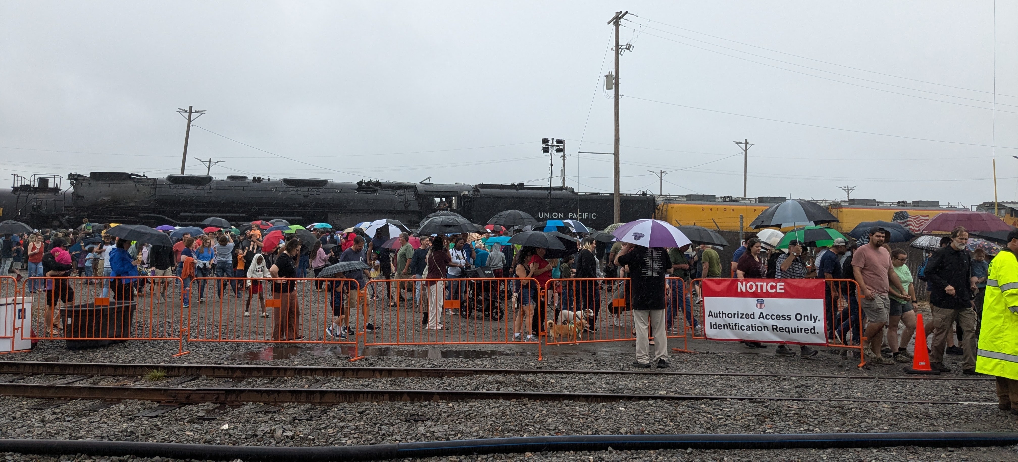
I made my way as close as possible to the railroad tracks earlier this month, as eager as children half my height, for a close-up view of Union Pacific’s “Big Boy” 4014 steam locomotive. It was at rest in the rail yard in North Little Rock, a scheduled stop along its 2024 Heartland of America Tour. The route takes it through nine states, with “whistle stops” in more than three dozen different communities. You might also see it passing through the countryside, but visitors are admonished to stay “at least 25 feet back” as the massive locomotive travels along the rails. View the route and tentative schedule.
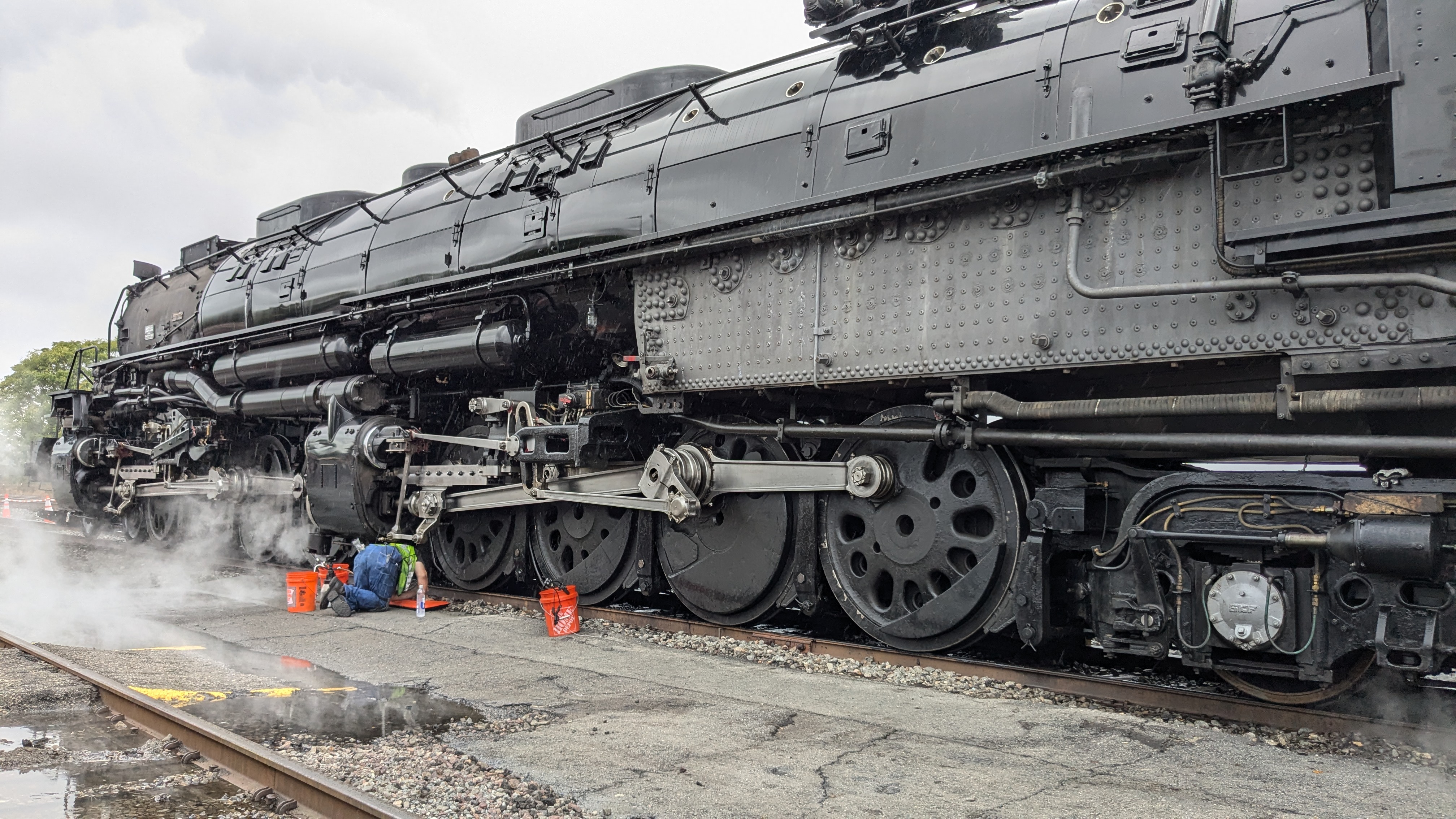
This relic from the glory days of transcontinental railroad commerce and loaded freight trains is the last operating steam locomotive of 25 built between 1941 and 1944 for the Union Pacific Railroad.
The public was invited to view the glistening black behemoth from 5 to 7 p.m. on September 15, during an overnight visit to one of the railroad company’s major modern servicing facilities. The facility is busy 24 hours a day, sorting freight cars that arrive and depart from across the country. It was a cloudy, grey afternoon, but hundreds of people, young and old alike, turned out to see the historic steam locomotive. The round-trip “rolling tour” began August 28 in Cheyenne, Wyoming, and will end back in Cheyenne in late October.
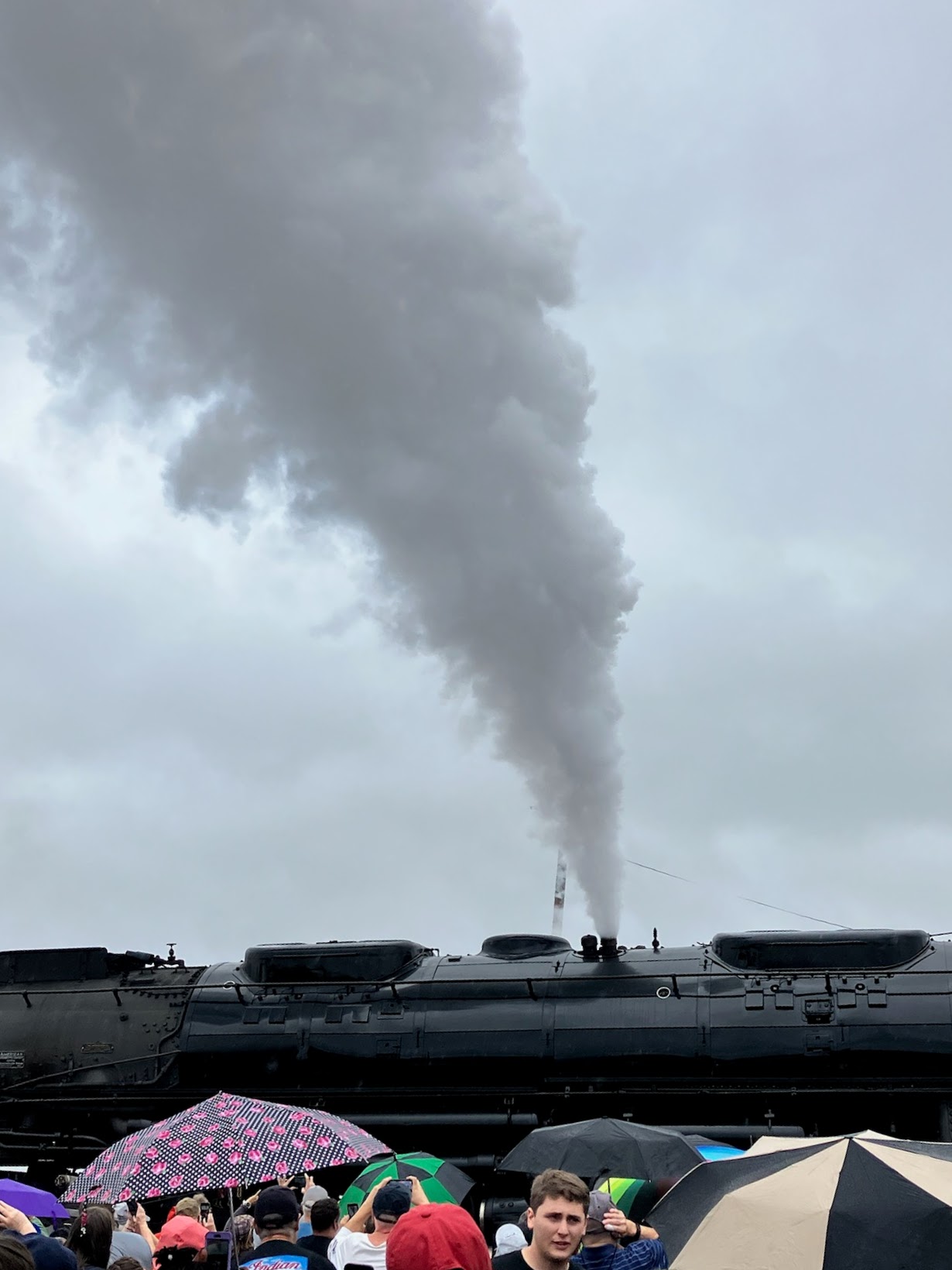
Some visitors parked blocks away, but a walk over uneven gravel and through a sea of mud puddles did not dampen their enthusiasm. Even the unrelenting drizzle was just a minor annoyance. Ed Dickens, senior manager of Union Pacific Heritage Operations, is the locomotive’s chief engineer for the tour. From all appearances, he was having as much fun as the viewers, waving to children and snapping his own photos of the crowd. Occasionally, he sounded the mournful whistle, and laughed as young children covered their ears.
People of all ages stood transfixed, the younger ones beside me pushing against the barricades. Many of them had probably never before been close enough to even wave at a train. There were aging men and women with canes and walkers, and others in wheelchairs. A layer of colorful umbrellas formed a spotty canopy above the heads of the crowd. Children sporting hoodies and ear-to-ear smiles clasped grown-up hands, and toddlers perched expectantly on their fathers’ shoulders.
A service crew was busy at work, even as raindrops continued to fall. The engine belched billows of steam into the sky and more steam drifted between the wheels along its underbelly.
A Return to Days Long Gone
Some of us who grew up watching freight trains rumble through small towns still love the “choo-choo” sounds of the wheels as much as the “melodies” of the whistles. Note: This recording is a blast of the whistle on another steam locomotive in Union Pacific’s Heritage Fleet, Number 844, the only one never to be officially “retired” from active service. Smaller than the Big Boy, it is used to pull expedition trains from its home base at the Union Pacific Museum in Council Bluffs, Iowa.
I have numerous train-related memories. My husband, who grew up in Maine, remembers placing pennies on railroad tracks near a rented summer beach house, waiting for a train to pass, and then retrieving the flattened, elongated pieces of copper.
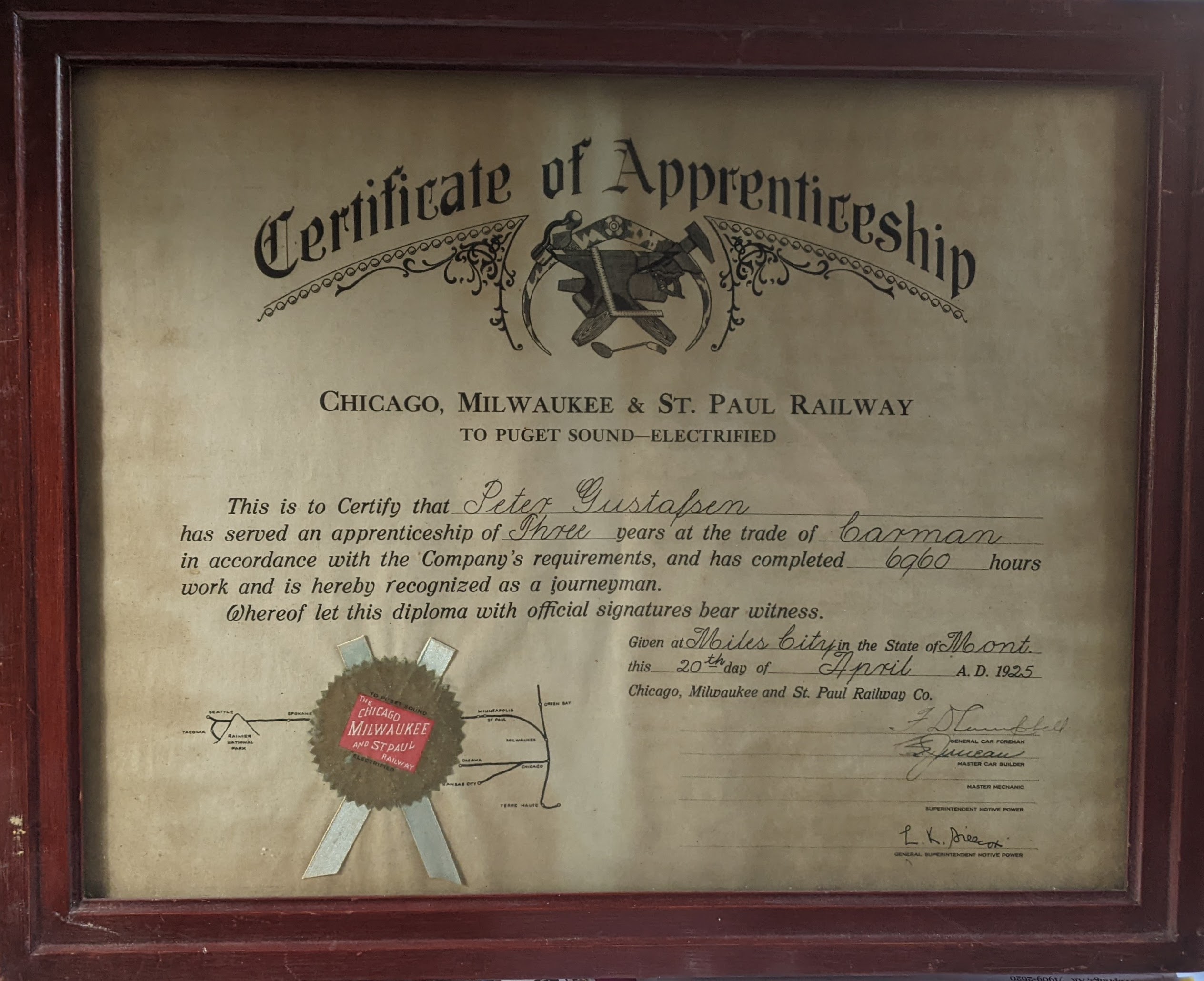
One of my grandfathers completed a three-year apprenticeship as carman for the Chicago, Milwaukee & St. Paul Railway Co., to “Puget Sound—Electrified” in April 1925. Today that certificate hangs on my office wall, along with a photo of yet another early steam locomotive. I confess that I still wave at trains, although I typically don’t expect a return wave from the engineer. Sadly, the brakemen on those cabooses of long ago have also now disappeared. Most trains no longer even have a caboose; they have been replaced by electronic small-box sensors.
I remember passenger trains as well as long-haul freight trains, and I sometimes yearn for those days of “slow travel,” observation cars, and meals served by white-gloved waiters in dining cars with linen tablecloths and distinctive china, silver, and sturdy glassware. Seeing this locomotive, the last and largest of its type still in use anywhere in the world, represents a step back into much-loved childhood memories for me.
The trains that now speed along tracks adjacent to the nation’s highways no longer have the same appeal, but freight trains still serve the needs of modern commerce and transport our country’s freight. The market is expected to reach $400 billion in 2024, with growth to more than $510 billion by 2029. There is also a growing resurgence in railroad tourism in some parts of the United States, and travel by high-speed rail in other countries is increasingly popular.
Saved from the Scrapheap
The Big Boy is the largest articulated steam locomotive ever constructed, and it was designed specifically to pull heavy loads over the steep grades of the Wasatch Mountains in Utah. Constructed by American Locomotive Company, with development input from Union Pacific, the Big Boy was designed to handle heavy freight loads, conquer the mountain grades of the routes through western mountain states, do it all at a reliable speed with no need for an auxiliary engine, and deliver the goods to western destinations on schedule.
Twenty were delivered to Union Pacific and placed in service in 1941, largely in support of the second world war effort. Another five were delivered in 1944, but the last of the Big Boys was pulled from service by 1962. Number 4014 completed its last revenue run in July 1959, and was officially retired in December 1961 after 17 years of active service, exactly 20 years after its first run.
Union Pacific launched a five-year-long restoration of Big Boy 4014 when the company reacquired it from a museum in California in 2013. The locomotive was moved from southern California to Cheyenne, where it sat idle for nearly two years as plans were completed for its restoration. Not only did the facility require expansion and updating to accommodate the Big Boy, but the locomotive had to be totally disassembled. In some cases, new parts were fabricated, and it was converted from coal to run on more efficient, less expensive diesel fuel.
Otherwise, however, the locomotive has been restored to its original design and configuration.
In the spring of 2019, a test-firing was successful, and Number 4014 moved “under its own power” for the first time in nearly 60 years. The revitalized Big Boy locomotive made a first test run the next evening from Cheyenne to Nunn, Colorado.
The rest, as they say, is history. And now, the public can share that history on annual runs that typically attract thousands all along the designated routes.
When the restoration was complete in 2019, Big Boy 4014 embarked on an inaugural tour to commemorate the 150th anniversary of the Transcontinental Railroad’s completion. The locomotive was then placed in excursion service as a member of the Union Pacific Heritage Fleet. Today, it is said to be Union Pacific’s primary public relations tool. Earlier this year, the locomotive completed a “Westward Bound” tour to California, passing through five states and culminating with an excursion for paying guests. Such special events help underwrite therailroad’s museum operation.
Who Cares about an Old Steam Engine?
Although Big Boy locomotives were said to be capable of speeds up to 80 miles per hour, there is no confirmation that they ever actually traveled that fast. They typically ran well under 60 mph, often chugging along at a much lower speed, but they did so reliably and consistently for nearly two decades.
Many of them traveled a million miles or more. Number 4014 logged 1,031,205 miles during its years in service. Astoundingly, the Big Boy locomotive is nearly 133 feet in length and weighs 1.2 million pounds. The primary advantage was its power. It is still robust and, for all its size and power, it is able to maneuver mountain curves because it is articulated, or “hinged” at strategic points.
This is no ordinary engine. And a lot of people care. I have fond memories of traveling by train both in this country and abroad, but the passenger trains I remember, with their sleek diesel engines, are a totally different breed from the steam locomotives that served as the iconic workhorses of the railroads.
Big Boy 4014 is the only one of 25 built that is still in operation. And it is the largest operational steam locomotive in the world today.
Ed Dickens of the train’s crew notes that the locomotive, with a weight of approximately 600 tons, “runs like a Swiss watch,” even though it can easily pull a train five miles long on flat ground. He says that it was designed to be simple to operate, adding that “you drive by the seat of your pants – you smell the brakes,” and the crew becomes familiar with the sounds.
If you’re interested in learning more about Big Boy 4014, and the history of the steam engine era, tune in to this episode of Jay Leno’s Garage on You Tube. You’ll love it!
Finally, if you’re interested in seeing Big Boy 4014, its home base is in Cheyenne, Wyoming, when it’s not on tour. Other Big Boy locomotives can be viewed in Denver CO, St. Louis MO, Scranton PA, Green Bay WI, Frisco TX, and Omaha NE, just across the river from the Union Pacific Railroad Museum in Council Bluffs, Iowa. If you’re a fan of old trains, though, and you go to Council Bluffs, plan to spend the better part of a day there. And you’ll leave wanting to return.
Imbued with a long and multi-faceted history, Santa Fe is a fascinating city characterized by a cultural richness that few other places possess. It offers something of interest to every visitor, in every season. But it’s impossible to see it all in just a few days, and no matter how much time you spend in the city or how many times you return, there is always something new to discover. First-time visitors are typically eager to learn about Santa Fe, but can leave exhausted if they attempt to see, do and “feel” it all.
Don’t let that happen to you.
Instead, prepare for a trip to this 400-year-old city by doing some homework before you leave home. Know that, at an elevation of 7,000 feet, you are likely to tire more quickly than you might at home. Understand that Santa Fe has a delightful downtown square, and the city radiates in all directions from that plaza. In many ways, it’s a city to explore on foot, but distances can be deceiving. Embrace the art, the food, the museums, and the galleries, the restaurants and bars, and the natural beauty that surrounds you, but understand that Santa Fe is not a “bargain” destination. Learn about Santa Fe’s history, and appreciate the cultural differences. It’s that mix of old and new, of “everyday” and “one-of-a-kind” that casts a spell and makes Santa Fe unique.
Plan your trip and your activities wisely. Santa Fe is the capital of New Mexico, a state known for its diverse attractions, from mountains and winter sports to the sprawling desert landscape of White Sands, from ancient cliff dwellings and Native American Pueblos to Old West mining towns and the futuristic Very Large Array National Radio Astronomy Observatory. If possible, take the time to get out of Santa Fe and visit other parts of the state.
Chances are you’ll find something to love no matter what direction you go. Santa Fe is just “up the road” from Albuquerque, New Mexico’s largest city with a major airport. If you fly into Albuquerque, it’s best to rent a car there and drive north. One of your first stops should be at the Tourist Information Center in Santa Fe, near the state capitol. The knowledgeable staff can help you flesh out your plans for the time you’ll spend in “The City Different.”
Where to Stay
Downtown hotels, particularly those within walking distance of the Plaza, are typically expensive and frequently fully booked. If one of these highly desirable options is your choice, make your reservations well in advance. There are also numerous boutique hotels, B&Bs, nearby resort accommodations, chain motels, timeshares, private guest casitas and rental condos in and near Santa Fe.
Use your favorite booking site or ask for recommendations from friends who have recently visited the city. On my recent trip, I stayed two nights at a delightful motel in a location that was convenient for what I planned to do in the city. I was there primarily to visit old friends. I was not looking for luxury, but was pleasantly surprised by the price and the amenities. The included breakfast is worth a shout-out — featuring freshly-prepared plump burritos and a variety of muffins, cereal, juice and yogurt — as is the level of service. The decor at Coyote South is distinctive, fresh and modern, and the staff is friendly and knowledgeable.
You will also find noted resorts and wellness retreats, although some are located quite a distance from downtown Santa Fe. Visitors can book packages that include spa treatments, pools and hot tubs, luxury accommodations, and distinctive meals. Two of the most unique are Ten Thousand Waves and Ojo Santa Fe.
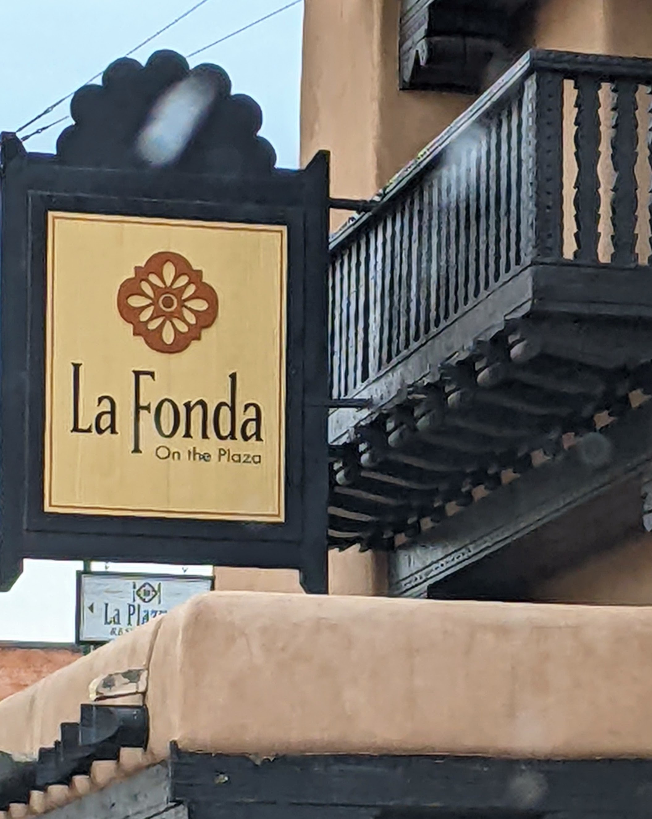
Wherever you choose to stay, I can recommend a visit to La Fonda on the Plaza, for a drink or a meal, or just to look around. One of the city’s oldest landmarks, it occupies the site of the city’s first inn, built in the early 1600s when the city became the northern outpost of Spanish colonization. In the 1800s, La Fonda provided hospitality for anyone traveling west on the Santa Fe Trail. The current structure dates to 1922, and many of its signature features — beams, tin chandeliers and skylights — are original.
The inn was acquired by the ATSF railroad in 1925 and leased to hotelier Fred Harvey, whose “Harvey Girls” provided travelers great food and service until the hotel was sold in 1968. Today, it continues to serve travelers, with 180 guest rooms, three dining options, luxury amenities and an onsite spa. It is also a popular event venue and business center, renowned because of its period architecture, its history, and its hospitality. Stop in for a drink or a meal, or take a complimentary history and art tour, and you’ll see why.
Ask for assistance from a hotel concierge or your B&B host to help you plan skiing, hiking or fishing excursions, and trips to surrounding pueblos and casinos. Locals are usually only too willing to share information and help visitors,
Where to Eat
Santa Fe is also a noted foodie destination, with almost limitless options for both casual fare and fine dining. Many of the city’s finest restaurants are small, and reservations are recommended. You may encounter lines at popular lunch spots, especially in summer, during the many festivals, or at the height of the ski season. Plan ahead and be patient.
Breakfast is a favorite meal and a long-standing tradition in Santa Fe. Pasqual’s, situated a block off the Plaza, is always crowded, especially for breakfast, but it’s open every day except Tuesday, and it’s worth a wait. When ordering breakfast burritos or any type of egg dish, you may be asked “red, green or Christmas?” The question is to determine your preference of chile toppings. Know that it’s no sin to ask which is hotter; if you’d like to sample the different tastes, ask for Christmas. You’ll get some of each.
Casual eateries serve a wide variety of tastes, offering food that is fresh, flavorful and fun. Stop to sample local specialties at out-of-the-way cafes with patio seating, or order New Mexican or Native American street food from a vendor during a Santa Fe festival. You won’t be disappointed, and people-watching is a popular pastime. Order take-out from The Burrito Company or the Plaza Cafe to eat on a bench at the Plaza, or spread a blanket on the grass near the river.
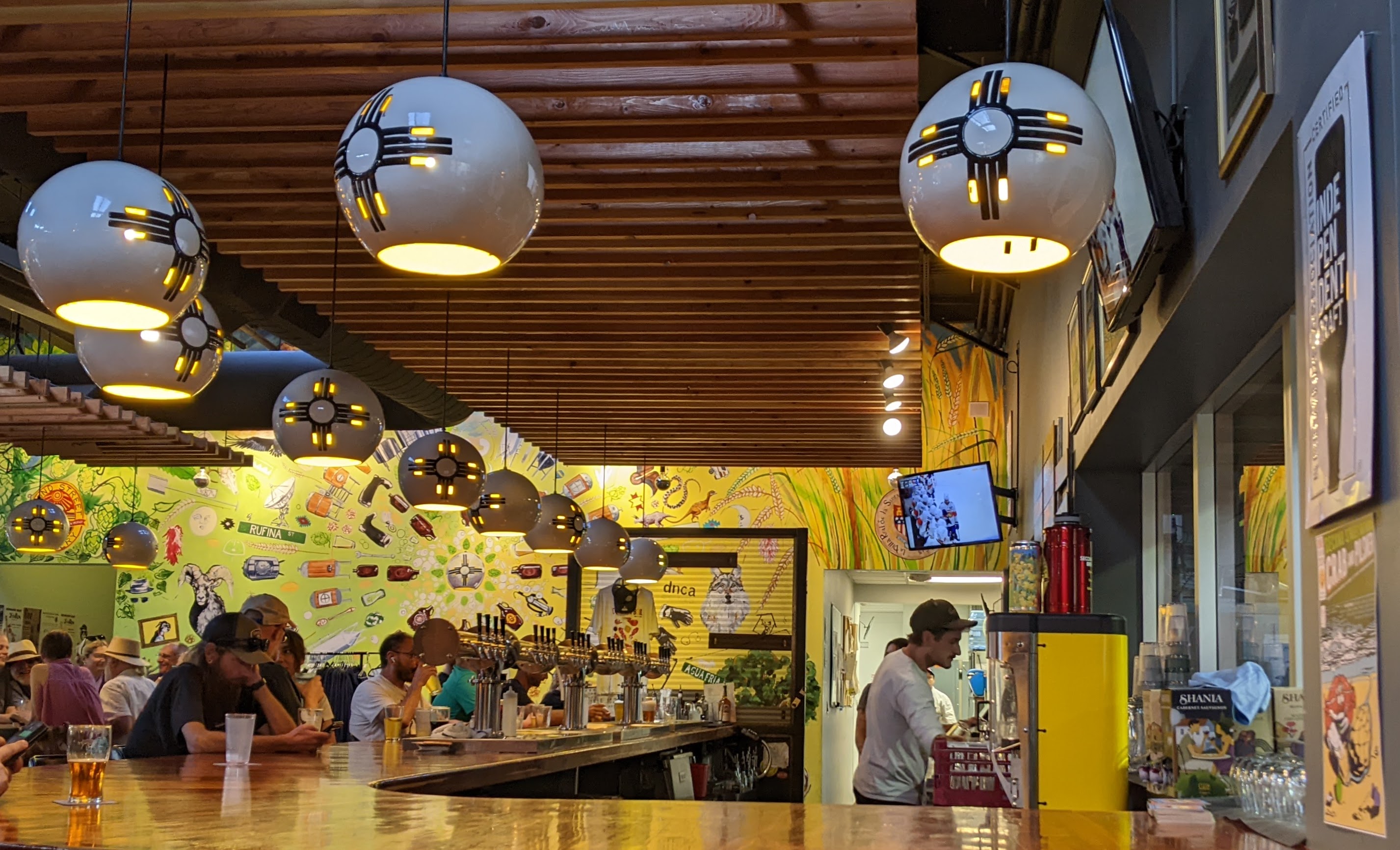
If you explore Santa Fe neighborhoods, don’t neglect shopping center eateries and local craft breweries. You’ll find reasonably priced food, prompt service, and friendly people. Joe’s, on the south side of town is one such place, and Santa Fe Brewing Co. has several locations in both Santa Fe and Albuquerque.
Need more suggestions about where to go? Here’s my short and very random list of personal favorites, but be open to exploring. Try someplace new and find your own favorites.
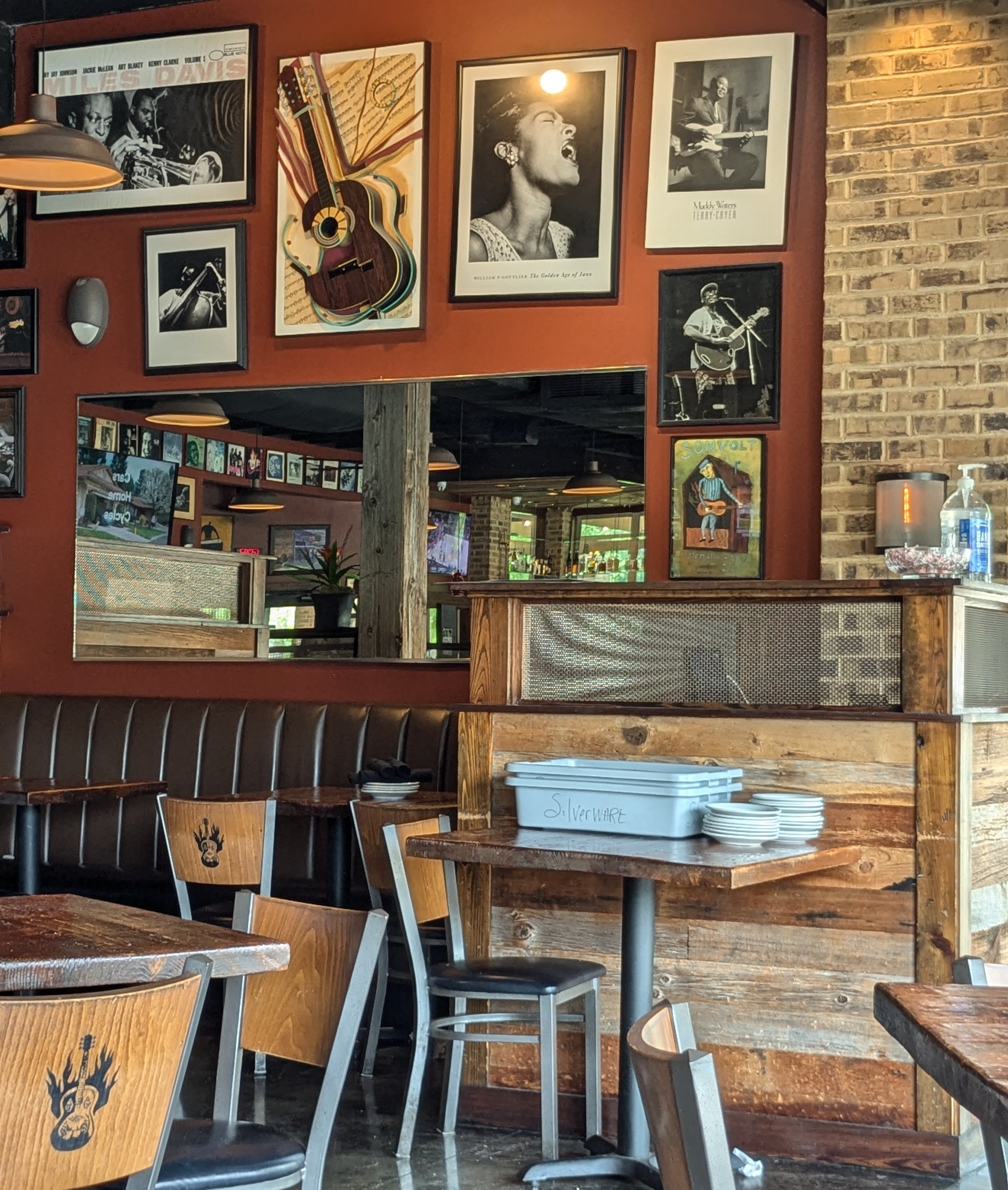
El Farol on Canyon Road is a classic Santa Fe hot spot located in an adobe building that dates to 1835. Open Wednesday through Sunday from 4 to 9 p.m., the parking situation can be difficult, and the decor is rustic rather than refined, but the live music and flamenco performances make it an experience rather than simply a meal. Daily Happy Hour drink and tapas specialties attract crowds. Dinner choices that include paella, mussels, beef, and salmon as well as New Mexico enchiladas and desserts are legendary. Vegetarian and vegan options are available.
Coyote Cafe at 132 W. Water St. has won awards since it first opened in 1987, and the acclaim continues to this day. Named 1st Place winner in the Best of Santa Fe competition for 2024, Celebrity Chef Mark Miller pioneered the use of strictly regional and native ingredients to develop menus that have stood the test of time. Coyote Cafe attracts an army of repeat visitors. The Rooftop Cantina is a lively casual gathering spot for locals and visitors alike. Order Mama Schutz’ Frito Pie as a nod to tradition. Santacafe, a sister venue, is located at 231 Washington Ave., and is noted equally for its elegant outdoor courtyard dining patio and its delicious food.
El Nido in Tesuque, another of my go-to choices, is especially soothing on a chilly fall afternoon or a cold, snowy winter evening. The heated garden portal is a wonderful gathering spot from spring into fall, but the interior is El Nido’s all-season haven, with the ambience of aged wood, original tin chandeliers and colorful wall murals. Meals are prepared at an open-fire grill center, so diners can watch the action. Order sake and sample starters from El Nido’s companion sushi bar “SU.” Then, your dinner choices — pizza, pasta, steak, seafood, or chicken — will arrive at your table perfectly prepared, well-seasoned and hot off the grill.
After a day of gallery hopping or sightseeing, a restorative Margarita from the 100 or so on the menu at Maria’s may be “just what the doctor ordered!” It’s a long-standing tradition, where Santa Fe friends meet and visitors to the city go to make new friends and exchange stories. It’s lively and loud, usually crowded, exceedingly friendly and welcoming, and totally likeable. I’m not kidding. Don’t hesitate to ask locals for recommendations for a late dinner or an early breakfast.
New bars and restaurants spring up regularly, while others have been open for decades, if not centuries.
What to Do
Excursions from Santa Fe provide a long list of opportunities. Depending on your interests, you can fish clear lakes or swift-running mountain streams. Visit Native American pueblos to learn about the ancient cultures that have existed here for centuries. Visitors are welcome, but respect the traditions of each pueblo, especially if you visit on a feast day or for a special ceremony.
Visit the Bradbury Science Museum in Los Alamos. It explains the history of the Manhattan Project and other research and discoveries during the atomic age, as well as continuing scientific studies. Admission is free, and the museum is open every day except Monday, but check current hours. On the way to Los Alamos, about an hour from Santa Fe, stop at Bandelier National Monument to explore ancient cliff dwellings in the Jemez mountains. Nearby Frijoles Canyon offers spectacular scenery and views.
The award-winning Los Alamos Nature Center is filled with interactive exhibits and displays, including live animals, a topo map of the surrounding plateau, a children’s discovery area, information about the Valles Caldera, and a wonderful planetarium. Evidence of volcanic action is still detected at this dormant, but not extinct caldera, formed by an eruption more than a million years ago. It’s a not-to-be-missed attraction, especially if you’re traveling with kids.
Las Vegas lies an hour or east of Santa Fe. In addition to its historic Old Town, the Las Vegas National Wildlife Refuge boast 8,000 acres of grasslands, wetlands, and forests, where birders and hikers can explore to their heart’s content. Guided tours are available at historic Fort Union that played a pivotal role in both Indian conflicts and the Civil War, and the Rough Rider Museum sheds light on the time that Theodore Roosevelt spent in New Mexico, offering insights into his legacy. Finally, a visit to Montezuma Castle, a pueblo structure built more than 800 years ago, gives visitors a unique glimpse into the history of the area. Las Vegas also has an active modern arts community, and you’ll find galleries, eateries, and plenty to round out a visit to an interesting historic town.
Madrid, pronounced with an emphasis of the “Mad,” is on the back road to Albuquerque, and if you’re driving, it’s worth your time to explore this funky old coal mining town turned artist’s colony. Madrid is pretty much the midpoint of The Turquoise Trail, the designated scenic byway between Tijeras, east of Albuquerque, and Santa Fe. It passes through the small towns of Cedar Crest, Sandia Park, Golden, Madrid, Cerrillos, and Lone Butte/San Marcos on its way to “the top of the trail,” and Santa Fe. The Mine Shaft Tavern in Madrid is worth a visit, whether you make it a lunch excursion from Santa Fe, or a stop along the Turquoise Trail.
Finding Enchantment in The City Different
New Mexico is termed the Land of Enchantment. I was first introduced to this enchantment in the mid-7o’s when I visited as a tourist from Dallas. Then, I moved to Santa Fe in 1991, and spent nearly 20 years there. During my tenure, the city changed in many ways, and I moved on. But my love for Santa Fe never waned. In some ways, I still miss the city, the culture, and the lifestyle. I have not returned often enough over the decade or so since I left. But each time I do, I fall in love with the city all over again. It tugs at my heartstrings.
If you haven’t previously visited this magical place, perhaps you too will be captivated as I was. Try not to draw comparisons with other places. Just enjoy it because it is The City Different.
In Santa Fe, you can eat the food of many different cultures, gaze at stars in the sky so bright you’d swear you could reach up and touch them. Breathe in the fresh mountain air — it will be pinon-scented in the winter from the wood that burns in local fireplaces. Smell the lilacs in the spring and savor the scent of roasting chiles in the fall. Bask in the warm sun all summer and don your boots to hear the crunch of fresh snow on crisp winter days. The sun will shine most days, no matter what the season. Hopefully, no matter how long you stay, you’ll leave wanting to return.
Pick and choose from the seemingly unending buffet of treats that Santa Fe offers. Stop to enjoy its quiet beauty. A traveler’s best resource is the Official Visitors Guide. It provides a great introduction to the City Different. View it online or request a copy delivered right to your home.
Note: The recommendations I have made are all based on personal knowledge gained during the years I was a resident of Santa Fe or my travels in New Mexico over the years. I have not been compensated, financially or otherwise, based on opinions I have shared.
It has been more than a decade since I lived in Santa Fe. But it’s a city one cannot easily forget. In many ways, it’s a city that I will always miss. I fell in love with Santa Fe the first time I visited, about 1975, and I still cherish the years that I lived and worked there.
Long described by both residents and visitors as “The City Different,” Santa Fe was known by its earliest inhabitants as “The Dancing Ground of the Sun.” Those of us who arrived to become new residents when it was still a relatively small town were attracted by its culture, its lifestyle, the spectacular sunsets, and the people. We were mesmerized by the changing seasons, the landscape, the diversity, and by city’s traditions and timeless quality. We hoped it would remain so forever.
But change is inevitable, and Santa Fe’s growth and growing popularity prompted many changes, some of them good and some not so well received. Over a span of nearly 20 years, the population grew by more than 20,000, with new residents from every state and many other countries. No longer was it a quaint New Mexico town with a predominantly Hispanic and Native American population. It became much more cosmopolitan, and more complex.
Prices increased, of course, not only for housing, but for all goods and services. New businesses opened, and new philosophies of growth, development, and government were born. Tourism thrived, and Santa Fe became an increasingly popular destination. Some “old-timers” feared then that Santa Fe would lose its appeal and become “not so different” from other prominent tourist destinations around the world.
Change and Growth Are Not Always Negative
Recently, my husband and I revisited Santa Fe. Our time was limited, but we made the most of the opportunity to see old friends, neighbors and business associates. We found, happily, that Santa Fe’s charm has not been diminished. The opposite is true.
Surprises still exist seemingly around every corner. Some of our favorite restaurants and old “haunts” have disappeared, but many are still there. New ones have opened and become popular, adding a new dimension. Annual celebrations and the festivals that we loved so much are still on the calendar — Summer’s Wine and Chile Festival, the traditional Spanish and Indian Markets, and the annual burning of Zozobra. This year marked the 72nd year of Spanish Market in July, and more than 1,000 artists from 200 tribes were featured at the 102nd Indian Market, held mid-August. But now, there are festivals and markets year round. The Holiday Folk Art Market complements summer’s International Folk Art Market, and popular Artists Markets are held near the Railyard Saturdays from May through December.
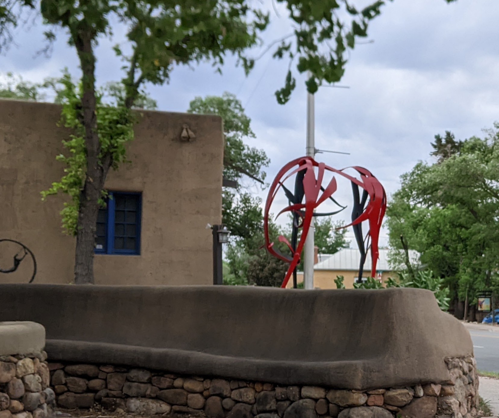
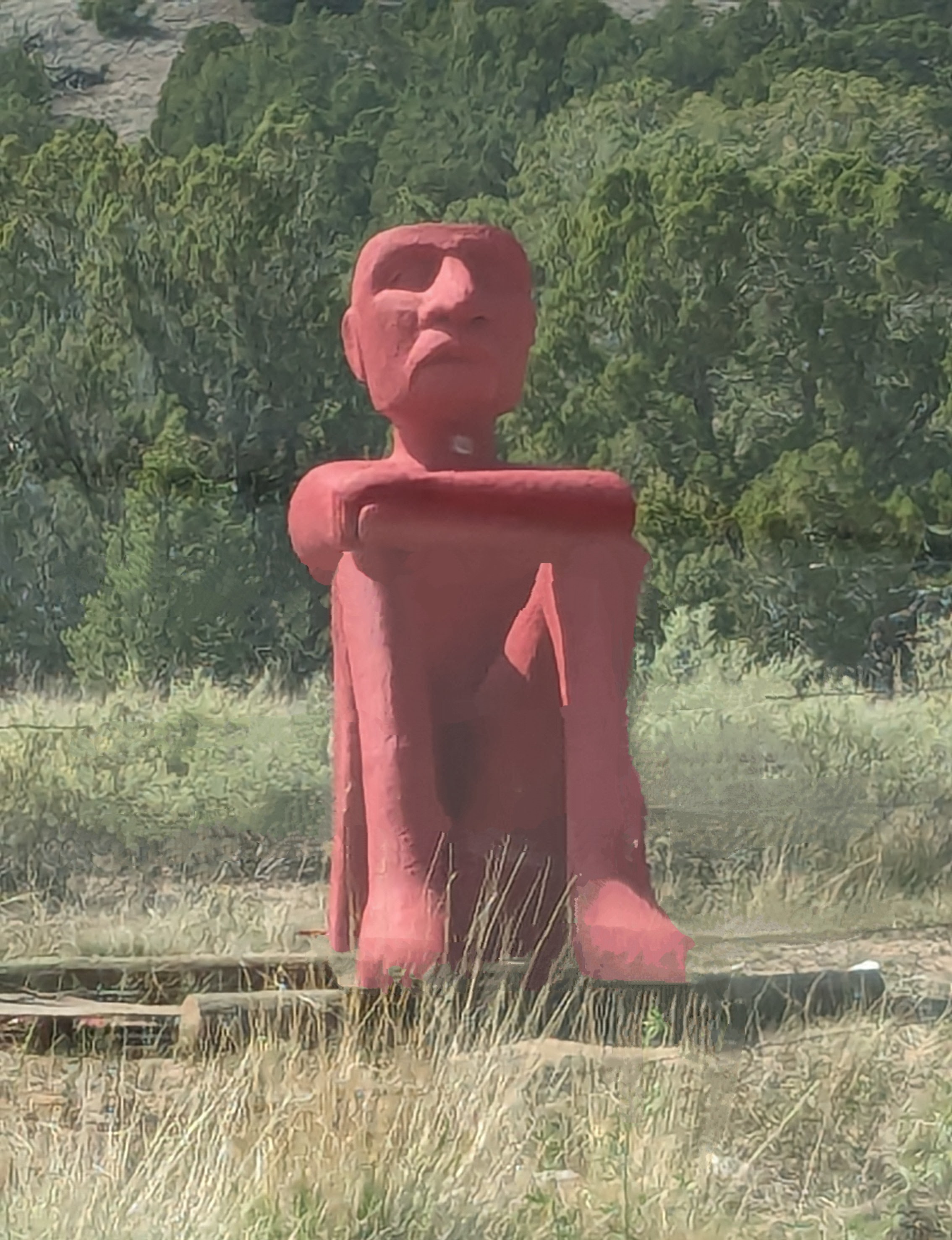
We found a large and lively market with fresh vegetables and crafts, much to our delight, when we visited, and our friends touted the appeal of new galleries, Meow Wolf, local pubs and breweries, and additional public art installations.
Historic buildings, parks, galleries, and art dominate the Santa Fe scene. New streets and highways make it easier to get around — and to get lost. We thought it would be easy to revisit our favorite places. Time and memory seem to have altered our perceptions. We found it difficult at times to even navigate to the addresses we once called home.
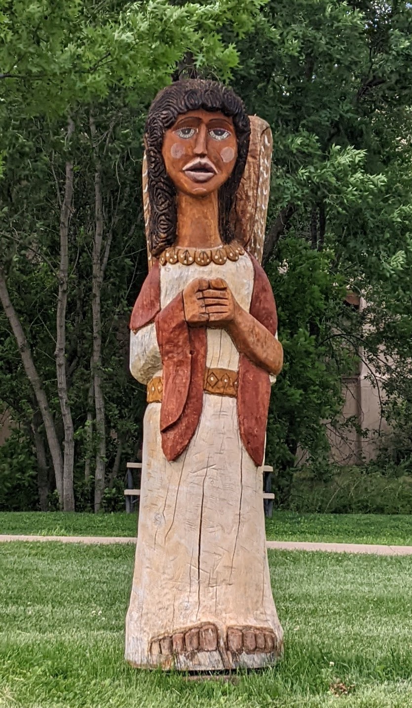
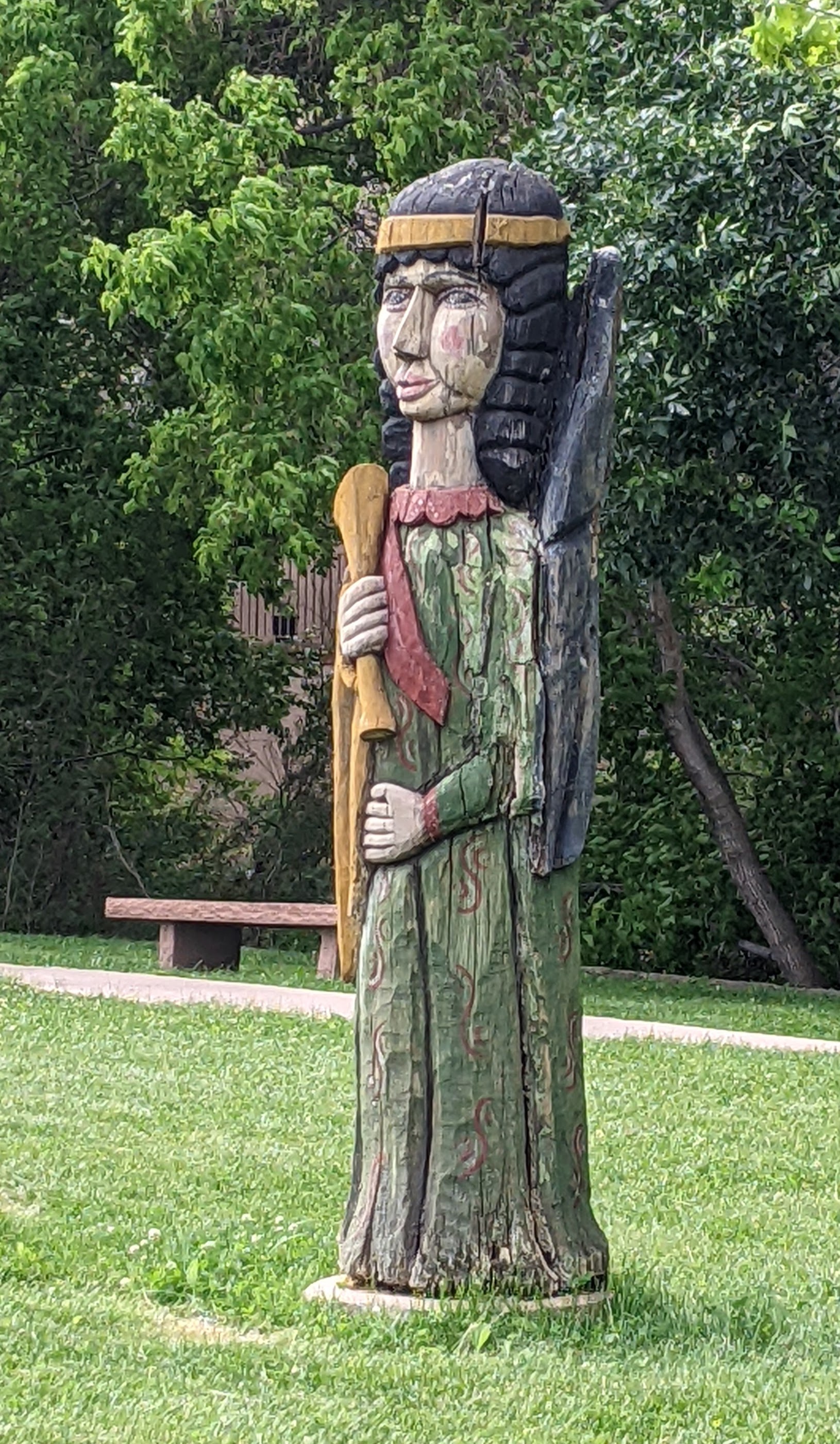
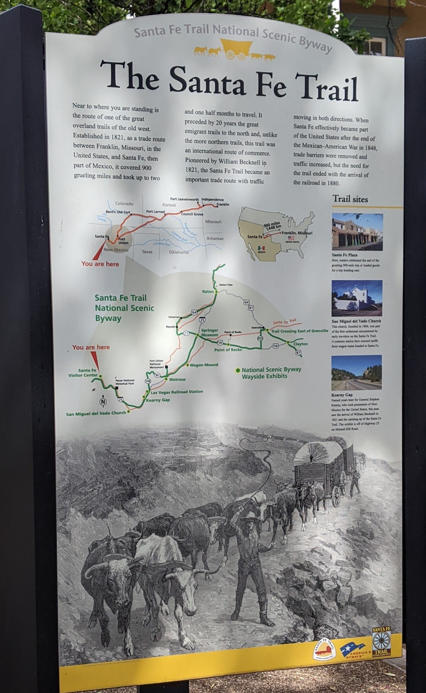
Santa Fe still proclaims itself The City Different and it remains unlike most other vacation destinations. There is a special vibe that’s difficult to resist, with much to see, do and learn in and around Santa Fe. Three historic travel routes converge in the city. It’s the end of the 900-mile Santa Fe Trail that began in Missouri and traversed the Great Plains, allowing goods and settlers to move westward. The pre-1937 Route 66 ran through Santa Fe on its path from Chicago to California, and the 1,600 mile route linking Mexico City, Spain’s colonial capital at the time, to its northern outpost at Santa Fe, was designated as an historic trail — El Camino Real de Tierra Adentro — by the U.S. National Park Service in 2000.
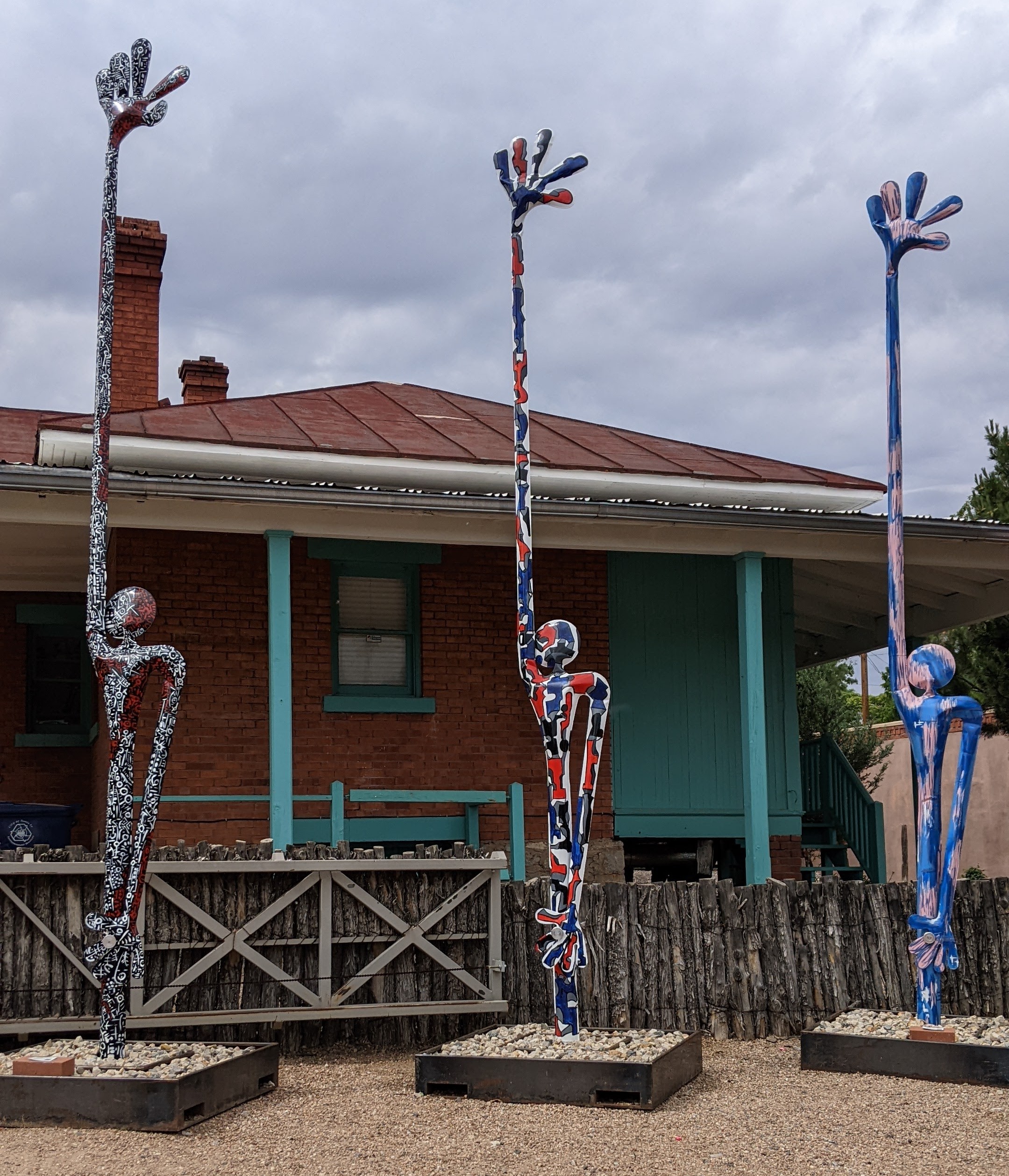
The city resonates with history, art that is sometimes quirky, and charm, and you’ll find wonderful food and a distinctive cultural experience no matter what time of year you visit the city.
What to Do in and Around Santa Fe
Whether you go to Santa Fe for two days or two weeks, there’s plenty to keep you busy.
Visit museums and art galleries, weekend markets, downtown shops and the stunning open-air Opera House just outside of town. Savor local food specialties. Talk with shopkeepers, artists, bartenders and street vendors. Purchase art and jewelry from galleries or directly from artist studios. Talk with the artists and artisans who sell their creations from the portal at the Palace of the Governors. Attend a service at the Cathedral, or step inside the 400-year-old San Miguel Chapel, known as “the oldest church.” Visit the Georgia O’Keefe Museum. Explore Santa Fe’s distinctive neighborhoods.
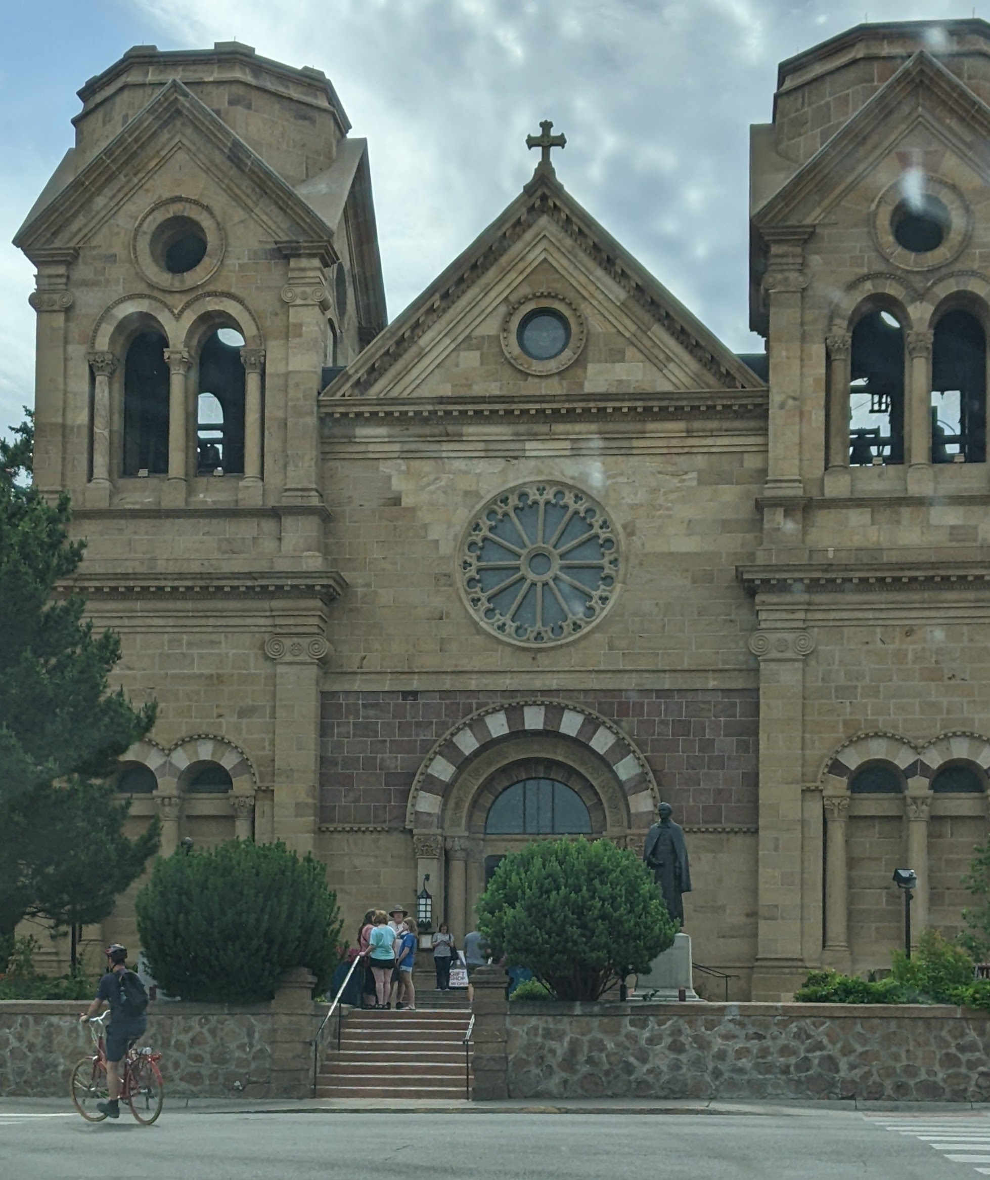
Stroll the Plaza and Canyon Road. Be awed by the imposing Cathedral Basilica of St. Francis of Assisi and the impressive and mysterious staircase at Loretto Chapel. Have a drink or a meal at the sprawling Hotel La Fonda, which is conveniently located at one corner of the city’s downtown Plaza. Embrace the weather, the sights, the history, Pueblo and Territorial architecture, the scents of pinon or roasting chiles in season. Bask in the natural beauty of the site and breathe fresh mountain air.
Take the “white knuckle” drive up the winding road to the Ski Basin. Nearby Chimayo, Los Alamos, La Cienega, Las Vegas (yes, New Mexico), and Madrid are worth a day trip. See ancient pueblo cliff dwellings at Bandelier National Monument or go fishing at Cochiti Lake or along the Rio Chama. Hike the Sangre de Cristo or Jemez Mountains in the summer. Ski or snowmobile on mountain trails in the winter.
Learn about Santa Fe’s history, and visit a nearby Pueblo, especially if there’s a celebration or special ceremony scheduled. Most welcome visitors, but be respectful of their customs and regulations. Schedule a spa treatment or soak under the stars in a hot tub at 10,000 Waves. Sample street food or pub fare. Enjoy it all. Santa Fe is unique in any season.
Next week I’ll write more about where to stay, where to “play” and where and what to eat while in The City Different. Follow me to receive timely email notifications about future posts.
Getting to Santa Fe
Despite its popularity as a tourist destination, getting to Santa Fe, and getting around the city once you’re there, can be problematic. Public transportation is, for all practical purposes, non-existent. Unless you stay in the heart of the city, you will want a car.
You can fly into Santa Fe; there are direct flights from Houston, Denver, Phoenix, and Dallas. If you fly into Albuquerque, you can rent a car there — it’s an easy drive to Santa Fe and will take little more than an hour. There’s a train that runs between the cities, and it’s an interesting ride, but it’s better as an excursion than as a comfortable, reliable way to arrive in the city for vacation.
Finally, most tourism guides will warn you that lodging and meals are expensive in Santa Fe. And they can be. But more modest accommodations are available, including B&B’s or private “casitas,” and it can be worth the effort to search them out. Also, be sure to ask for dining recommendations from shopkeepers or guides. Savor delightful breakfast places and long-established local favorites for distinctive dishes and ethnic specialties. Learn what “Christmas” means when asked how you want your burritos served.
Santa Fe Today
Santa Fe has become a cosmopolitan city with an estimated 2024 population of just under 90,000, but its soul is still “small town,” rooted in the traditions of its more than 400-year history. It was originally established in 1610 as the capital of Nuevo Mexico, a province of New Spain. That was 13 years before Plymouth Colony in Massachusetts was settled by pilgrims who arrived on the Mayflower. Its history, however, began long before that.
Santa Fe boasts not only the oldest public building in the United States, the Palace of the Governors, but also the oldest community festival, first celebrated in 1712 to commemorate the Spanish reconquest of New Mexico in 1692. This year’s Fiesta de Santa Fe is scheduled August 31 through September 11. The city was built on the ruins of an earlier Indian Pueblo, and it’s not only the earliest European settlement west of the Mississippi but also the oldest state capital in the United States.
Want information about things to do in Santa Fe? Here are some specific suggestions, whether your interests are primarily arts and culture, outdoor activities, foodie experiences, or shopping. You might also want to order a copy of the Official Visitors Guide to help plan your trip. And when you’re in town, stop by TOURISM Santa Fe, located downtown at 201 W. Marcy St., for the best up-to-date information about local special events and exhibitions.
Daylight lasts longer in the summer and weather is typically more predictable, even if it’s predictably hot. Close-to-home day trips or spur-of-the-moment, loosely-organized one or two-night excursions, are a welcome treat. Getting away, particularly to someplace new just seems easier, not to mention more fun. The goal, of course, is to choose a destination that promises captivating sights, provocative activities, stimulating people, and, of course, a local food adventure.
My husband and I found all that and more just a few hours from our home. Our destination — Alexandria, Louisiana — is a relatively small city in a state just to the south of Arkansas. We planned our route along a scenic highway. No interstates to navigate. Minimum traffic to contend with. As much as we enjoy road trips, we wanted this drive to be easy. The bonus? Close friends had recently relocated to Alexandria from our community in Arkansas. We missed them. After helping them pack boxes before their departure, we wanted to see them settling into their new home. We were curious.
Although we were happy to accept the offer of a guest room, we stipulated only hot coffee in the morning. We wanted to sample local eateries, and requested no homemade meals.
Finding Distinctive Local Food
Our first impression, as we drove into town, was positive, but our first decision involved food. We had skipped breakfast that morning, opting instead for take-along coffee and a relatively early start to our journey. When we arrived, we were ready to quell our growing hunger pangs, so the priority became food over friendship.
A quick online search yielded a convenient address and favorable customer reviews.
Spirits Food & Friends
The dining area was far from filled in the early afternoon, but our initial impressions of Alexandria were boosted immeasurably by the “look and feel” of this eatery. Other diners seemed to be having a good time. An amiable and informative waiter greeted us warmly and seated us promptly.
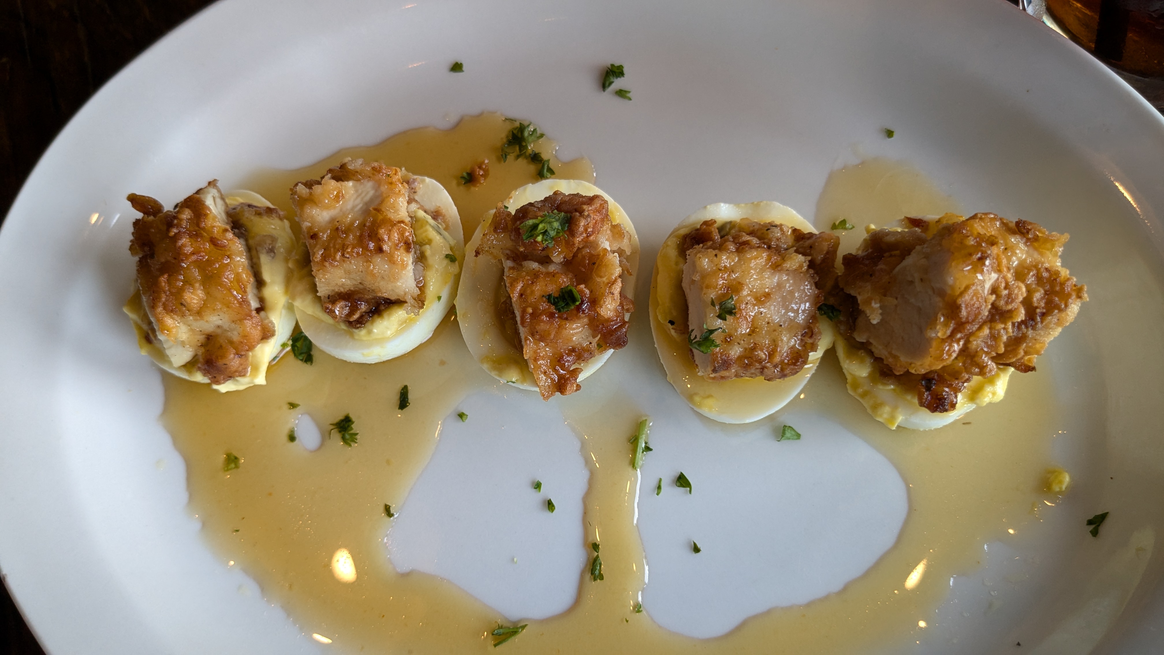
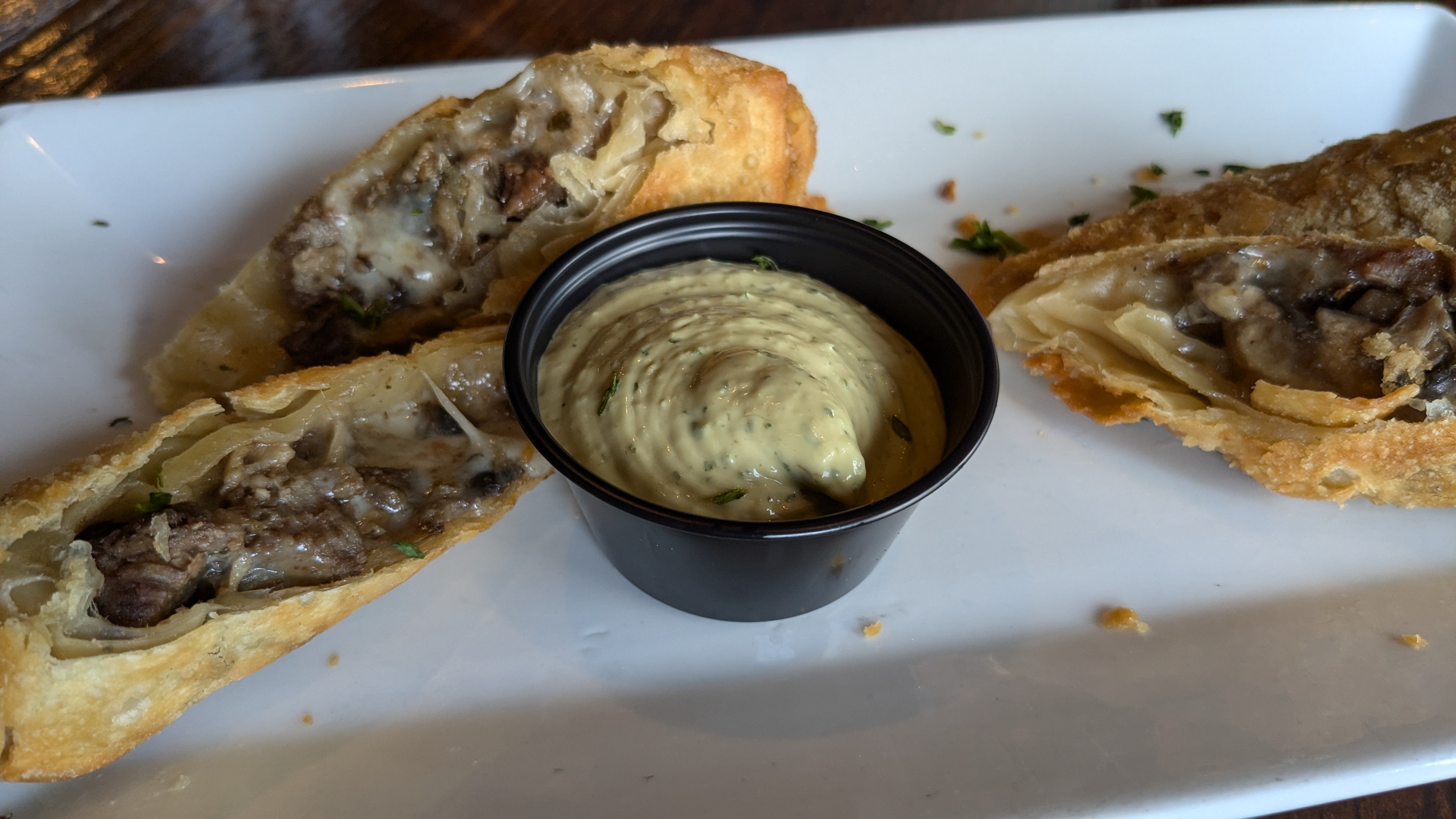
We chose not to order a complete meal, but instead selected appetizers to share from the extensive menu. An order of “Which Came First” Deviled Eggs, topped with fried chicken bites, bacon jam and sweet chili sauce, combined both breakfast and lunch in a unique way, and unusually good Philly Cheesesteak Eggrolls with creamy avocado ranch dressing more than satisfied our hunger.
Our server kept our glasses of iced tea and lemonade full, and he answered all our questions about things to do and places to go in the city. We chatted about the history and growth of the “family-owned, Alexandria-grown” establishment.
We were captivated by our first taste of local food and hospitality and more than pleased with our choices. We also asked for suggestions about where to dine that evening, and were treated to a “mini-course” in local culture and history.
Our visit to Alexandria was off to a great start. We were beginning to understand the reasons our friends had chosen this city on the banks of the Red River as their new home. Cajun food and culture are certainly part of the appeal. But, as we discovered, there’s much more to savor about Alexandria.
The Cottage
Another day — another lunch. The Cottage proved to be another delightful surprise.
Renowned for its specialty cream of shrimp soup available in sizes from a “demi” cup to a large bowl, The Cottage features daily luncheon specials. Although the compact lunch-only spot looks somewhat like a ladies’ tea room, its clientele runs the gamut from suited businessmen to golfing foursomes to families with children. Personalized service is one key to its popularity, but the food lives up to the reputation it has built. Dishes are full of fresh flavor and served with flair.
Just one note of caution. A special of fresh fish with spinach salad and cottage potatoes had been listed online at a price substantially lower than the price that was charged. We noted the discrepancy with great surprise when the bill was presented. Although restaurant staff honored the lower (and incorrect) online price, it is probably always a good idea to confirm special prices before ordering.
Beer and wine are available, but the specialty almond iced tea was exceptional. We didn’t try any of the homemade dessert offerings, but I’m willing to bet they’re wonderful as well. Next time, I’ll have a hard time deciding between a Strawberry Crepe and the P-Nutty Oreo Pie.
Know that The Cottage is only open from 11 a.m. to 2 p.m. Monday through Saturday. Would we return? Absolutely!
Tunk’s Cypress Inn
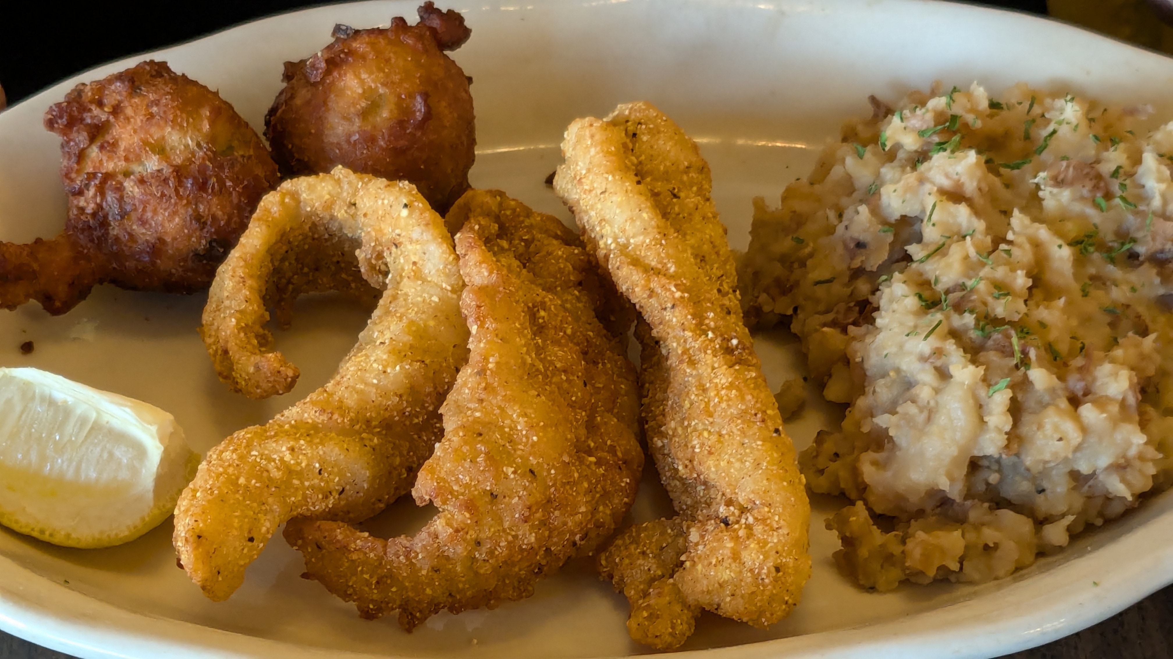
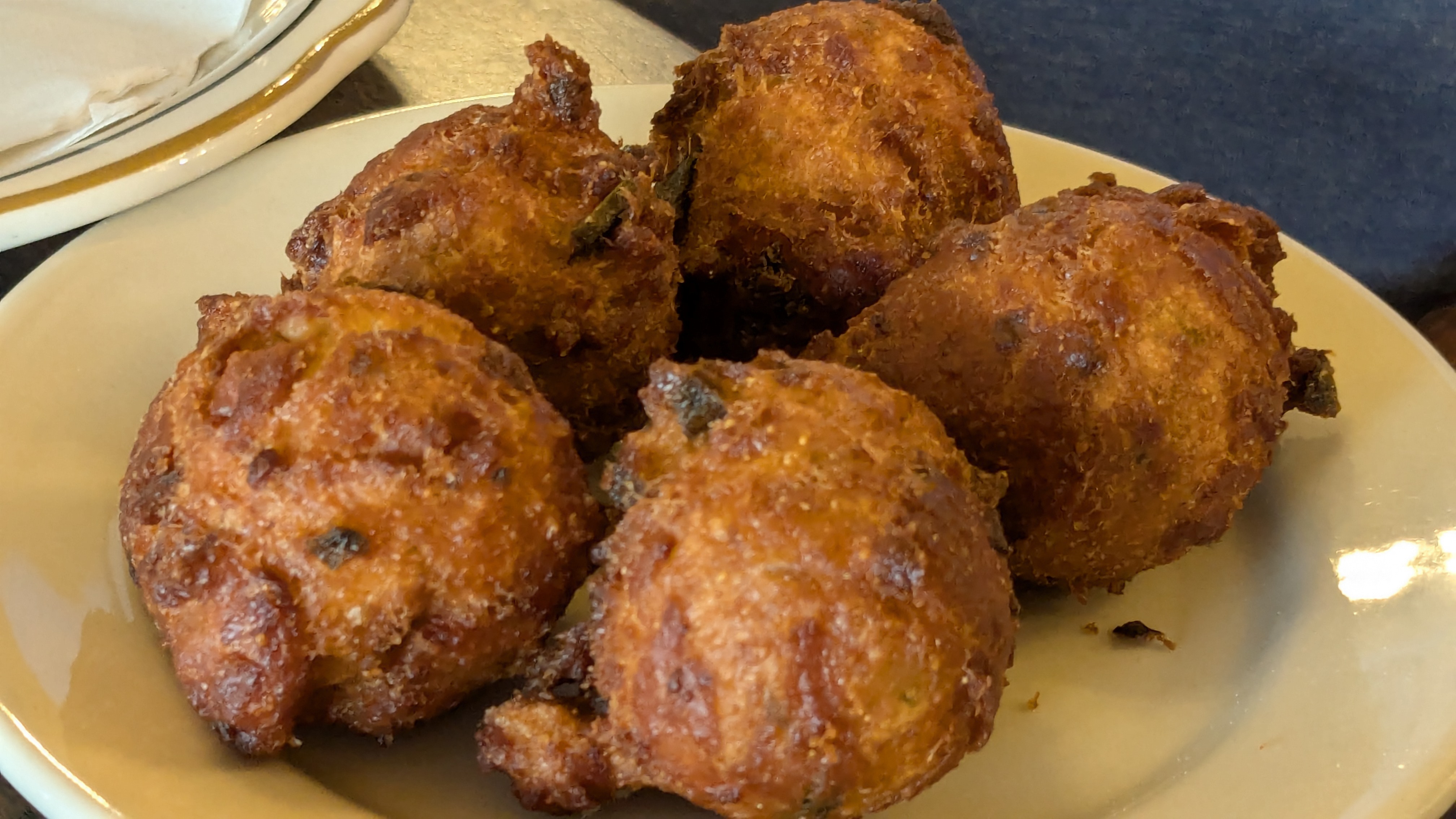
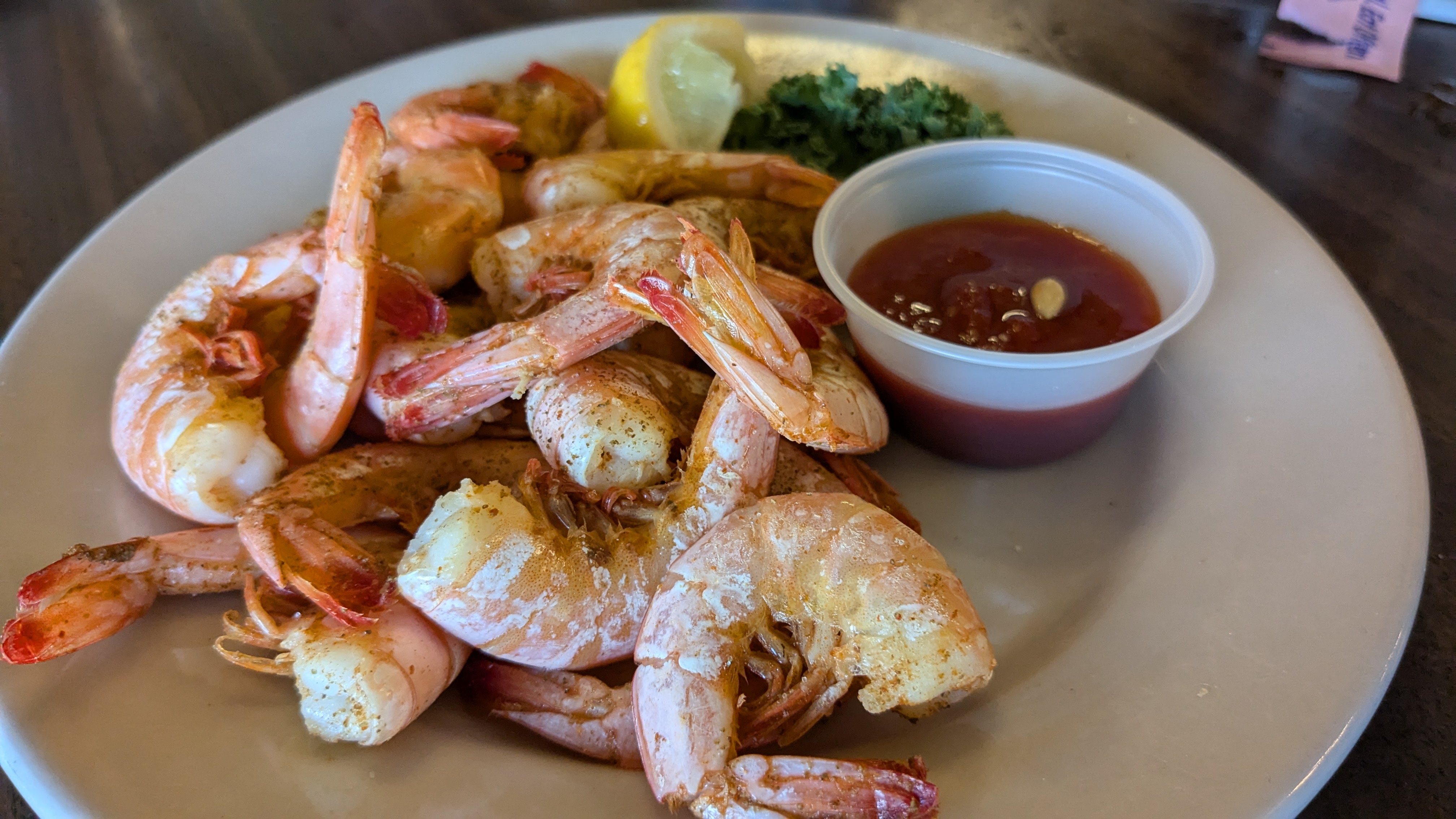
It would be worth visiting Tunk’s Cypress Inn & Oyster Bar just to sit on the deck with a cool drink while gazing at the serene view. However, to miss the food would be almost criminal. The Oyster Bar, right at water level, even features a choice of Po-boys as a Thursday night special. We missed that, but what we had — shrimp-topped fried green tomatoes with basil pesto cream sauce, boiled shrimp, fried catfish, seafood gumbo, and hush puppies — more than compensated for any disappointment we felt about missing the Poboy Special.
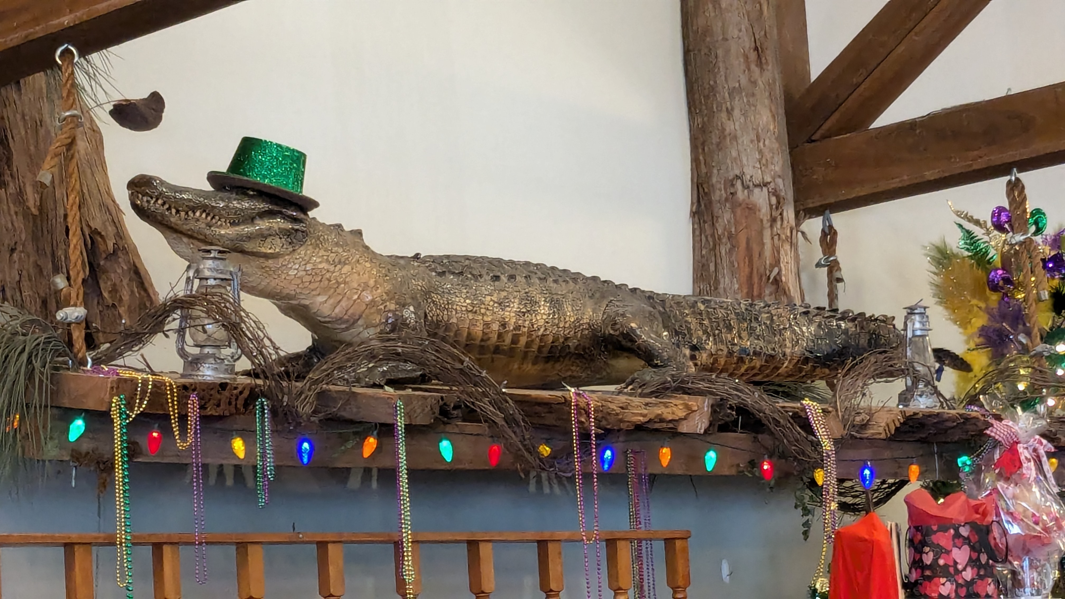
In case you’re wondering, the alligator, dressed in Mardi Gras finery, oversees the dining room on a perch adjacent to a pine tree trimmed in traditional purple, green and gold. And “the good times roll” here, we’re sure, all year long.
Mardi Gras colors, along with beads and memorabilia, are not necessarily limited to Tunk’s. You’ll find reminders of the “good times” throughout Alexandria. It’s part of Louisiana’s mystique, along with Cajun and Creole food and music.
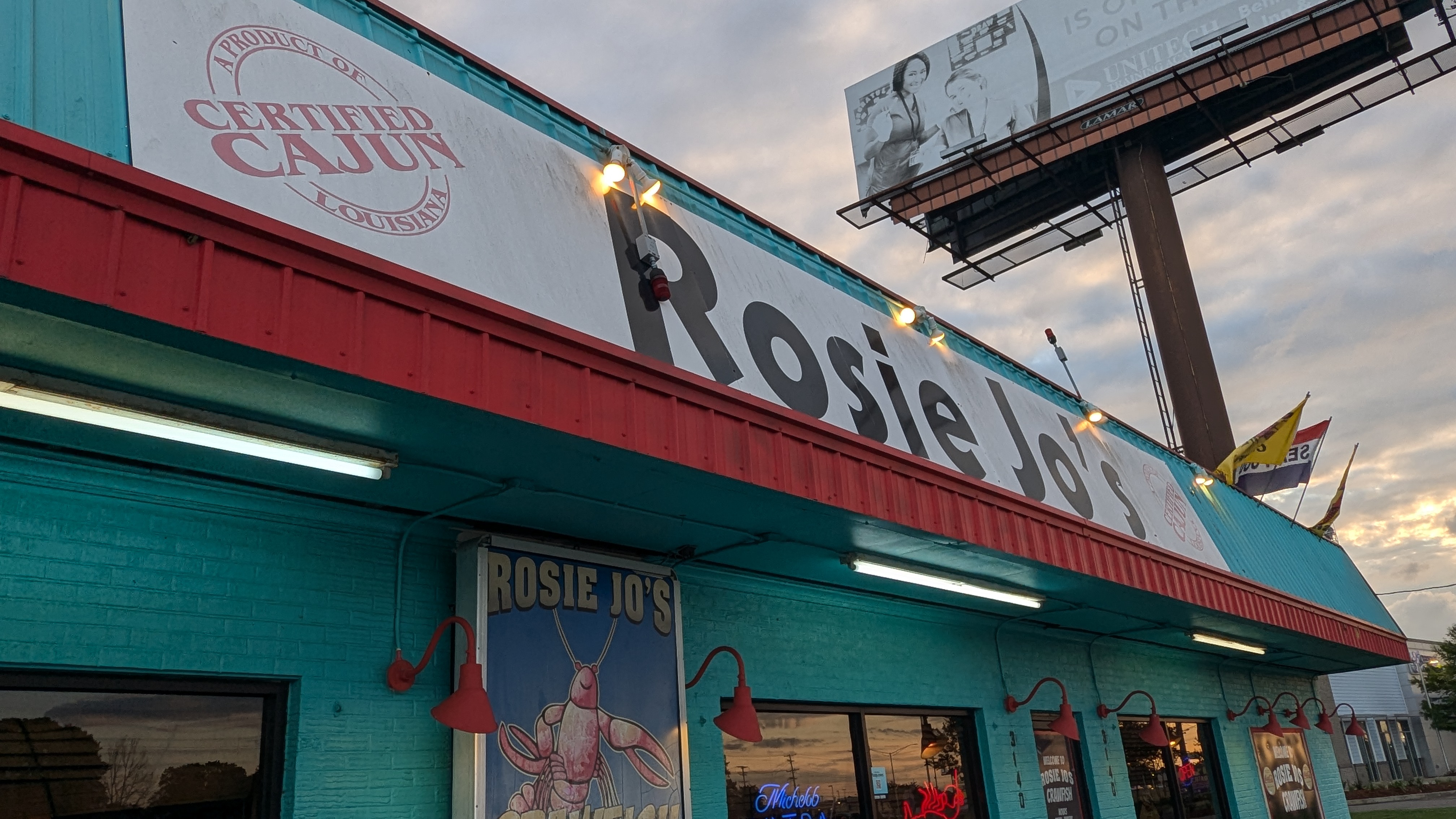
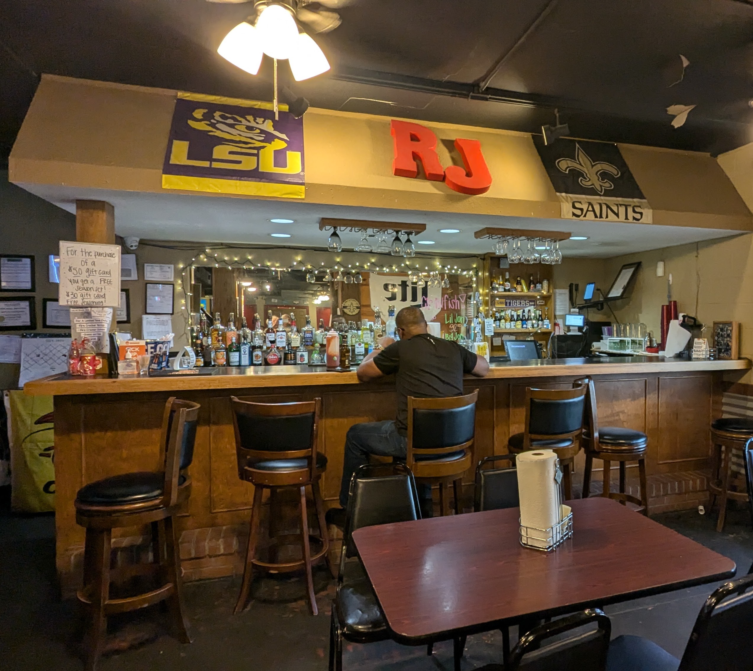
Rosie Jo’s
Rosie Jo’s looks like a roadside diner from the outside, and the interior has some of the ambience of an after work watering hole, or a late night honky-tonk. But don’t let that keep you from going. It’s hip, friendly, busy, and fun. And the food — everything we ordered — was well-prepared, hot, and delicious. Service was on point, as well. So, for the pure fun of it, as well as the quality, we heartily add our names to the list of local recommendations we received about Rosie Jo’s.
We visited Rosie Jo’s during crawfish season and and, even though we didn’t order a bucket to share, plenty of other diners did! As I looked around, I realized that not many crawfish go uneaten! If you go, you might want to time your visit so that you can have the experience!
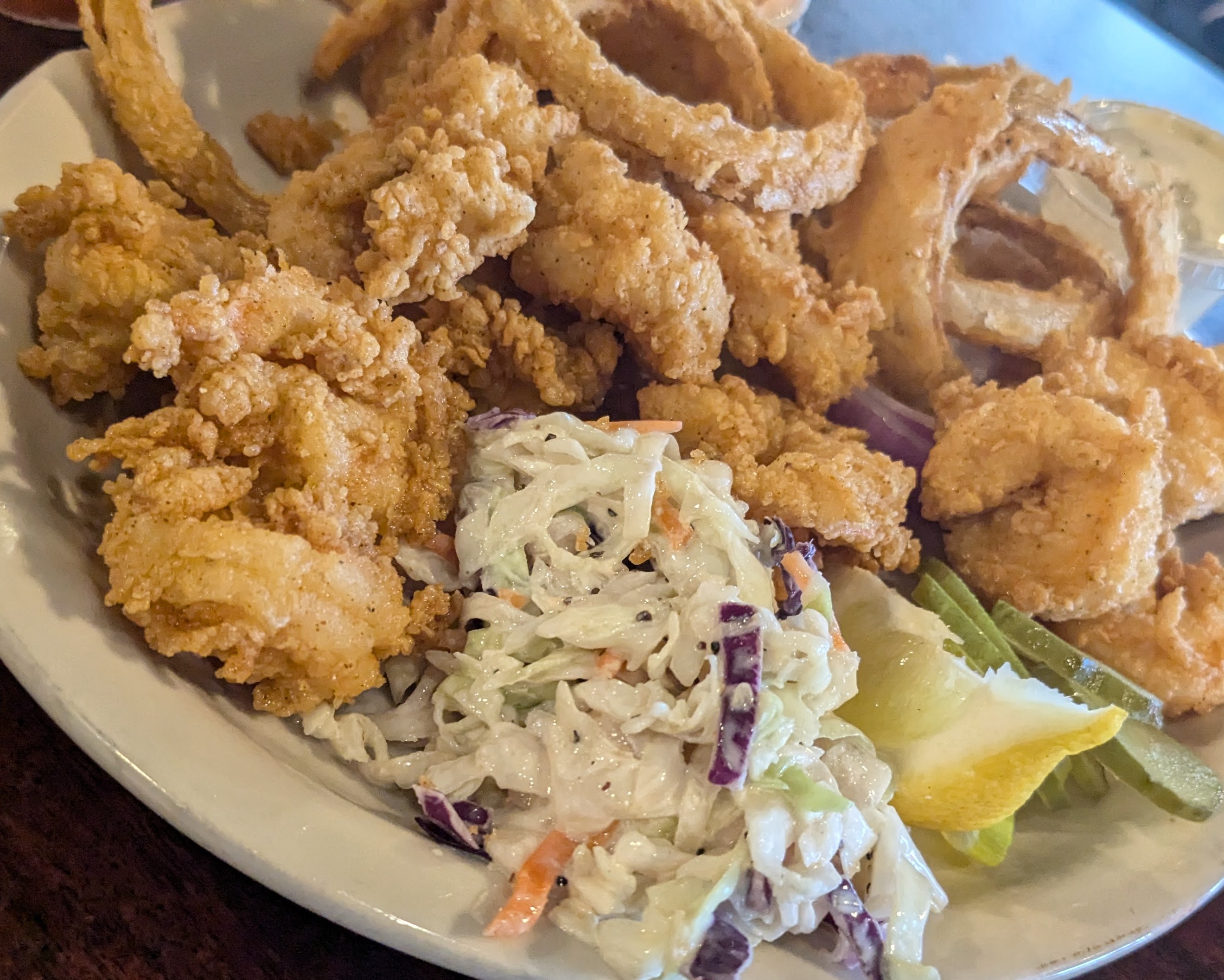
We thoroughly enjoyed what we did order. I’m not sure I wouldn’t choose the hearty Shrimp and Grits again, but it’s a large order, suitable for sharing. Others in our group chose Fried Shrimp, complete with onion rings and coleslaw, and Pistolettes, fried pockets of dough stuffed with boudin and covered in shrimp etouffee.
Needless to say, samples all around were willingly shared.
Even though the city lies to the north of what is considered “Cajun Country,” there’s plenty of good Cajun food to be found. Over the course of the next two days, we sought recommendations from everyone we met and were rewarded with a list of options that would satisfy even the most discerning diners. There are fine, upscale restaurants as well. And we understand that food booths and food trucks are there for the festivals.
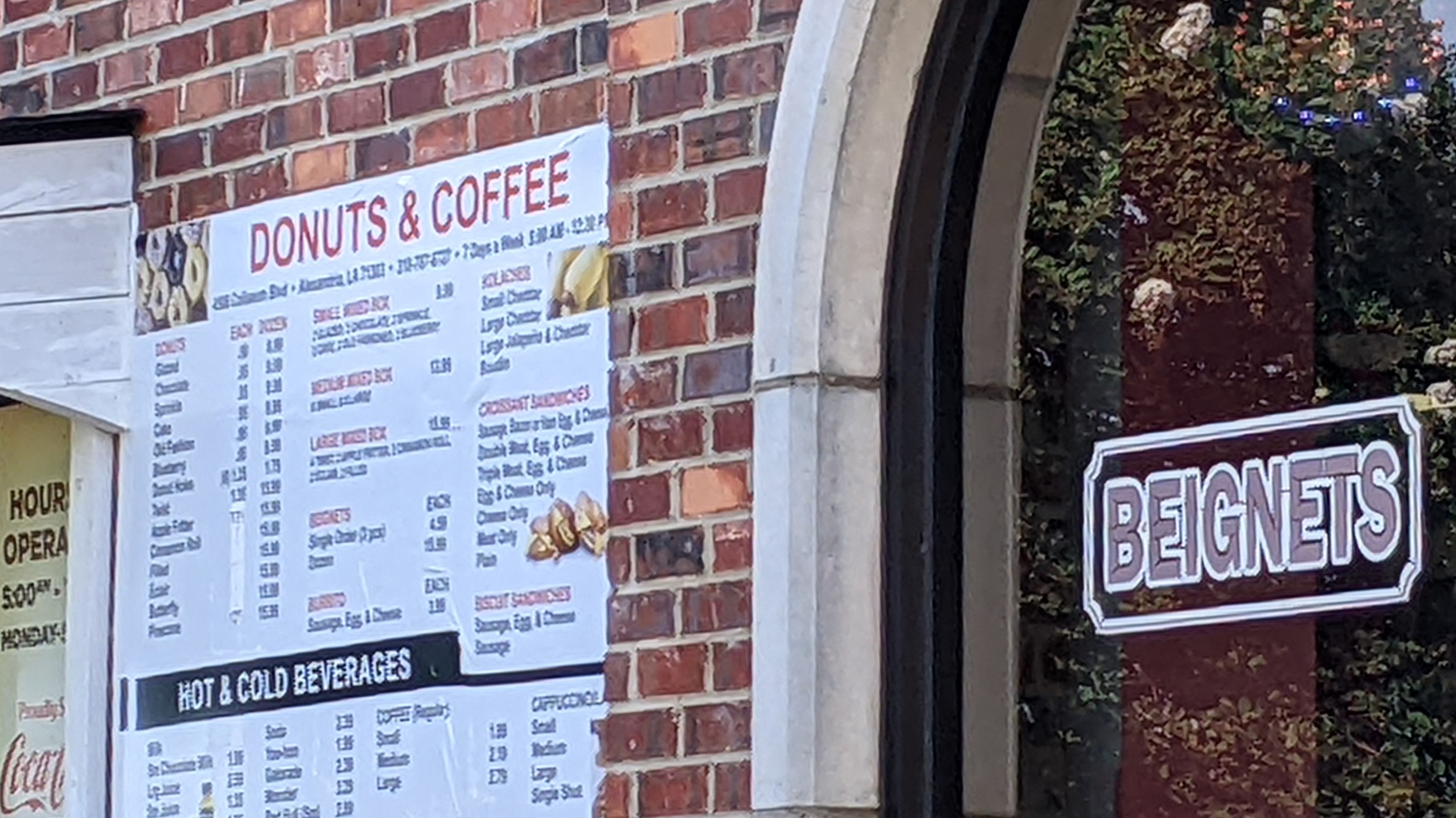
Our final morning came too soon. After leisurely coffee and conversation with our hosts, we made ready to leave. Previously, we had spied a neighborhood Coffee and Donut Shop. We couldn’t resist stopping. Served fresh and piping hot, three to the order, the large beignets drenched in powdered sugar reconfirmed that Louisiana residents definitely know how to enjoy the good things in life. One more reason to return.
On our return trip to Arkansas, we passed through the charming town of Ruston, not quite two hours north of Alexandria. Home to Louisiana Tech University, it seemed a good place to stop for a bite to eat — home was approximately another four hours away. Our friends had recommended Ponchatoulas, with a convenient downtown location. Another chance to sample “the flavor of Louisiana” was tempting, to say the least. We had been forewarned, however, that we might have to wait for a table, and that was the case.
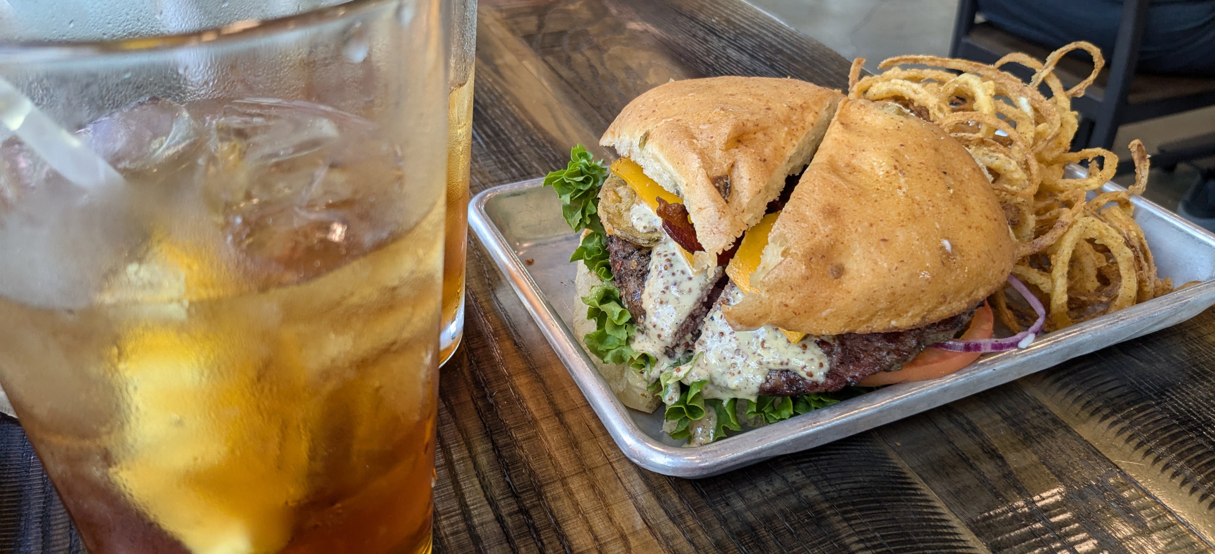
Another quick online search yielded results: Dawg House Sports Grill. It has a tempting menu of burgers and was easy to find. Obviously popular with students and sports fans, there were also a fair number of families there to watch Sunday games. Although tempted by menu items like Boudin Egg Rolls, Fried Green Tomatoes, or a Shrimp Poboy, we settled on a Bulldawg Burger with Onion Strings, after our server’s assurance that it was large enough to share.
It was indeed! We felt confident we would not have to worry about dinner that evening.
“On the Road” Learning
Driving home, we reviewed everything we had packed into the all-too-brief road trip. Importantly, we had learned that there’s more than food to love about Alexandria, but that food is an important aspect of any good travel experience.
We knew our two-day time frame would allow little time to do more than scratch the surface of Alexandria. We had hoped to explore some of the city’s casual eateries, with the goal of finding, at minimum, interesting food options and Cajun flavors. A variety of Poboy choices and local brews would have satisfied us.
What we found was so much better. We hadn’t expected a food dilemma, but there simply are too many good options, it seems, for the time or appetites we had.
We left wanting to know more about this distinctive Louisiana city. There’s a plantation house that dates to pre-Louisiana purchase days, a grand century-old hotel that must have many stories to tell, a highly-rated zoo and art museum, an undergrad campus of Louisiana State University, and several popular annual celebrations, including Mardi Gras. Alexandria also boasts a fascinating military history. It was near here that thousands of soldiers trained prior to World War II and many different types of aircraft flew out of the former England Air Base that has been “recycled” as a regional international airport.
Alexandria seems like a “happening” place to be, any time of year. It’s now certain that we’ll return.
Strengthening the ties of friendship with former neighbors was important to us, and we vowed not to allow much time to pass before doing it again. Getting away for fresh experiences in unfamiliar places is good for the soul.
And sampling new foods definitely adds spice to life.
I am apt to brake quickly when driving along the byways of this country.
I’m always on the lookout for distinctive photo ops, and I can’t resist interesting signs (especially unique place names like Toad Suck and Smackover in Arkansas,) decaying fences, old churches and cemeteries, or American flags painted on the sides of old barns and brick buildings. As my husband notes, I am sometimes a pain in the neck, but I try not to be too demanding about those stops.
Most of the time, at least.
However, I also have been known to request, if not demand, a “slow down and turn around” when I spy a roadside vegetable stand or come upon a weekend farmers market. There’s something appealing about buying produce direct from the source. It’s gratifying to meet the people who grow our food. That food, whether just-ripened berries, plump tomatoes, or recently-picked apples and pears, always tastes better somehow.
At times, as I willingly admit, I can be insistent.
What’s better than cutting into a fresh peach and tasting it as its proud grower looks on approvingly? Typically, I don’t mind when the juice drips down my chin and onto my shirt! It’s all about the flavor, the freshness, and the fun.
Seasonal specialties like fresh melons and sweet corn, pumpkins and apples or the products made from a fresh harvest — pickles, preserves and jams, sauces, or homemade breads — often seem irresistible. In states where it’s possible to buy fresh pecans and freshly roasted peanuts, we brake for those too. And, occasionally, for just-picked bouquets of daffodils, tulips, or chrysanthemums.
On an impromptu weekend excursion with friends the last weekend of July — destination: the 41st Annual Grape Festival in Altus, Arkansas — we happened upon a farmstand, and it was the prospect of fresh peaches that clinched our decision to stop.
Farm Stands and Festivals
Luckily, everyone was willing, even though this became one of those turn-around-and-go-back moments. It didn’t take long. Nor did it take long to fill several plastic bags with juicy peaches, plump red tomatoes, and vine-ripened sweet grapes. We chatted a bit with the owners of the farm stand. Then, satisfied that we had made a good decision, we loaded our treasures into the back of the SUV and hastened on down the road, eager to get to the festival.
Truth be told, I’m a huge fan of quirky local festivals all across America. It helps to have a willing partner, and my husband and I have made special efforts to visit more than a few of them, including The Goat Festival in Perryville, AR, held annually on the first Saturday of October. We plan to be there again this year and have already ordered our t-shirts. Who can resist the prospect of a fashion show that features young kids in pajamas? The second weekend, on October 12, we plan to attend the 15th annual Sorghum Festival in nearby Mt. Ida, AR, sponsored by Heritage House Museum.
In Arkansas, it seems there are enough festivals and small town celebrations to keep me on the road all year long.
Following the grape festival, we planned to stop for a picnic on the way home. We opted for Paris.
Arkansas, not France.
Small Town Discoveries
The Olympic Games were slated to begin that very day in the “real” Paris across the pond. We had heard that the townspeople of Paris, Arkansas had decorated the 25-foot-tall replica Eiffel Tower that stands in the town square with iconic colored rings, symbol of the Games. It seemed only fitting that we stop there.
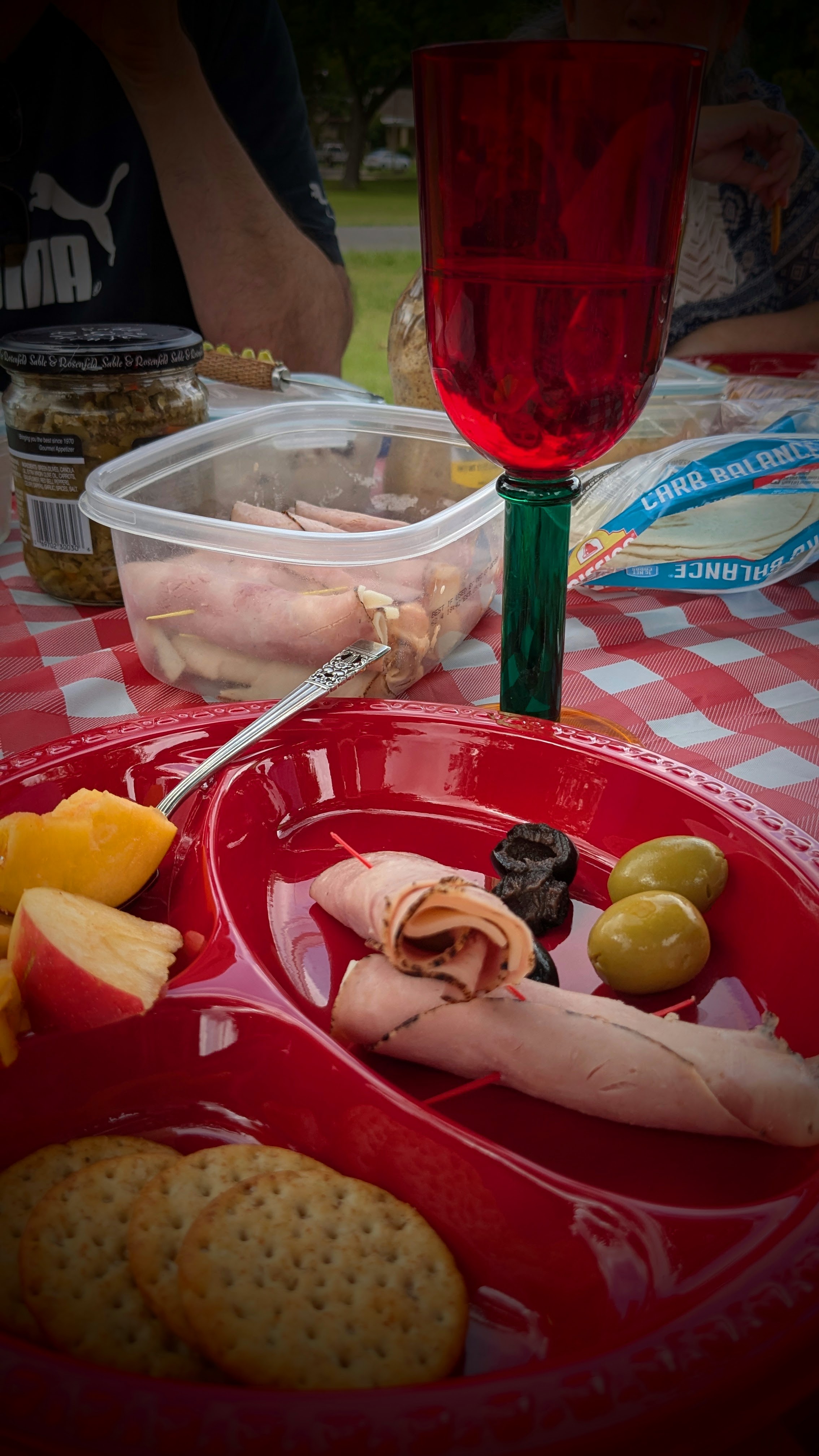
We had packed a picnic basket with bread, crackers and cheese, chicken salad, sliced ham, olives and pickles, cookies, fudge, and lemonade. And we had peaches from the farmstand, a bonus. Leaving Altus, we made a brief stop at Wiederkehr Village, which now also includes a tasting room and restaurant. Johann Andreas Wiederkehr, who arrived in the area in late 1880 from Switzerland, founded the family winery that is now the oldest continually operated winery in the state.
We planned to drink a small toast to the start of the Games. By the time we reached Paris, the air had cooled a bit and we found a picnic table in a city park. Large trees offered shade as we unpacked our picnic basket.
Small Town Delights
Traveling the back roads to Paris took us across rolling hills and along picturesque fields and pastures in this Ozark Mountain valley. It is rural, to be sure. Although I acknowledge that there are valid reasons to travel Interstate routes across the United States, country roads just seem more interesting.
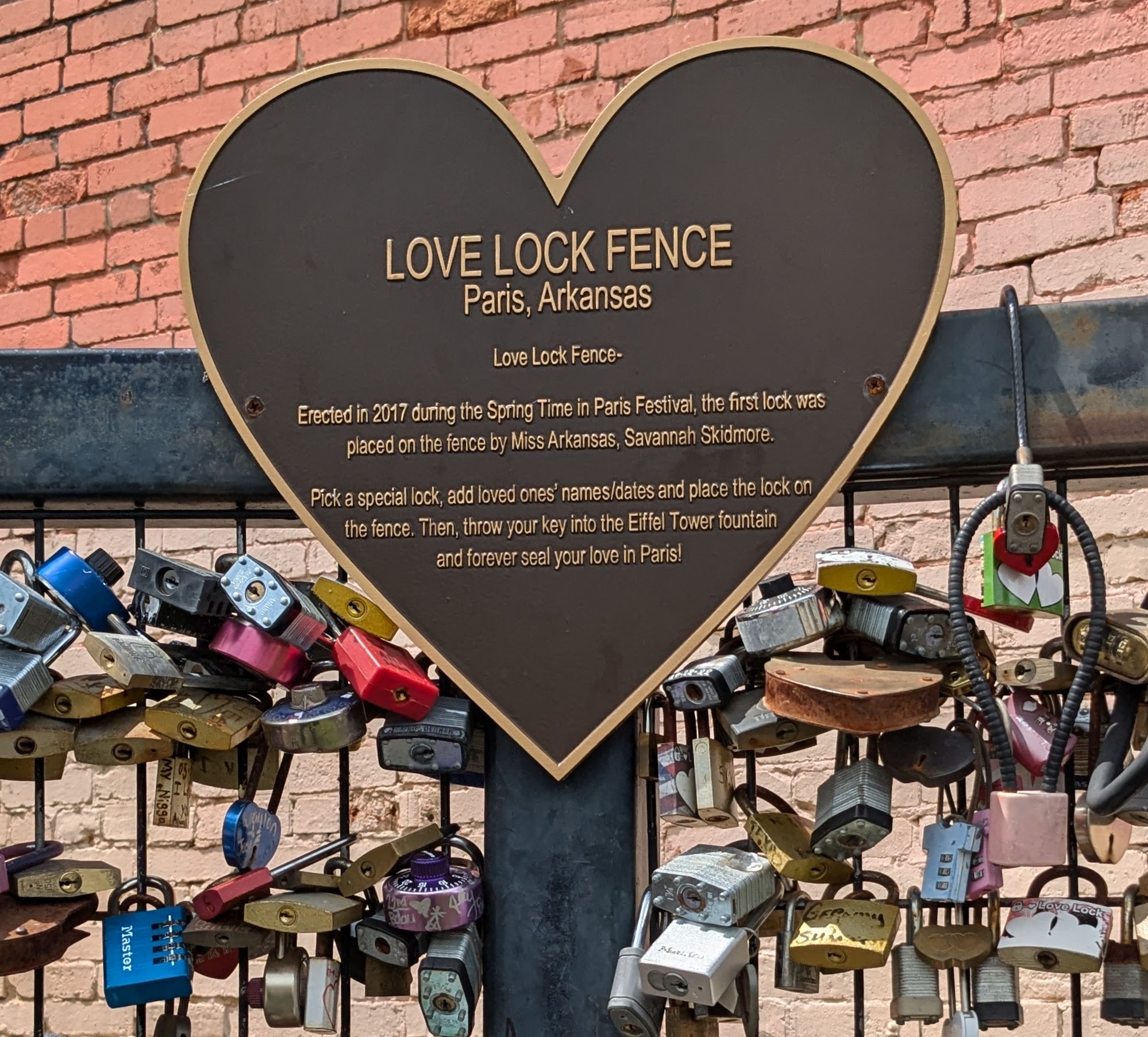
That was the certainly the case for our drive to Paris, and I now have a full handful of reasons to return. In addition to finding the Eiffel Tower, we were intrigued by the adjacent Love Lock Fence, and spent a fair amount of time reading the names and dates on the locks.
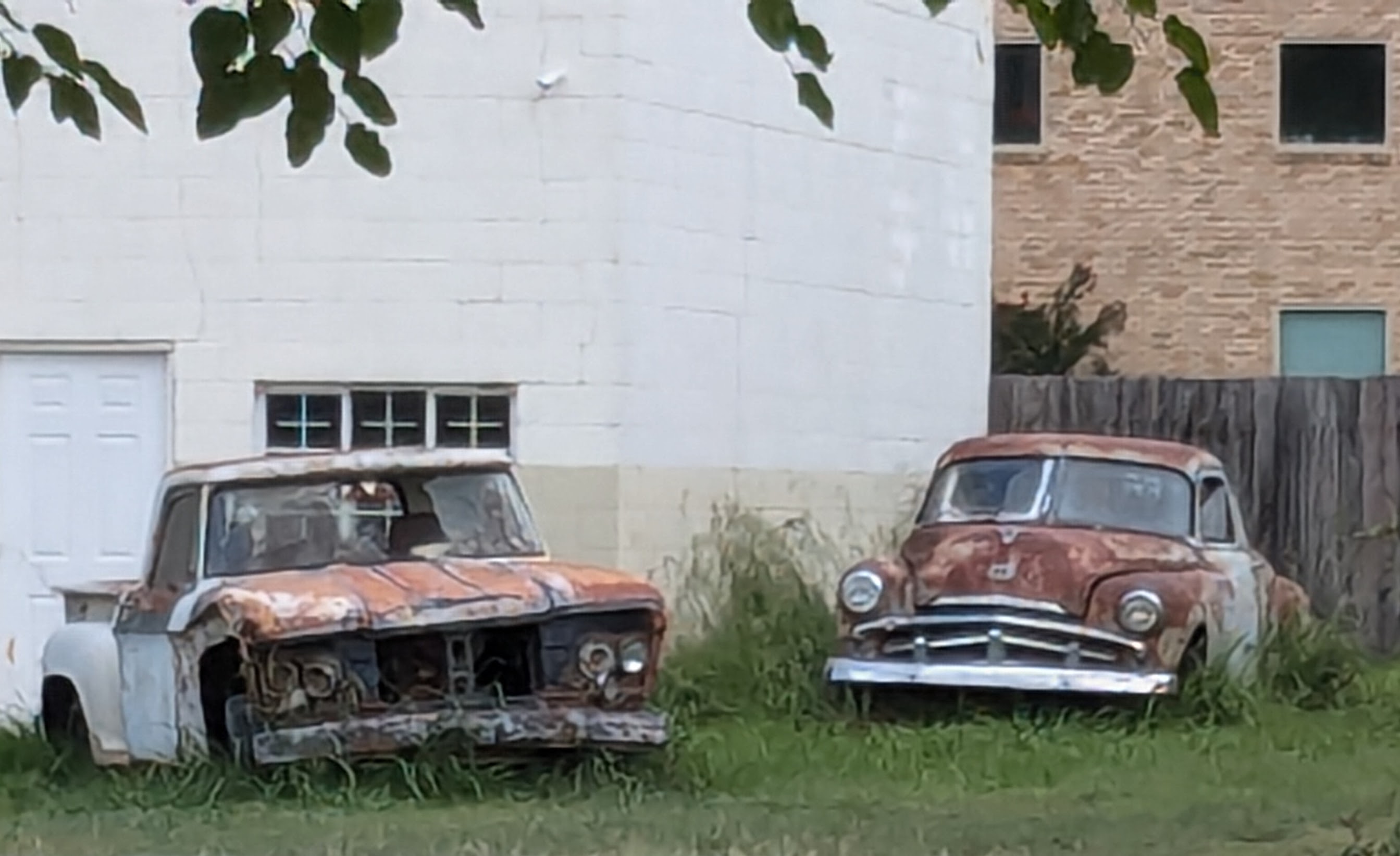
There are well-maintained public buildings, stately old homes, towering shade trees, and flowers seemingly everywhere in Paris. I savored the sight of vintage automobiles resting aside old buildings as much as the flower-filled baskets hanging from the light posts.
I longed to visit the charming shops in the downtown area, and to walk through gardens filled with colorful flowers. I vowed I would return to visit the “Old Jail” Museum, the Coal Miners Museum, a wine museum, and Subiaco Abbey, a “working” Benedictine monastery founded in 1878. The monks there produce a hot sauce known as Monk Sauce, made from Habanero Peppers grown in the Abbey gardens.
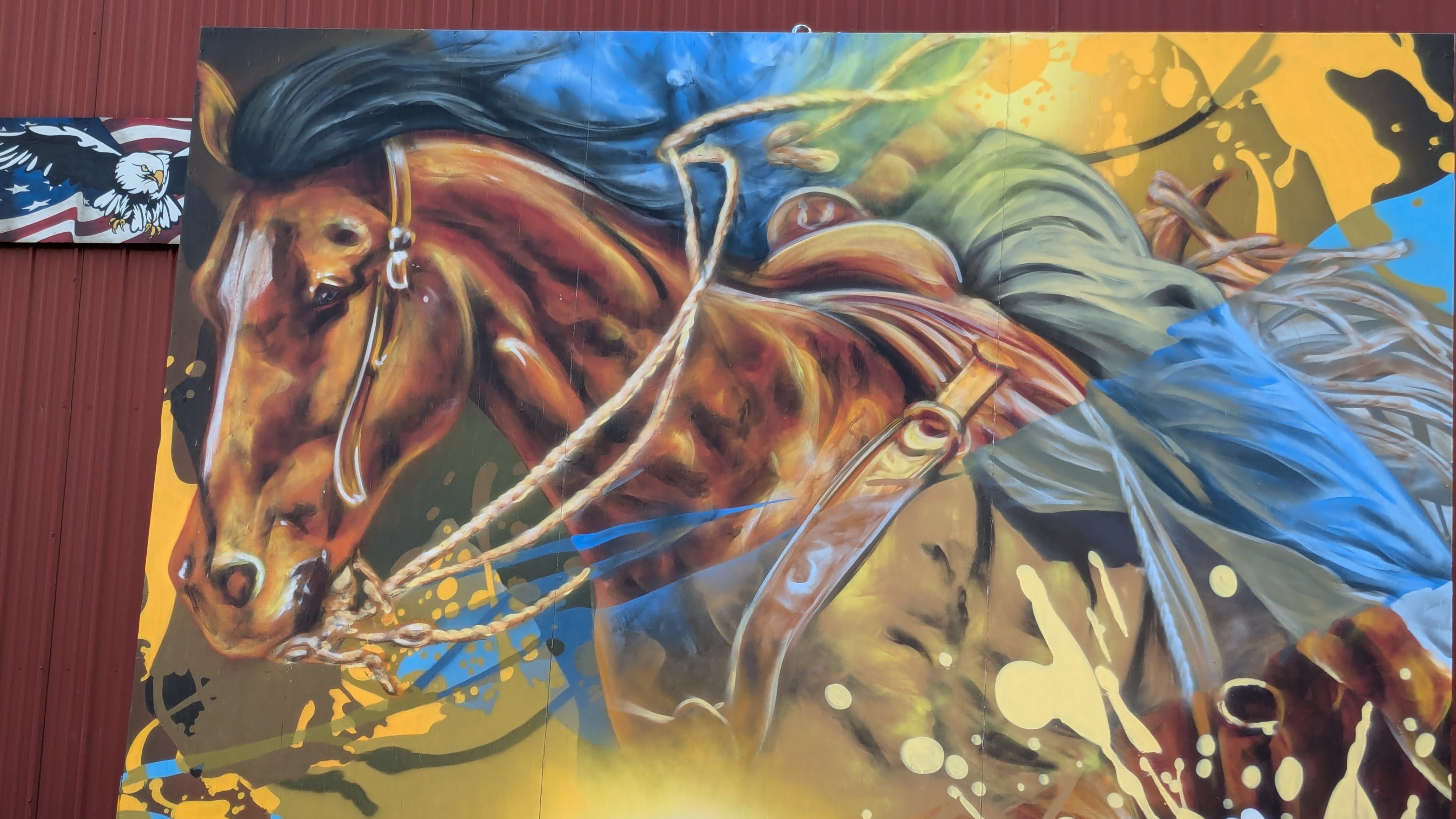
And the murals! The street art and murals in this small town are exceptionally varied and striking, as unexpected as they are enchanting.
Paris is a small town with a population just slightly over 3,200 and a distinctive history. The city was incorporated in 1879, but a settlement had been established there five years earlier. Once the heart of an agricultural area, it has also been a railroad town and a coal mining center. We had too little time to explore fully, but I would like to learn more about life there, for it seems to “live larger” and have a more intriguing story than one would expect.
On April 12, 1961, Soviet CosmonautYuri Gagarin became the first person to fly in space. The event not only made world news, but it reinforced American fears about being left behind in the technological competition with the Soviet Union.
Two and a half years earlier, the Soviet satellite Sputnik 1 had circled the planet for approximately three months before burning up as it re-entered Earth’s atmosphere. That was followed by dogs in space, a fly-by of the moon, a crash of the Soviet Luna 2 probe onto the surface of the moon, and the first photos of the dark side of the moon. All were Soviet accomplishments.
John F. Kennedy was elected President in November 1960. At the time, it seemed as if the Soviet Union had beat the U.S. into space before the term “space race” had even been voiced.
Then, in an address to Congress and the Nation on May 25, 1961, President Kennedy proclaimed: “I believe that this nation should commit itself to achieving the goal, before this decade is out, of landing a man on the moon and returning him safely to the earth.”
At the time, it seemed an audacious, if not impossible, dream. But the mood of the nation was energized and hopeful.
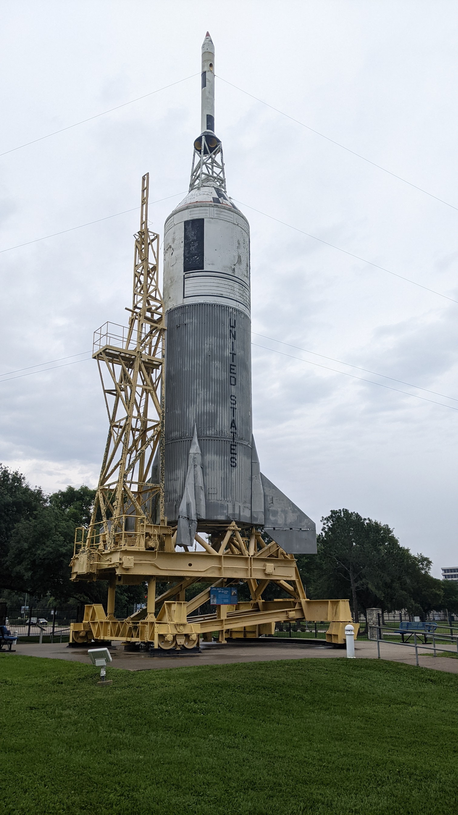
Plans were made for two new rocket launch complexes north of Cape Canaveral in Florida, although construction of the enlarged Launch Operations Center wouldn’t begin until November 1962. Land was set aside near Houston for what was to become NASA’s Mission Control Center. The new president wasn’t about to let the other side gain further advantage. The National Aeronautics and Space Administration had already established the Marshall Space Flight Center (MSFC) in Huntsville, Alabama.
The Race to Space Had Begun
My visit to Space Center Houston included a tour of the Mission Control Center in use for most of the country’s early space flights, including the first moon landing in 1969. It has been preserved as it was then — down to cigarette butts in ashtrays, Styrofoam coffee cups amidst the banks of monitors and scattered about on the floor, a few black desktop telephones with curly cords, and bulky vintage computers.
Today, the room looks somewhat like a movie set. Stadium seating behind a wall of glass allows visitors to see the array of desktops and equipment. For those of us who watched that first landing in real time, it was eerily familiar.
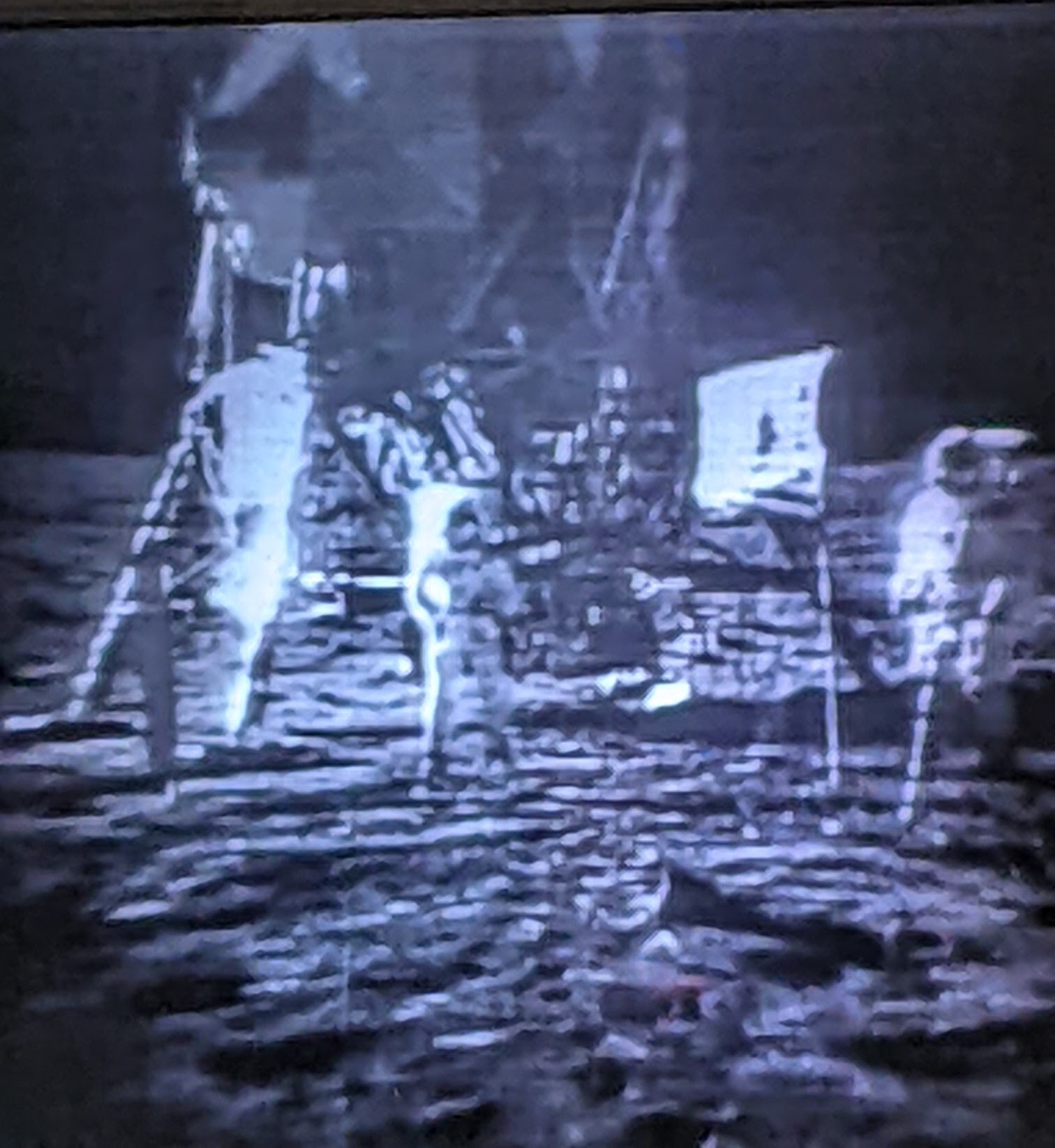
Visitors watch the broadcast tape from July 20-21, 1969, replayed on a wall-mounted TV screen. Listening to the raspy voices of mission control directors and news reporters, I was transported back to that time. I nearly teared up once more as veteran television commentator Walter Cronkite appeared overcome with emotion. I couldn’t resist mouthing the words: “The Eagle has landed.”
First Men on the Moon
In quick sequence, I relived the disbelief, the awe, and then the jubilation of that July day. I almost forgot that it had happened 55 years ago.
The first words spoken by Neil Armstrong were unclear: “One small step for . . .” Did he say man or a man? And then, “One giant leap for mankind.”
Astronaut Buzz Aldrin followed Armstrong, stepping out of the lunar lander onto the moon’s surface approximately 20 minutes later. The lander itself was an odd sort of taxi from the orbiting Apollo spacecraft to the moon’s surface. With spindly “toothpick” legs, it seemed held together by aluminum foil and chewing gum. Pilot Michael Collins remained aboard the Apollo command module Columbia in orbit around the moon.
The lunar lander was on the surface of the moon for about 21 hours, and the two astronauts didn’t venture far from the landing site, dubbed “Tranquility Base” by Armstrong. They did, however, plant the first American flag on the surface and they collected more than 45 pounds of moon rocks before reboarding Eagle. When they returned to Columbia with their payload, the lander was jettisoned to fall back onto the surface of the moon.
The Apollo 11 mission that brought these first humans to the moon was just the fifth crewed mission of the Apollo program. Six Apollo missions actually included moon landings, and Armstrong and Aldrin were the first of only 12 men to step onto the moon’s surface.
Ever!
The final moon landing was a 12-day Apollo 17 mission in December 1972, just a little over three years after Apollo 11.
NASA Today
The current mission control center is still located in the same building at Johnson Space Center, just a floor or two below the original. Our group did not visit, but I expect it is sleekly outfitted with an updated array of wireless communication technology necessary to monitor today’s space launches and landings.
The grounds of Johnson Space Center, however, are “littered” with reminders of early American space exploration.
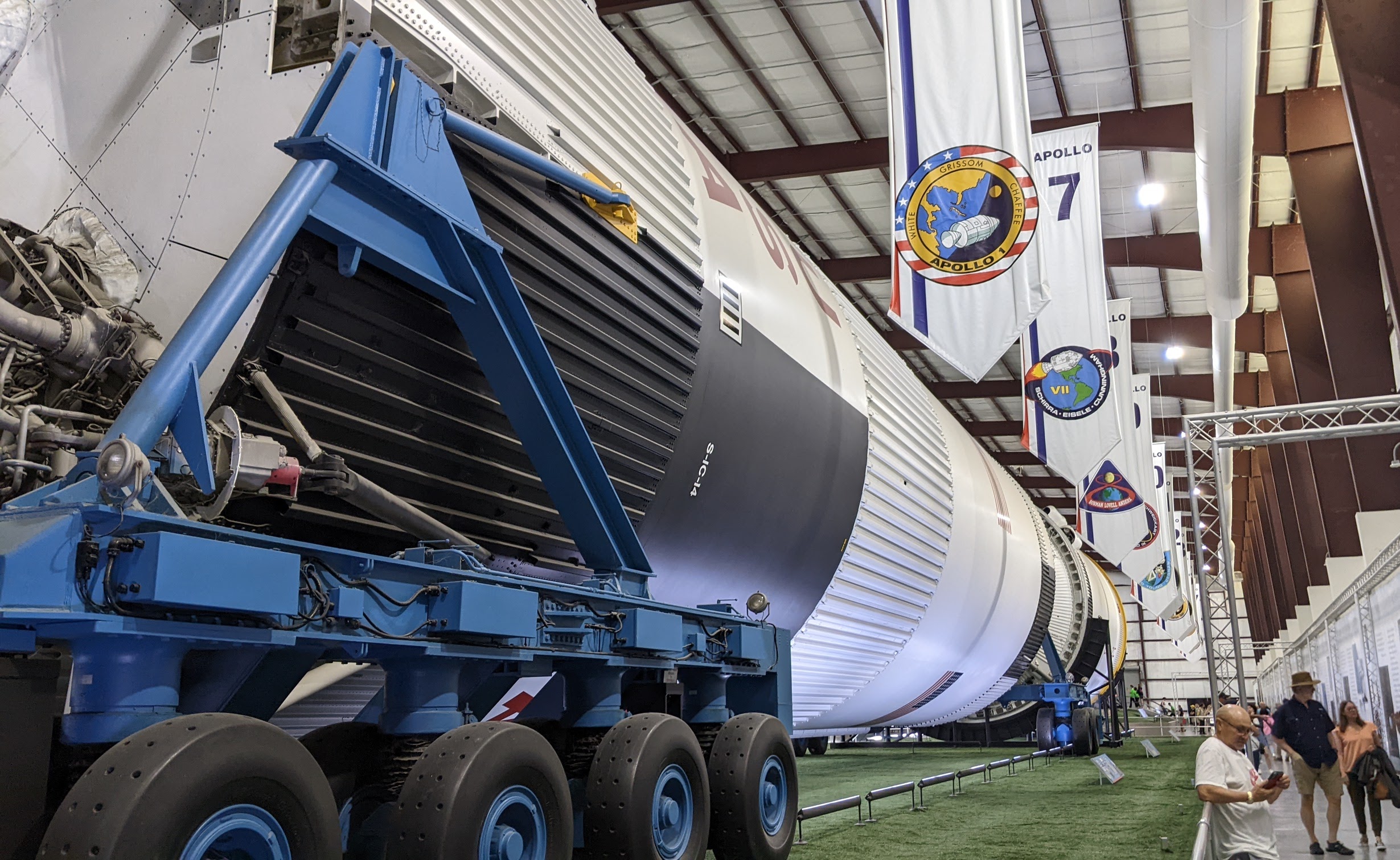
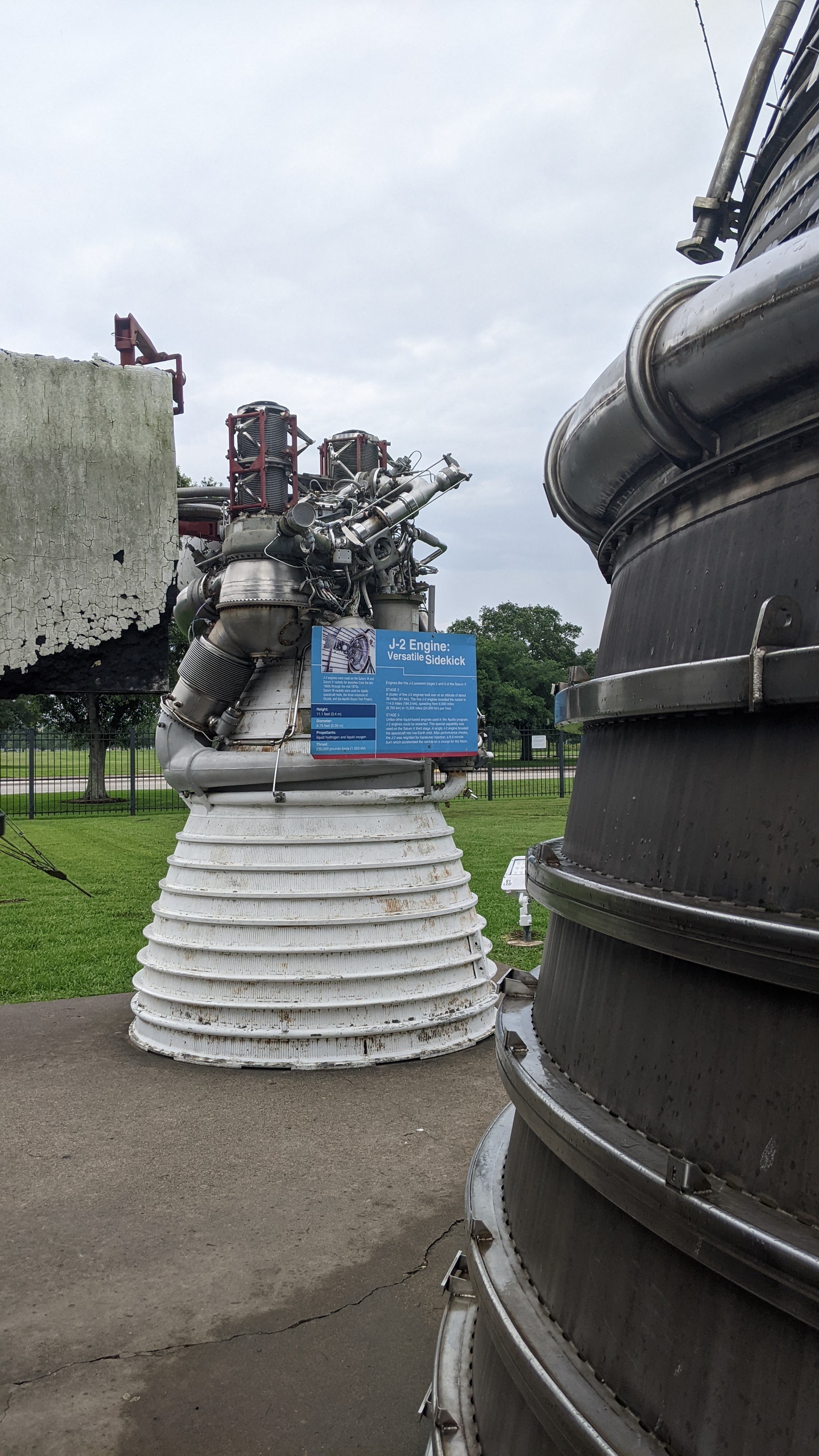
Marvel at the immense Saturn rocket that carried Apollo astronauts into space. The 30-story tall rocket was displayed outside and upright for two decades, but it suffered “weather abuse,” so it has been restored and is now displayed horizontally in a specially constructed building.
I gasped at the size of the five immense thrusters on the Saturn V. It is one of three intact Saturn V rockets that still exist, and it stretches for what seems like blocks, while flags and story boards chronicle NASA’s 17 Apollo missions, both the successes and the tragic failures. It’s a sobering experience.
Learn the history, from initial pre-orbital flights through later missions used to transport men and supplies to the orbiting Skylab, launched into orbit in 1973.
Then, move on to the space shuttle era.
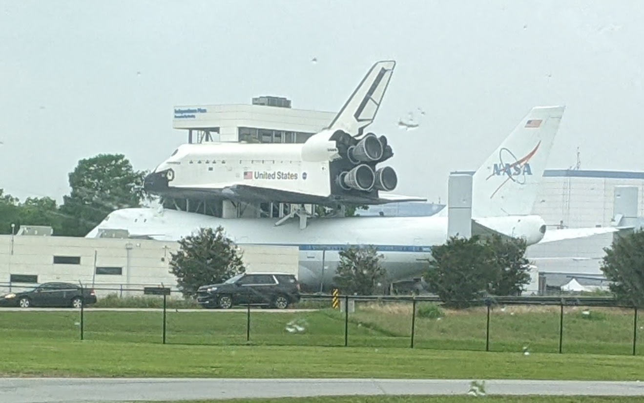
Between 1981 and 2011, American shuttles successfully completed 135 missions and carried 355 astronauts from 16 countries. My husband and I were observers twice for shuttle launches, including the last flight of Space Shuttle Discovery in February 2011. Discovery was the third of five shuttles built, and the first to be retired. The U.S. shuttle program was discontinued later in 2011, with the final flight of Shuttle Atlantis.
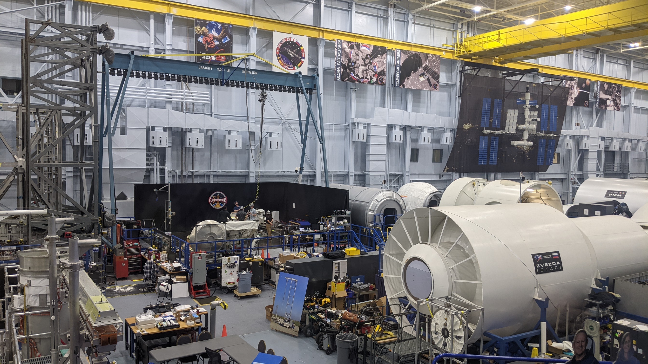
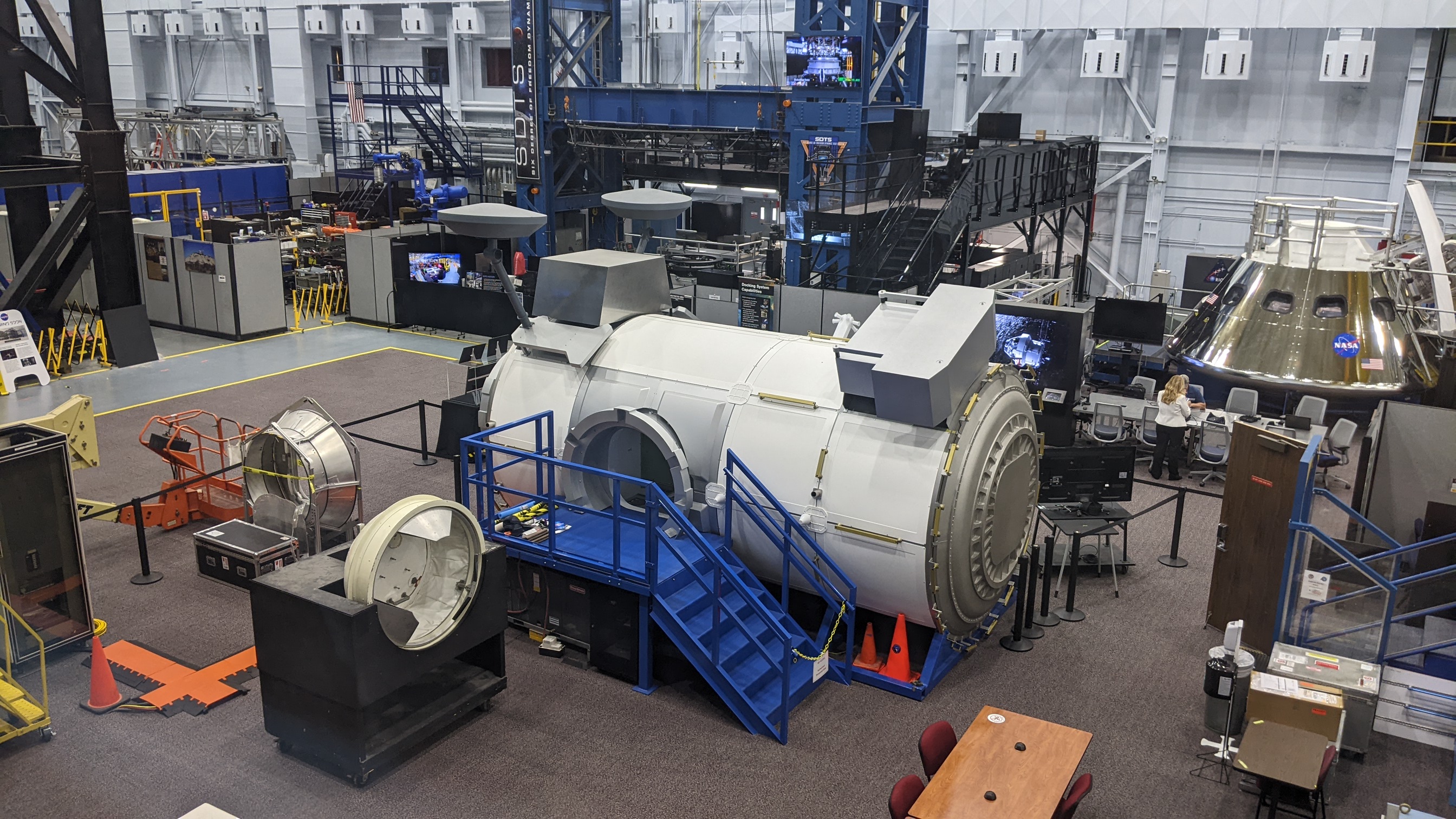
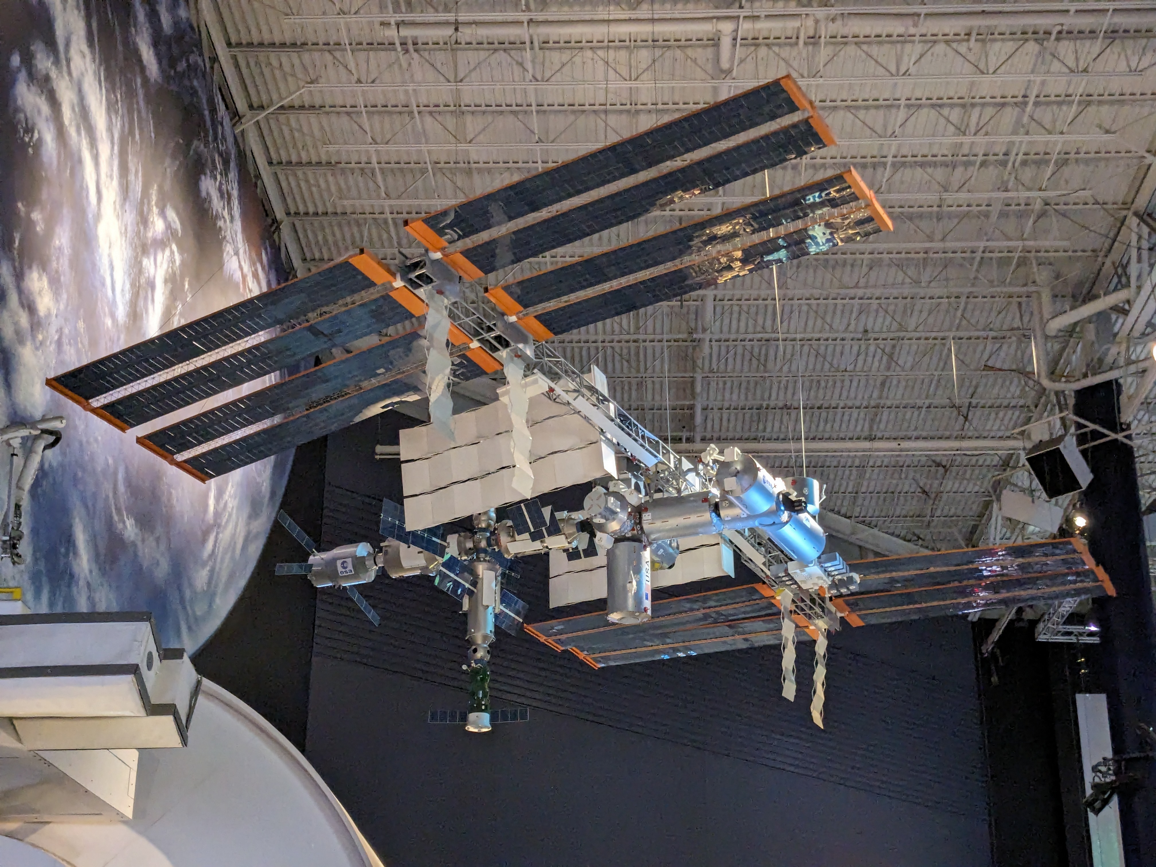
Get close to a full-size Boeing 747 aircraft with a sleek white space shuttle on its back. It rests in a peaceful field, adjacent to a herd of grazing Longhorn cattle. The reusable, winged spacecraft was designed to carry large payloads and crew into orbit. It was instrumental in the development, initial outfitting, and staffing of the International Space Station (ISS). Crews have lived and worked aboard the ISS continuously since the year 2000. Today, however, NASA cooperates with other nations and private companies to transport crews and supplies to the space station.
Walk through the outdoor “rocket garden,” then spend as much time as you wish in the Space Center Museum to learn about NASA’s past and future missions. Make time to visit interactive exhibits or to attend a lecture. I found it interesting to learn about meal preparation in space.
My tour also included a walk along a raised catwalk to peer down at the floor of a huge astronaut training center with full-size replicas of space station modules and transport capsules that journey to and from the space station. Although I am certain it can become a hub of activity at time, it appeared quiet and relaxed the day we visited.
Anticipate Future Exploration
Many more space missions are planned, but they will be very different.
First, according to NASA, the United States will return to the moon, perhaps as early as 2026. The ISS is set to be “retired” and dismantled by 2030, replaced by two or more international orbiting space stations, likely to be commercial or privately financed ventures. Then, American astronauts and the international community will turn their sights towards Mars and beyond.
The Artemis Accords, a set of principles designed to foster international partnerships for space exploration, were conceived and signed by representatives of eight nations, led by the United States, in 2020. To date, 42 countries have signed the voluntary agreements.
At Home on the Prairie
The NASA site is well-integrated with its Texas prairie roots. The agency has been working on sustainability projects in one form or another for more than 20 years. In addition to the Longhorns that share the 1,600-acre campus, the Johnson Space Center hosts a Houston Zoo program dedicated to increasing the population of endangered Attawater Prairie Chickens. The birds are bred in onsite field pens in an area that resembles their native habitat.
Another unique feature offers employees free access to more than 300 bicycles while on site to provide emission-free alternatives to driving while on the campus that’s adjacent to Clear Lake, which flows into Galveston Bay. During heavy rain, flooding and associated pollution can occur, so the space center has installed mitigation measures to alleviate potential problems and avoid disruption of operations. While NASA continues to have its sights set on space missions, it is also serious about protecting the home planet.
Visiting the Space Center
Space Center Houston is said to be the Number 1 attraction for foreign visitors to the Houston area. Leave plenty of time for your visit. There is much to see. One could easily spend an entire day in the exhibit hall, and tram tours of the 1,600-acre campus are offered.
The center brings alive the history of American space efforts, from the first sub-orbital flight of Alan Shepard in 1961 and John Glenn’s three orbits around the Earth in 1962, to future planned Mars missions.
It is affiliated with the nation’s Smithsonian Institution and is one of several locations where visitors can learn about the U.S. space program. Visitor centers are located throughout the country, including Kennedy Space Center in Florida and the Marshall Space Flight Center in Alabama. A Space Camp is also held at Marshall.
If you’re interested in the full story of flight, the National Air and Space Museum in Washington, D.C, should be on your list. And, if you’re visiting the Midwest, a side trip to the Cosmosphere in Hutchinson, Kansas, is well worth a visit. There, you can see a full-size Blackbird spy plane and “Liberty Bell 7,” the Mercury capsule that sank in the Atlantic upon splashdown after a successful 15-minute sub-orbital flight in 1961. The accident almost killed Astronaut Gus Grissom, the second man in space. The account of its retrieval and restoration is legendary.